Stuart Peck is a freelance writer and video producer who specializes in outdoor, travel, corporate and commercial messaging and branding. He has written for national magazines, video copy for healthcare and other corporate videos. He also provides production support for commercials and TV shows.
Why actually go hiking when you can sit at home and eat Cheetos and keep hitting the forward arrow on your own virtual excursion? I mean... Cheetos really don't pack well in a 25 pound backpack, that's definitely a factor.
Google is an amazing thing. I’m fairly certain they are going to map the entire world. It’s all part of an elaborate scheme to take over the world... well the virtual world that is. As someone who follows the trends in social media and search engine marketing there is a lot to be said about Google and their arsenal of web based products. Gmail, maps, plus, drive, etc really are revolutionizing the way we search and think.
So about this point you’re thinking “What on Google Earth does this have to do with hiking... or backpacking or traveling?” That would be an excellent question. As we run to the search engine that knows everything including where we are, where we are going and probably even where Jimmy Hoffa’s body is buried, it leads me to wonder if actually backpacking or traveling is even necessary? About a year ago, the search giant announced plans to start adding street view to various trails and national parks. We can now walk down the streets of London (England & Kentucky) and hike to the bottom of the Grand Canyon, at the simple swipe of a screen or click of a mousepad and all without ever leaving the comfort of my extremely comfortable chair... although it doesn’t recline nor does it have a built in mini-fridge. So are we a Google society? Have we come to terms with the idea that who really needs to travel when I can see it in 360 degree views on my computer screen?
I’m of the mind set that some places are better left wild... the WILDerness is probably one of those places. We’re a too plugged in society and we need areas that are still of the grid, away from all the dinging cell phones and sirens and distractions of living amongst the well... living. People need to get off their backsides and get outside... and maybe walk off the Big Mac (without cheese) that we ate for lunch. The Goog does a lot of ridiculously cool things that make my life a lot easier. Virtually hiking trails probably doesn’t need to be one of them.
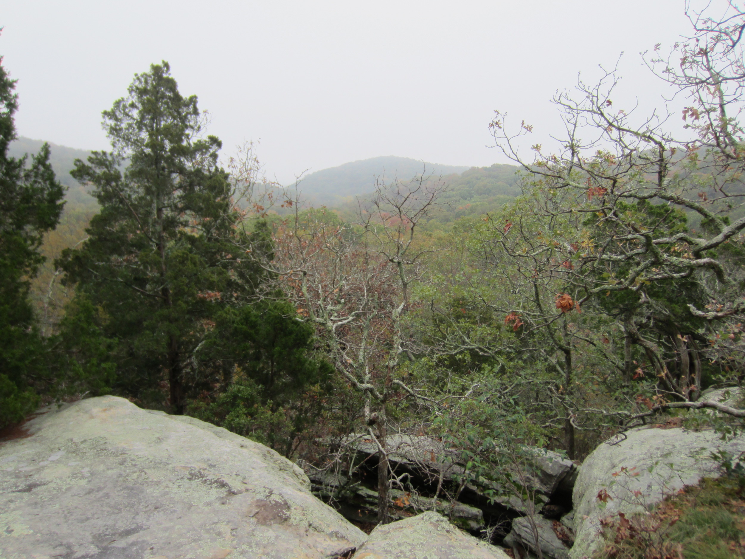
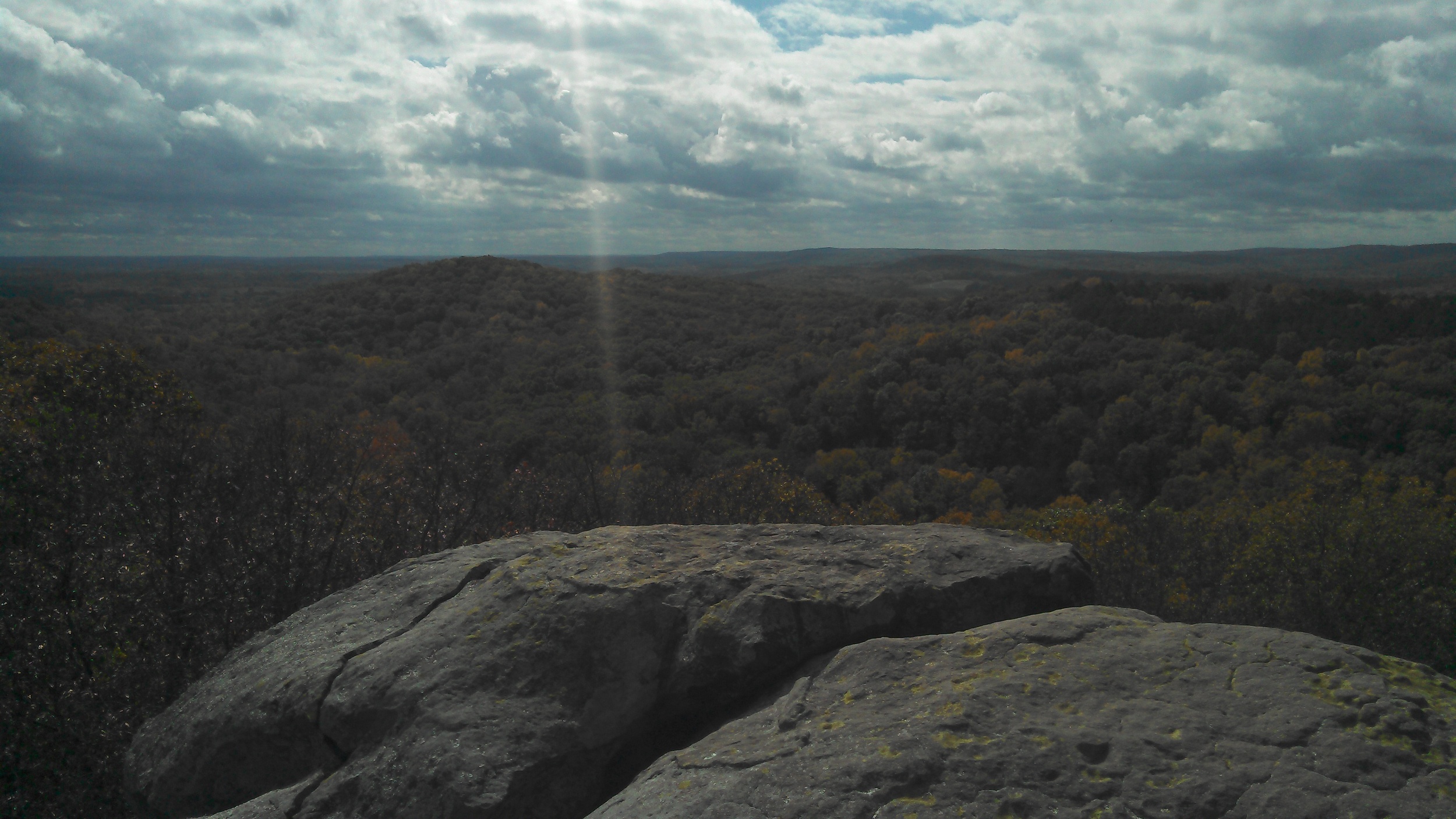
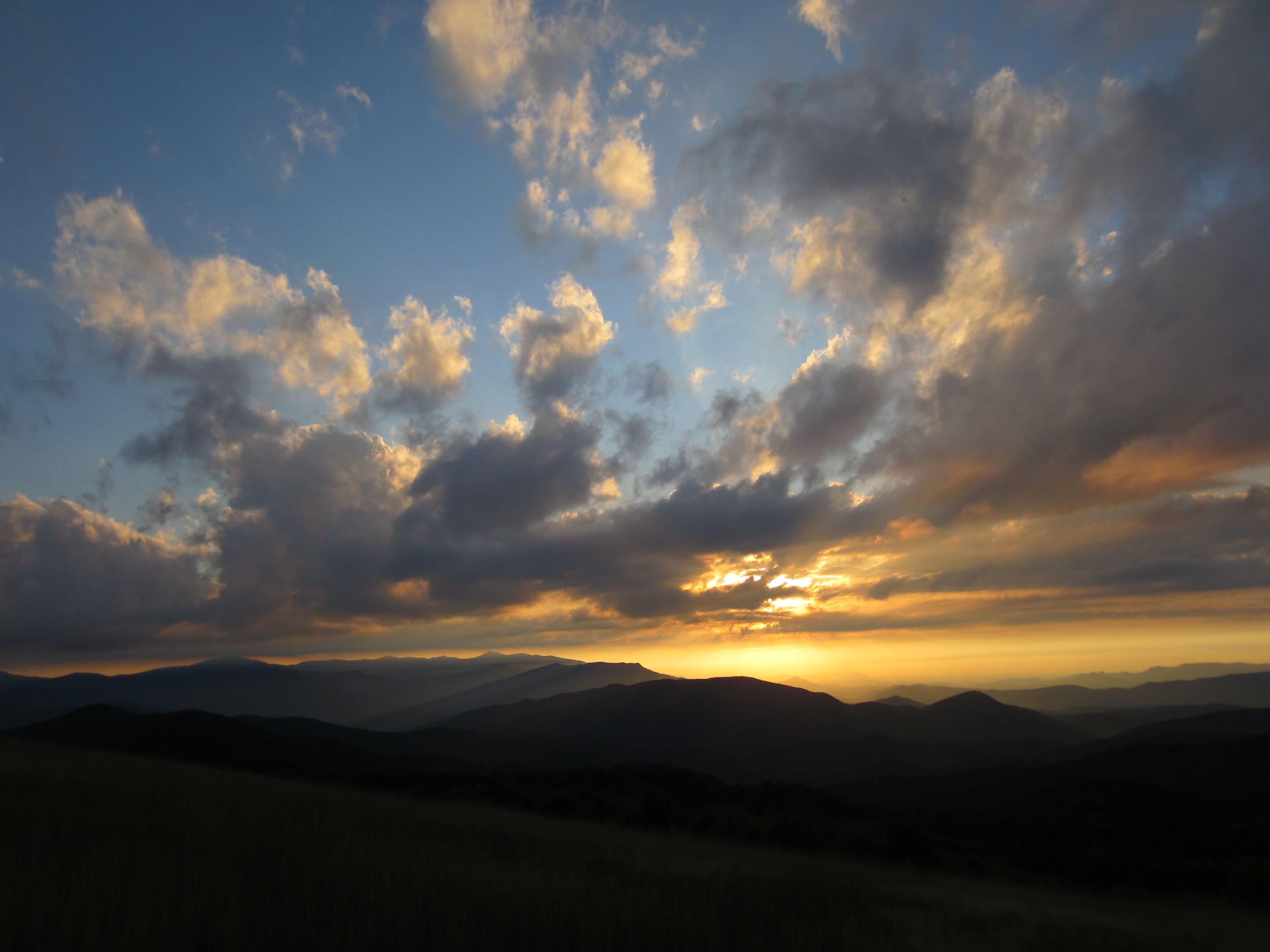
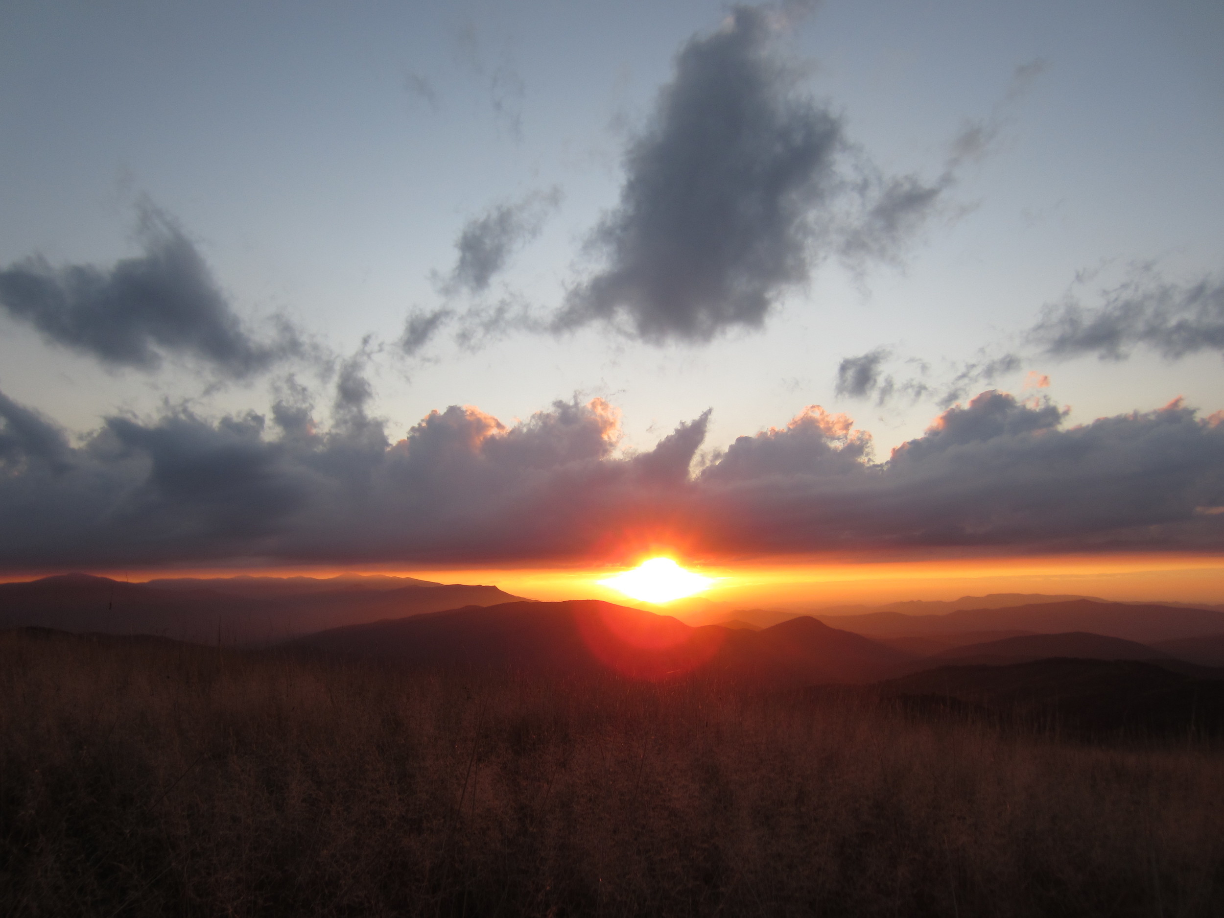
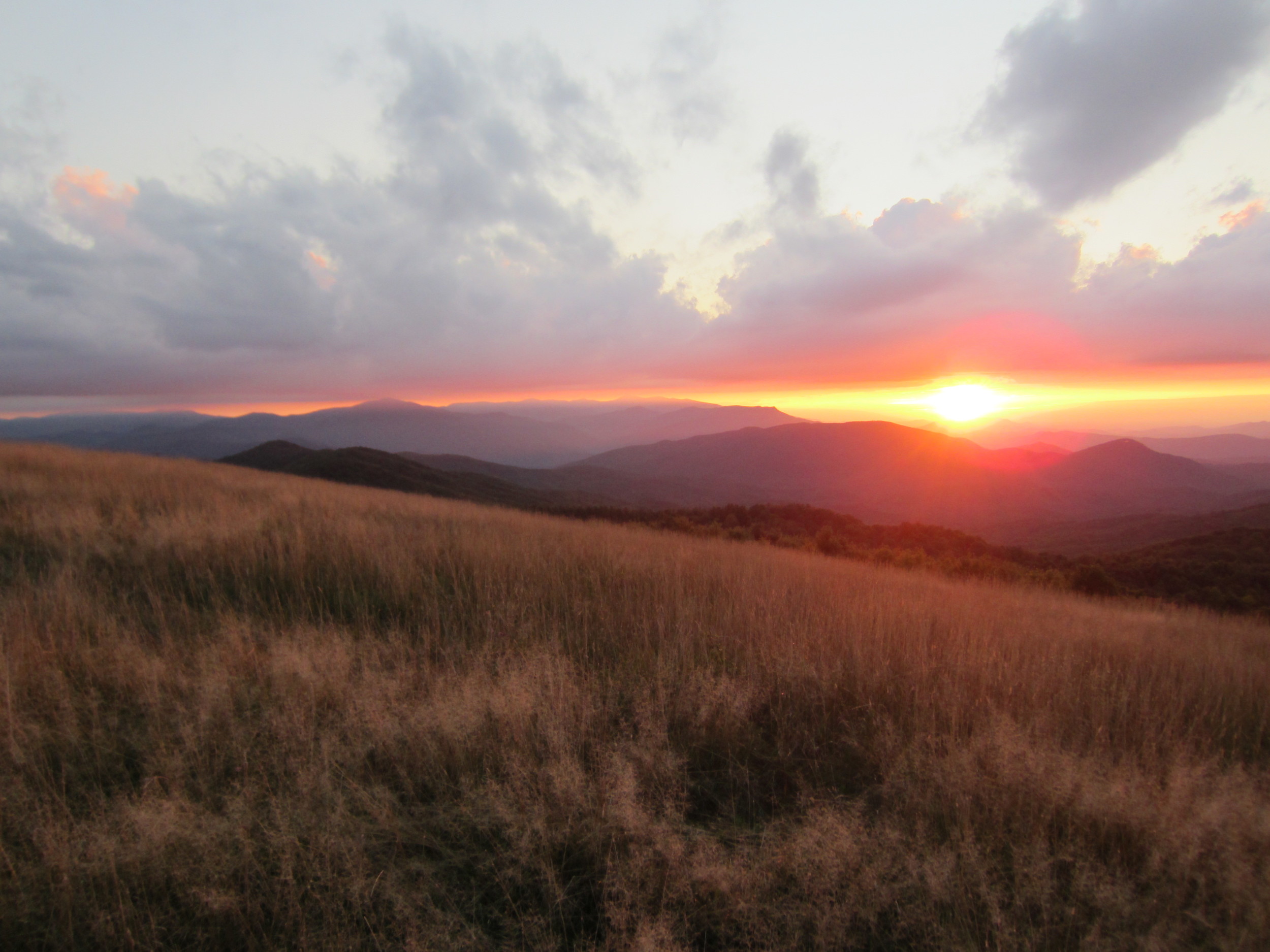
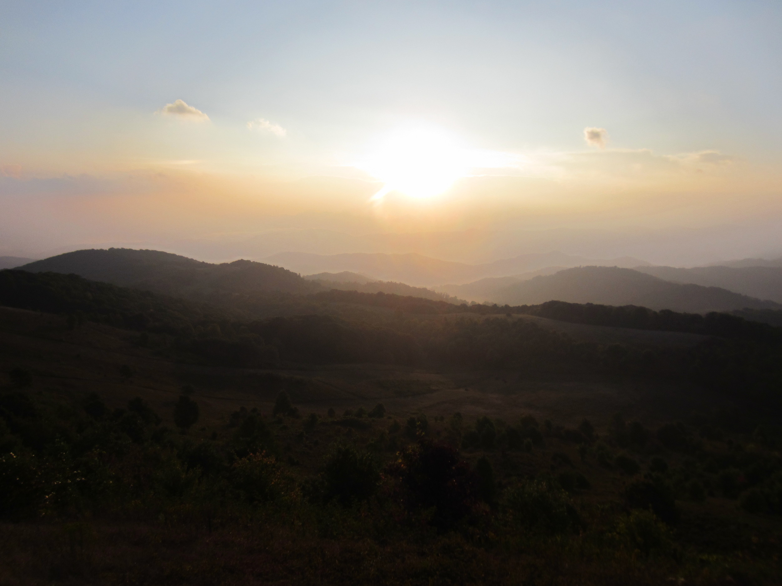
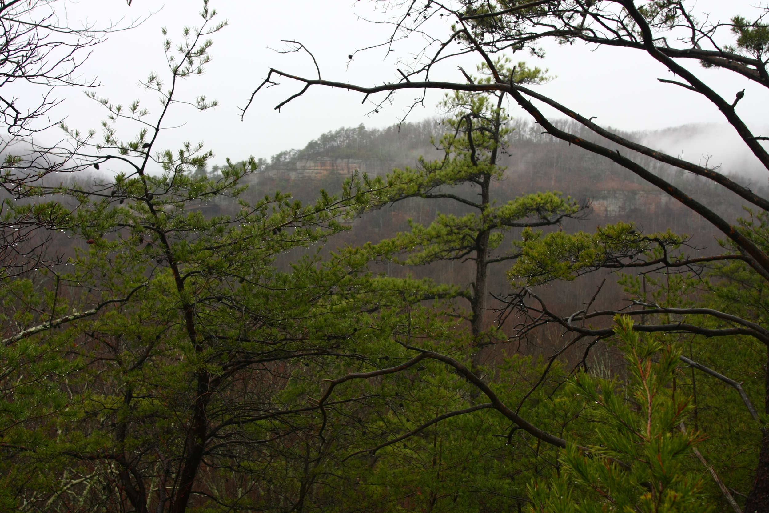
Big Bluff Overlook along the BRT. Best view on the trail as it looks down hundreds of feet to the river and surrounding valley.
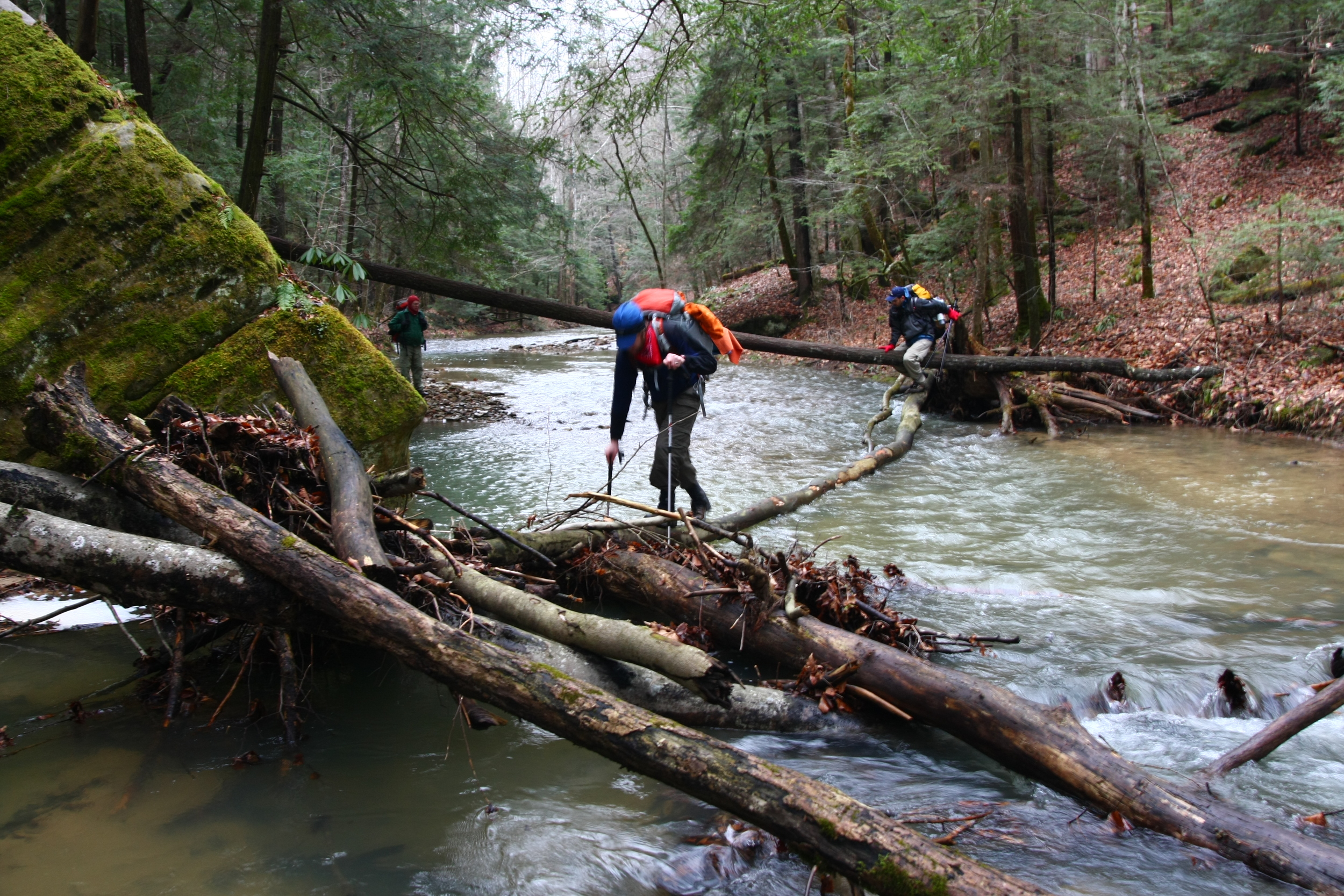
Do you know where Thayer, Missouri is? Yeah, neither did I before this past weekend. When you’re stuck in the backwoods of far southeast Missouri between a “town” full of abandon buildings with a population of 200 people and a swollen creek with class two rapids flowing over the “major” highway Thayer is an oasis. They have a gas station, the smallest Walmart I’ve ever seen and a surprisingly nice McDonalds. Twice we were turned around by rushing water over the highway. Twice we ended up in Thayer. We got around one of the creeks by taking a detour onto some country roads. Lesson learned, if water is flowing over the state highway that tells you the quality of the road system. Clearly SE Missouri has been forgotten about by the Department of Transportation. County roads in this part of the state equal dirt roads.
“Turn left at this next road,” Meg says.
“Where are you taking me?” “Are you using Google maps or Apple maps?” I respond.
I’m thinking the entire time we’re about to become one of those unfortunate accidents of Apple maps poor programing where the road actually drives right off a cliff. Five minutes later we’re staring at another road with water cascading over it. I’m done with this as I hit the gas and drive straight through the water, spraying it everywhere, like something out of a Ford truck commercial (except I’m not driving a Ford truck... I’ve got a Subaru, which sits quite a bit lower to the ground and is a lot lighter). That was just the trip home, only part of the weekend that included driving eight hours, hiking 36 hours and then driving back 10 hours.
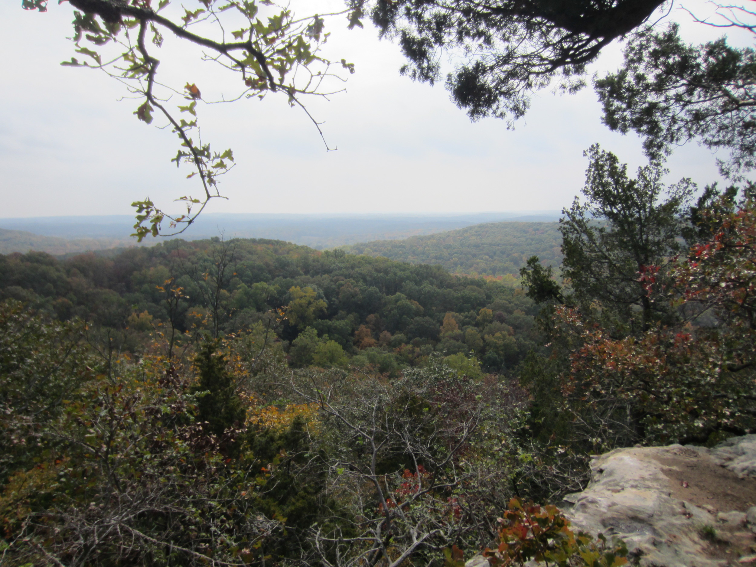
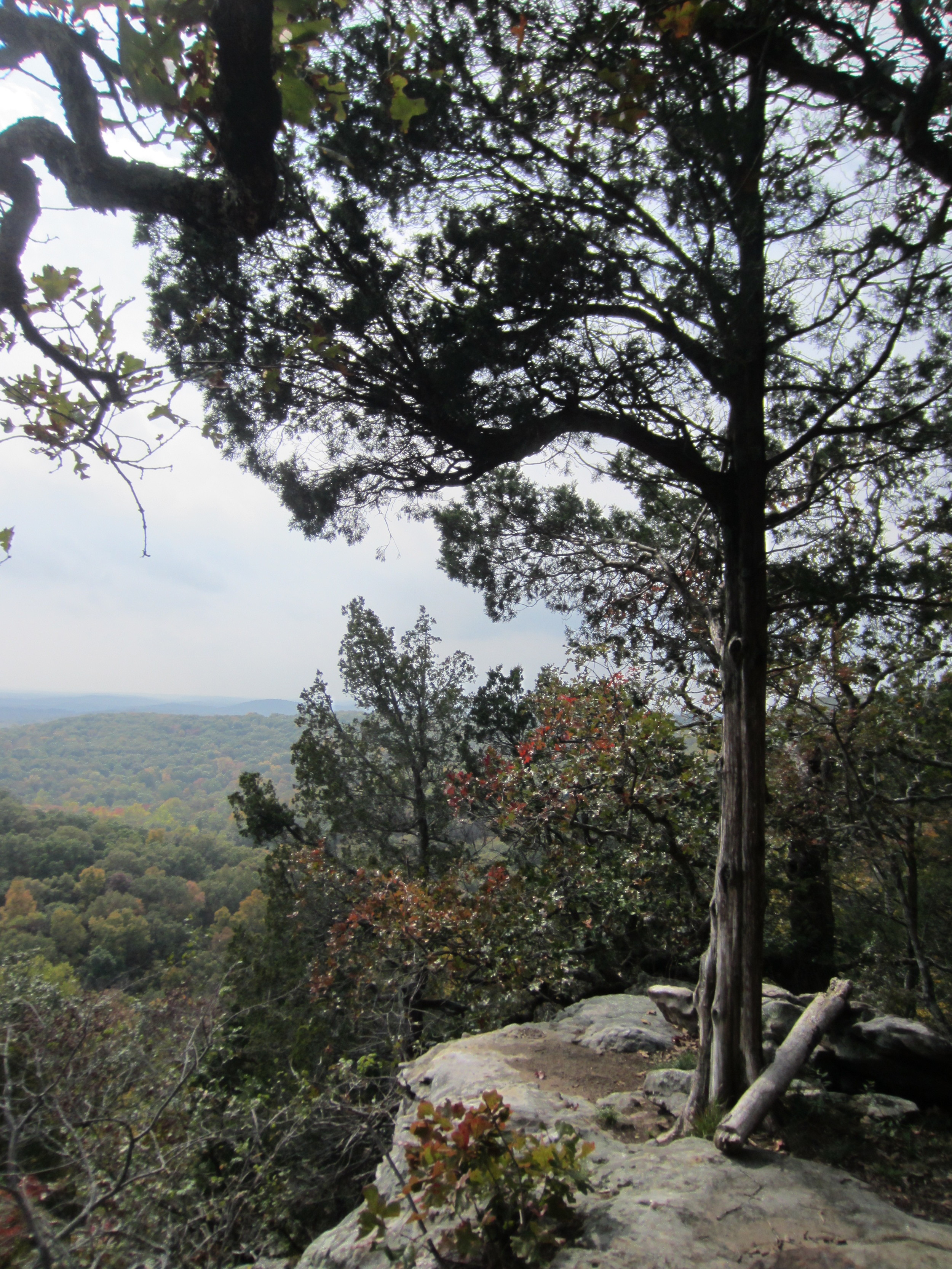
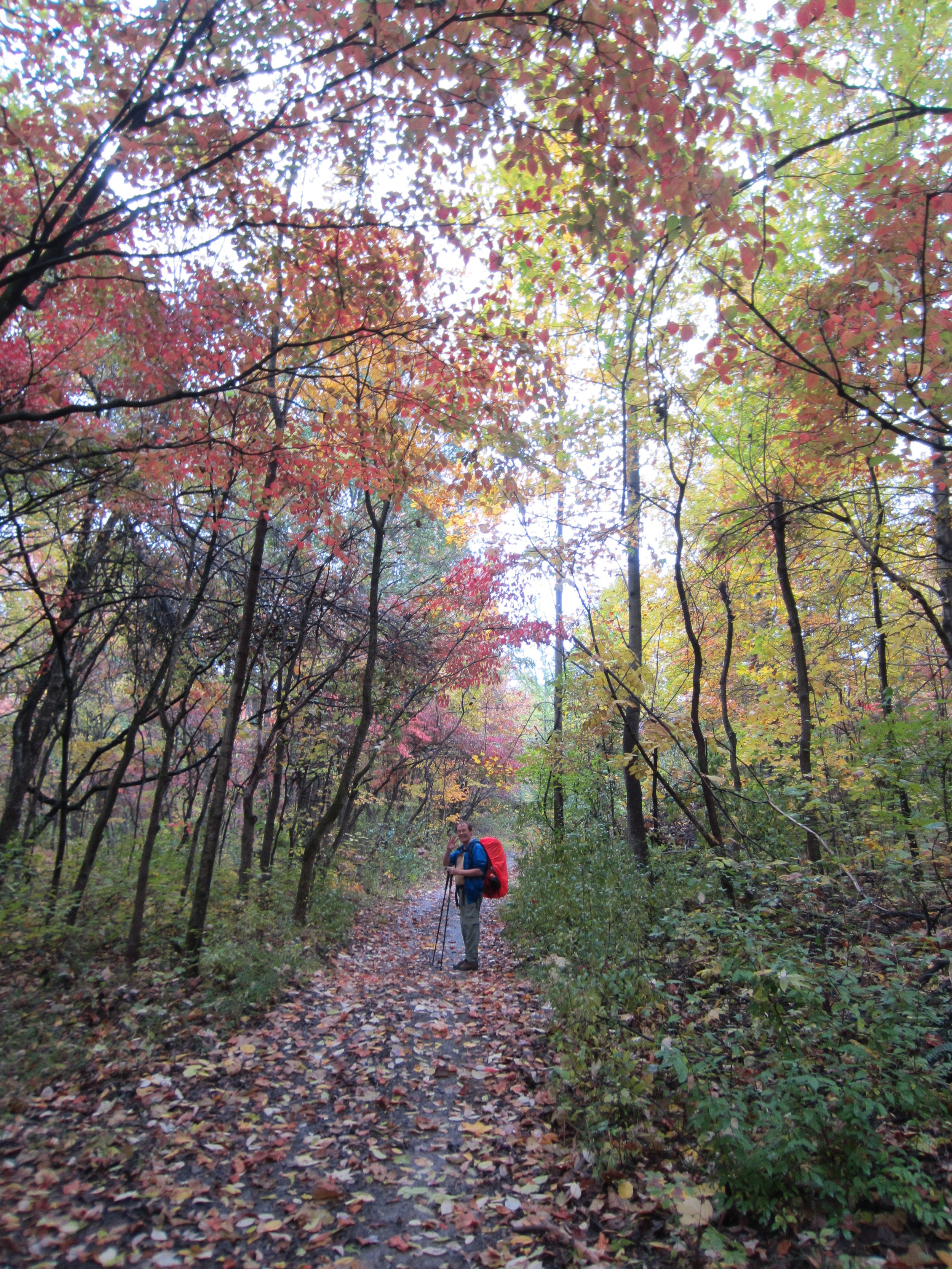
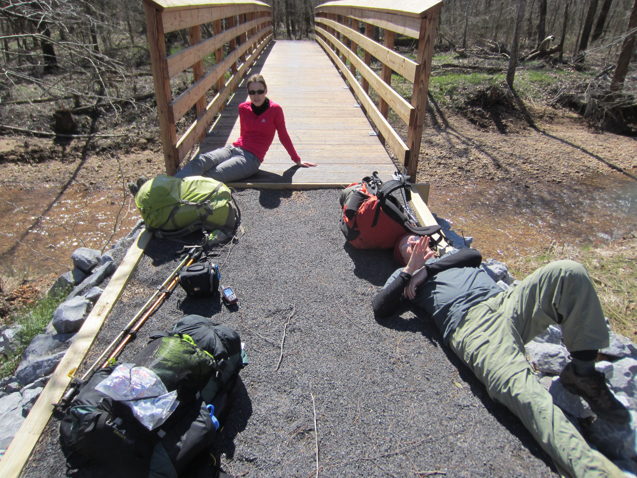
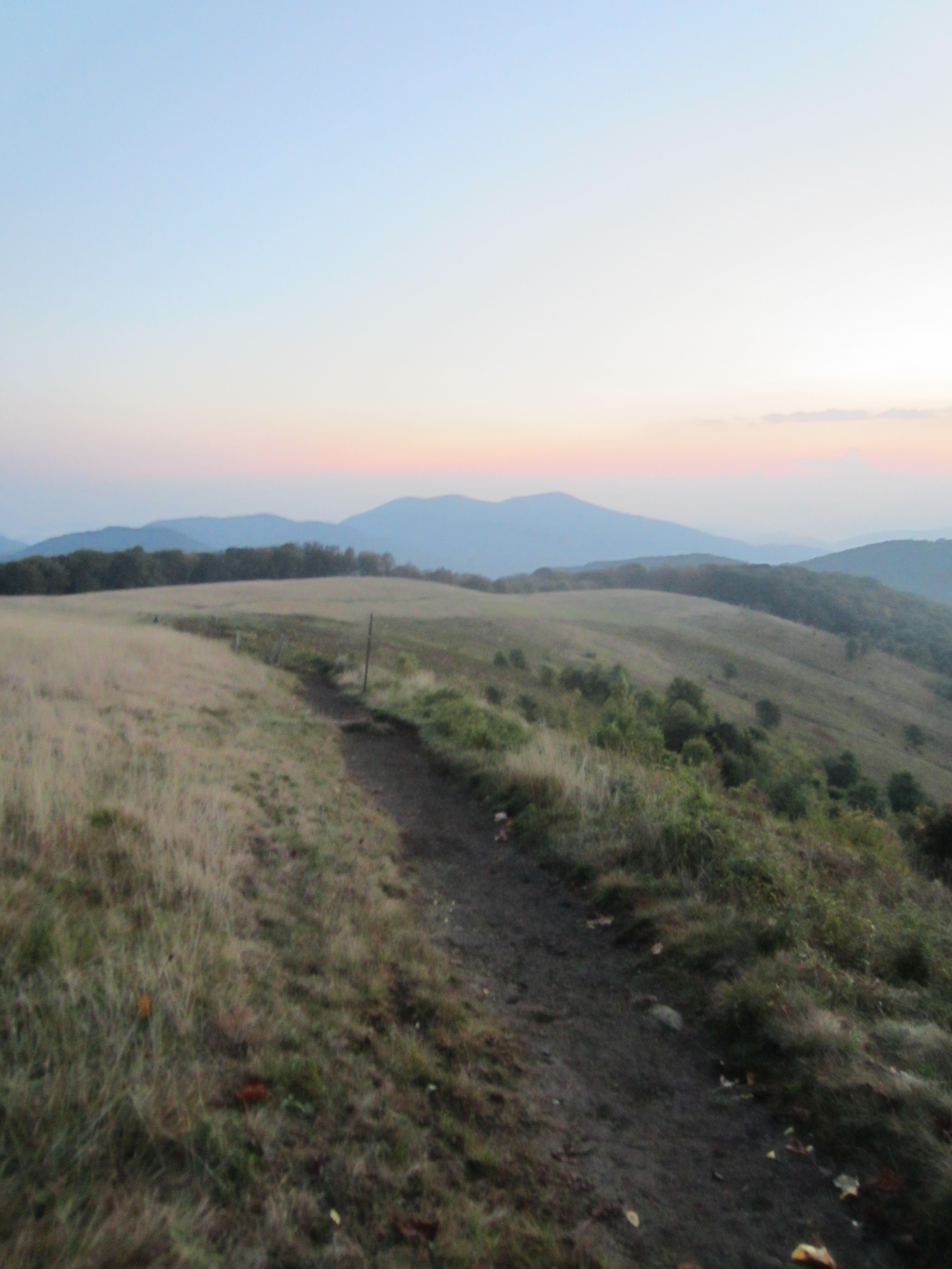
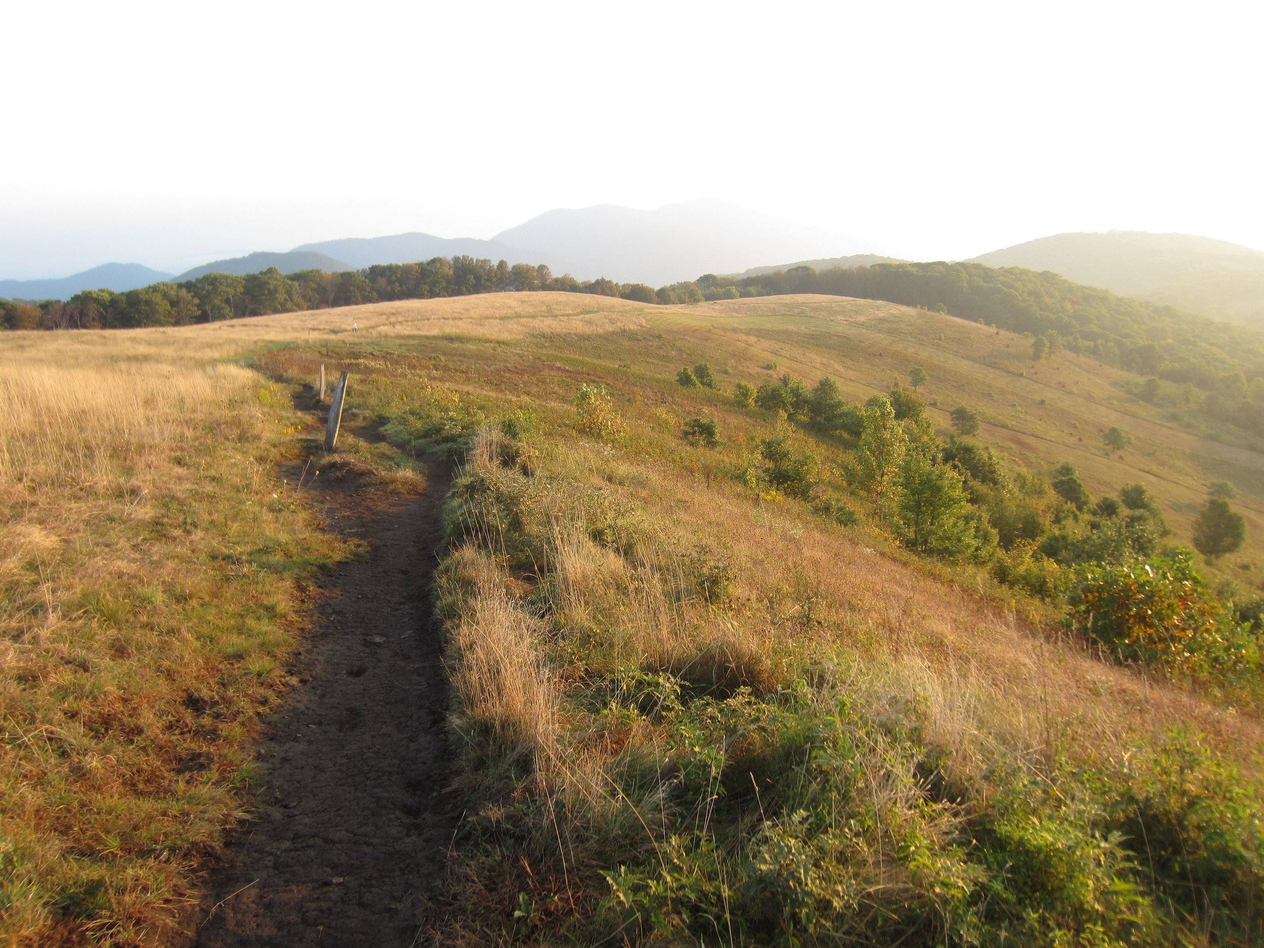
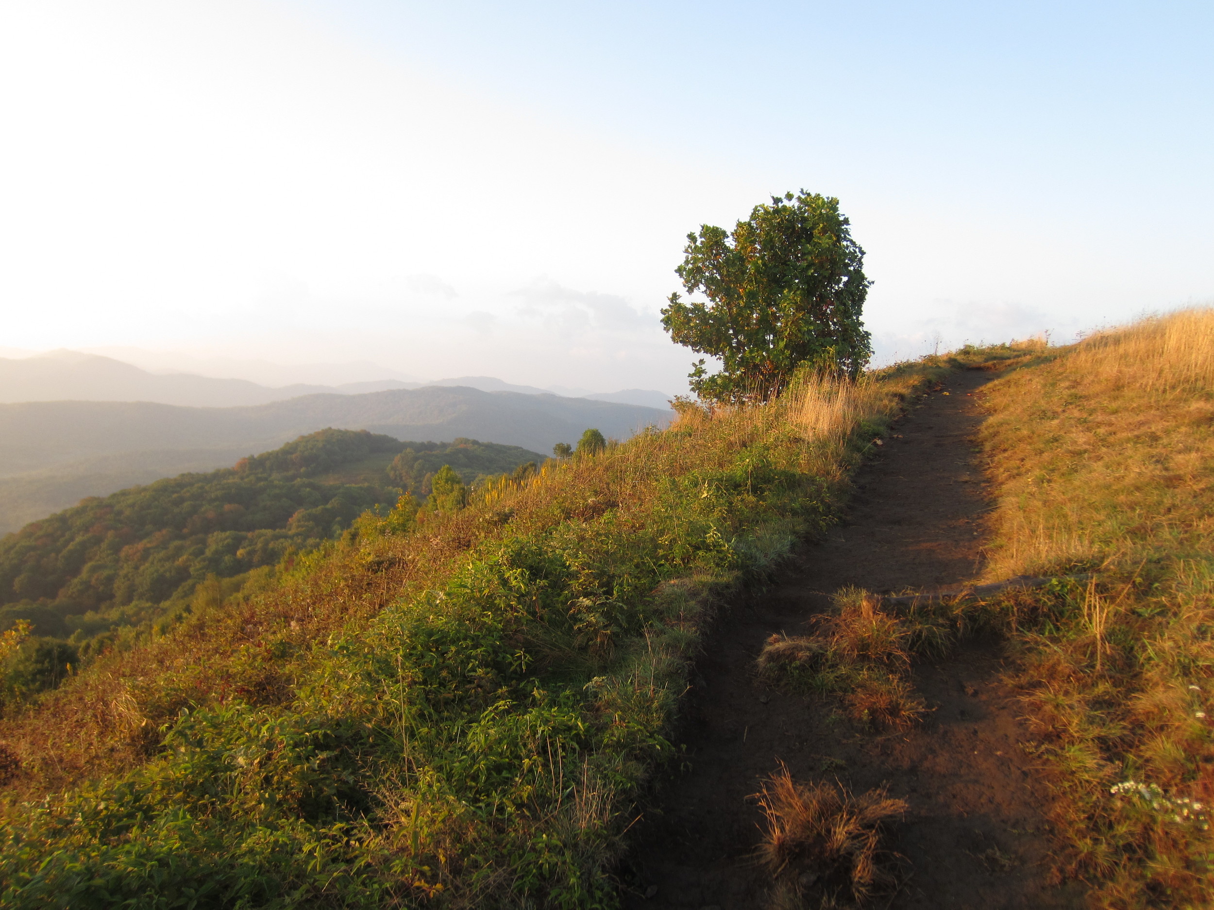
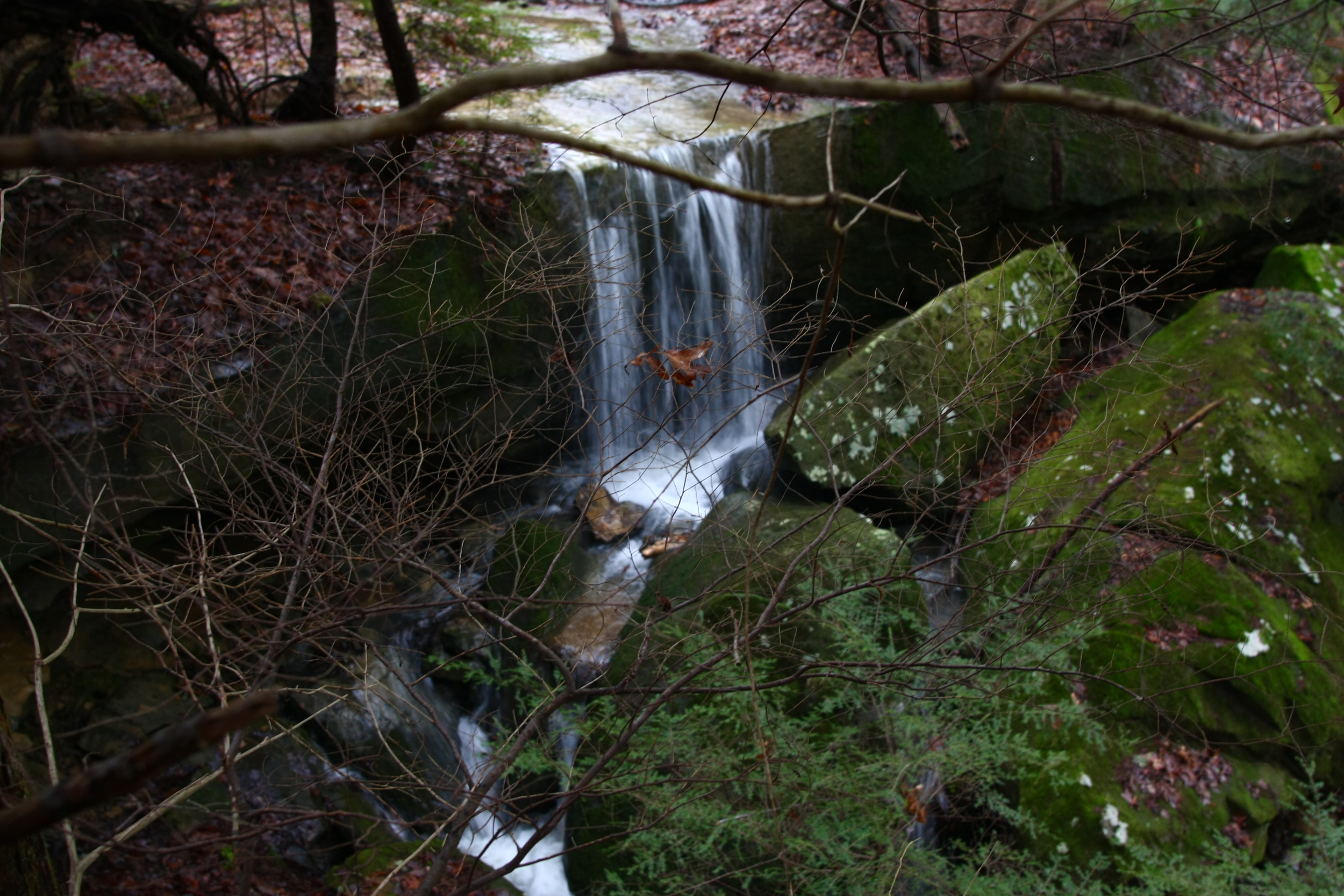
The Buffalo River Trail as it winds through northern Arkansas.
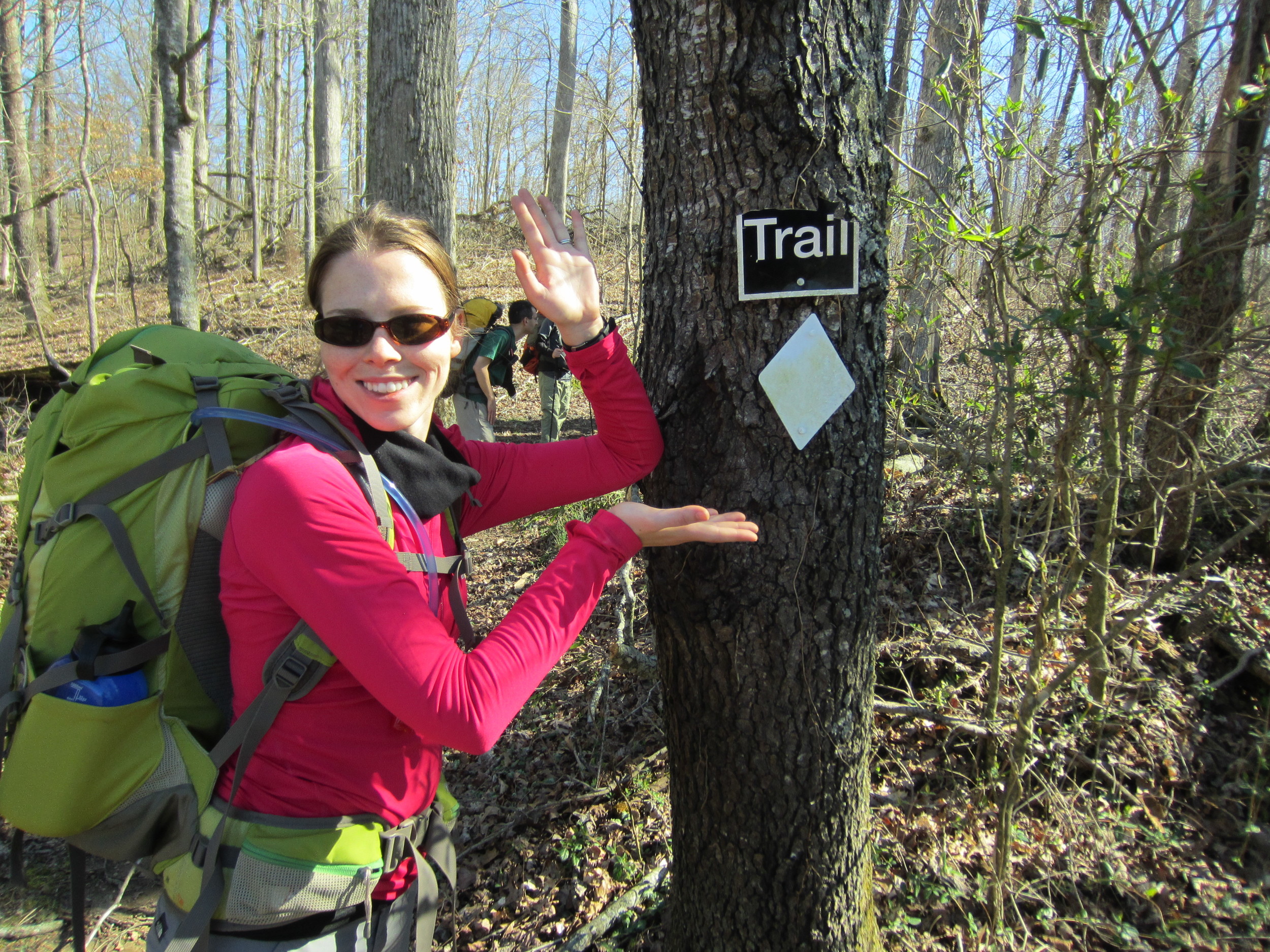
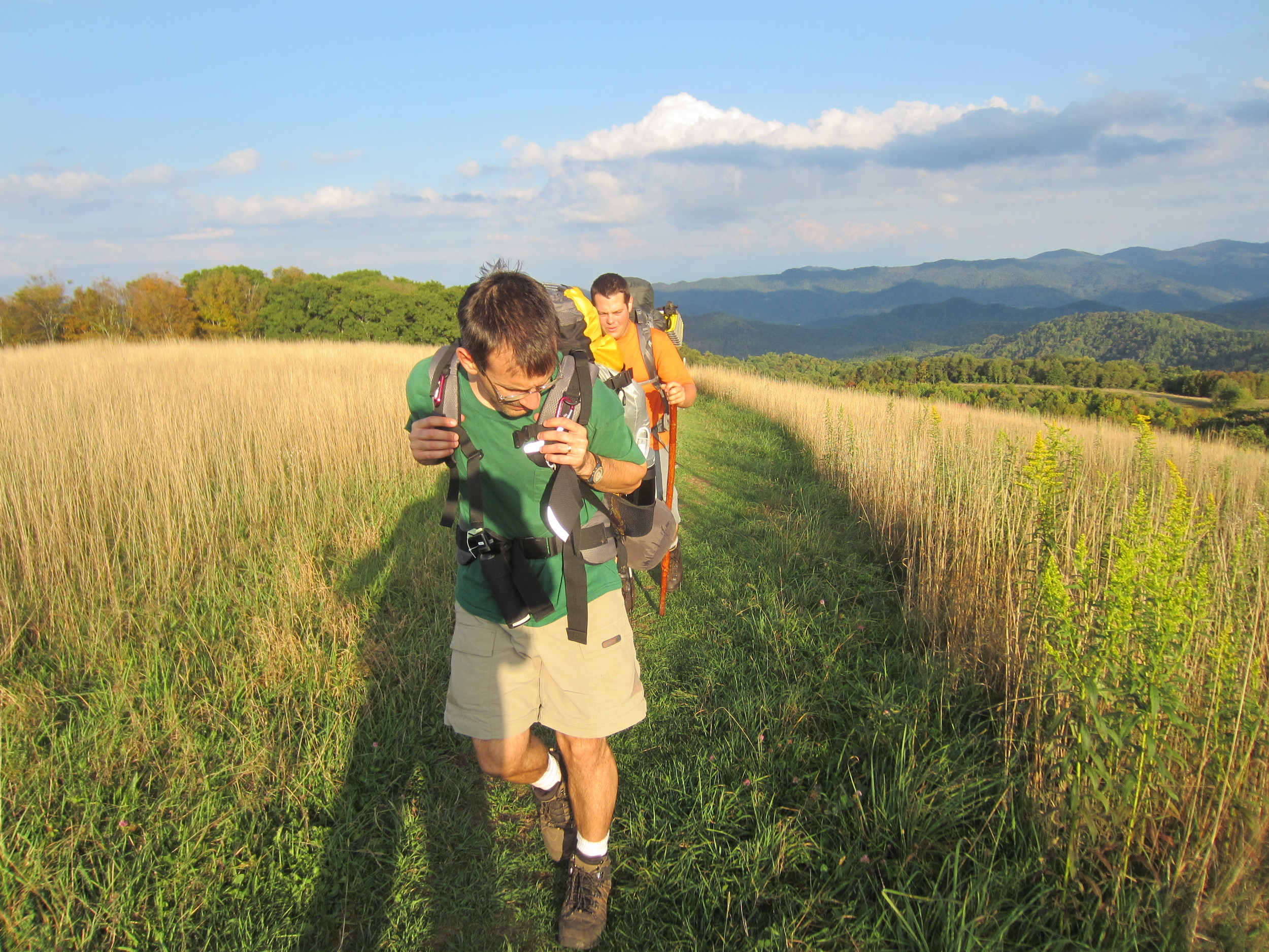
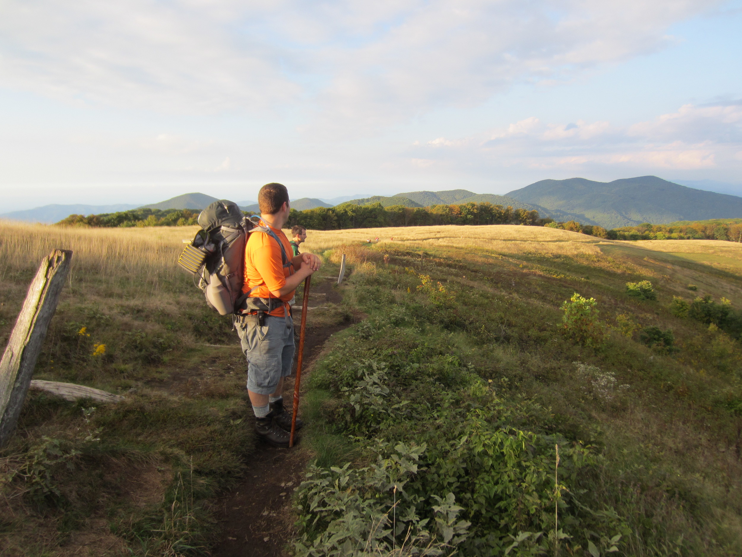
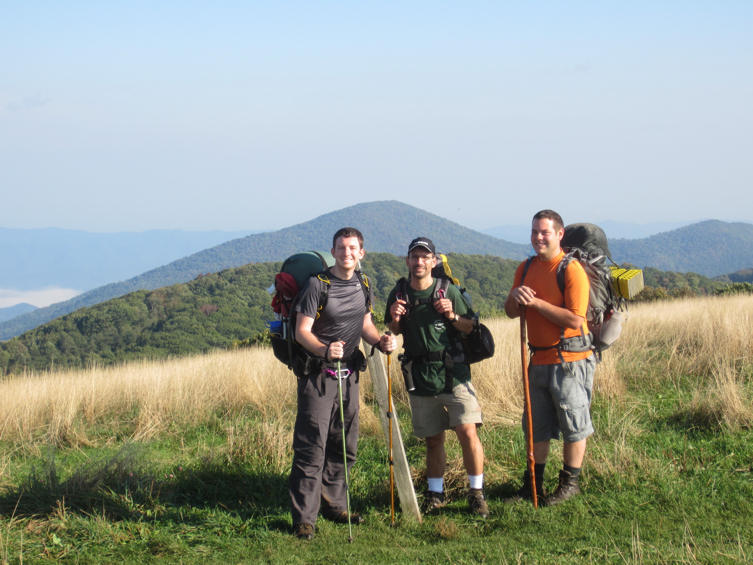
Meg and I did a 36 mile weekend hike of the Buffalo River Trail in northern Arkansas. It was an itenirary that left people looking at us as if we had just murdered somebody and were planning to take them out into the woods to bury them.
“20 miles a day, that’s real optimistic,” said the guy that looked like an ex-navy seal who rides a road bike 50 miles a day. “You know they’re calling for rain tomorrow.”
Excellent, I’m thinking, are there also rabid dogs along the trail that are going to try and eat us when we sleep tonight?
“You know there are rabid dogs along the trail,” he said. “They like to eat hikers when they bed down for the night.”
Ok... so he didn’t really say that second part but he might as well have because at this point Meg is thinking... I WOULD kill Stuart and leave him in the woods if I didn’t need him to carry half the tent.
We did the hike (more to come on that in a future edition of Backpacker) and set a personal high mileage day of 20.4 miles. We had amazing weather for early March on the first day and then a deluge for part of the second. The nice thing about the rain was it made all the waterfalls more magnificent. The trail was actually very nice and very rugged, a great challenge for anyone into backpacking.
So in the end the lesson we learned was southeast Missouri and northeast Arkansas have some beautiful scenery... but really horrendously, awful roads.
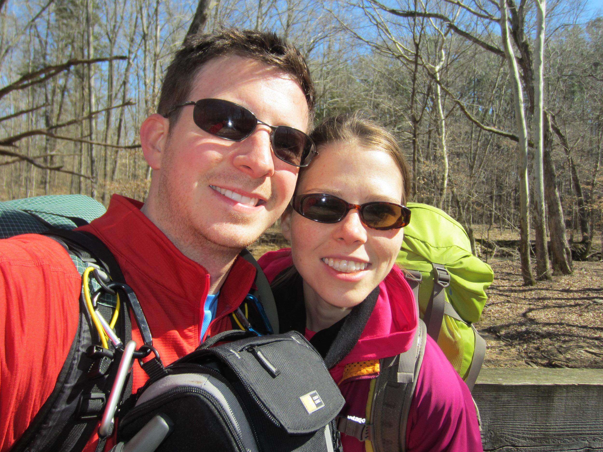
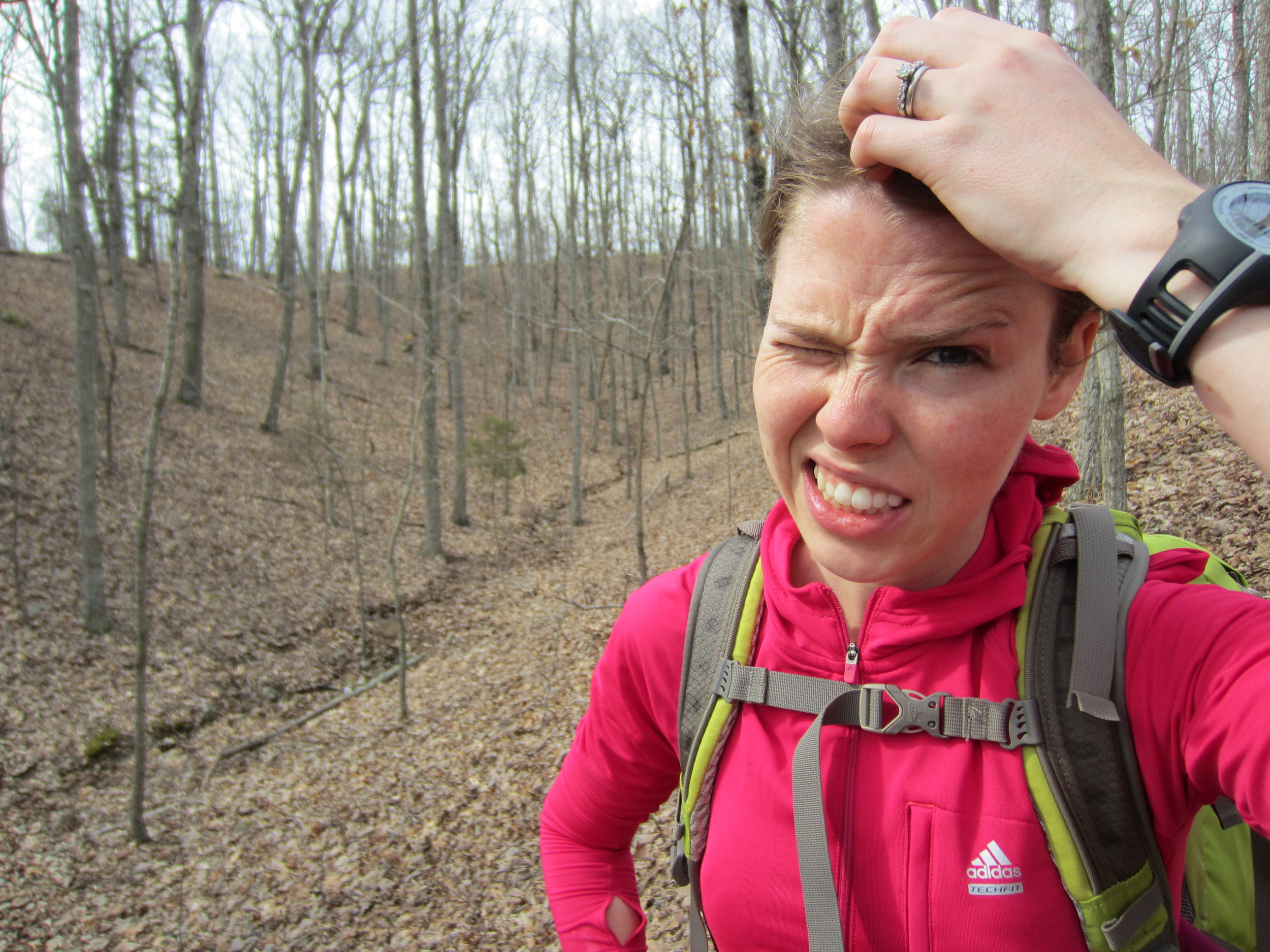
With every adventure... we're adding to our wall. She looks happy in all our pictures (I think she's actually enjoying the crazy things we do).
When I met my wife, I will admit, one of the things I thought pretty soon after we started dating was ‘awesome, now I have a climbing partner’ - I didn’t tell her that... but that’s what I was thinking. We dated and did a good deal of climbing. Even now, most of the time when I bring up the idea of taking yet another trip to go climbing her response is almost always positive. Occasionally, she’ll even bring up the idea of taking a weekend trip, which makes me think she may actually enjoy our not-so-normal hobbies.
So what exactly does true love look like? In my case, it looks like a woman who puts up with my crazy antics and ideas. It’s a person who stands by and rolls her eyes when I suggest we take a five day hike as a way to celebrate our anniversary. I’ve met some women who shutter at the thought of even standing outside for extended periods of time. My wife didn’t shower for five days while we hiked in the 95 degree heat and slept on the ground... and we didn’t get a divorce after that trip was over, to me that’s true love.
It takes a special person to hang off the side of a cliff and still smile at the end of the day and say ‘I had a good time’. It takes a special person to sleep outside, get up at 6:00 a.m. and walk all day, on a Saturday, when she could be sleeping in until 10:00 in a climate controlled room. I’m 100% sure I’ve found that special person.
We have a wall in our house with photos from our big adventures. It’s small now... but growing. I often times find myself standing in front of it, as a I brush my teeth at night, looking at the pictures and smiling. We’re happy in each one of them. I think I’ve found a keeper. What’s true love look like to you? It’s completely different for each person.
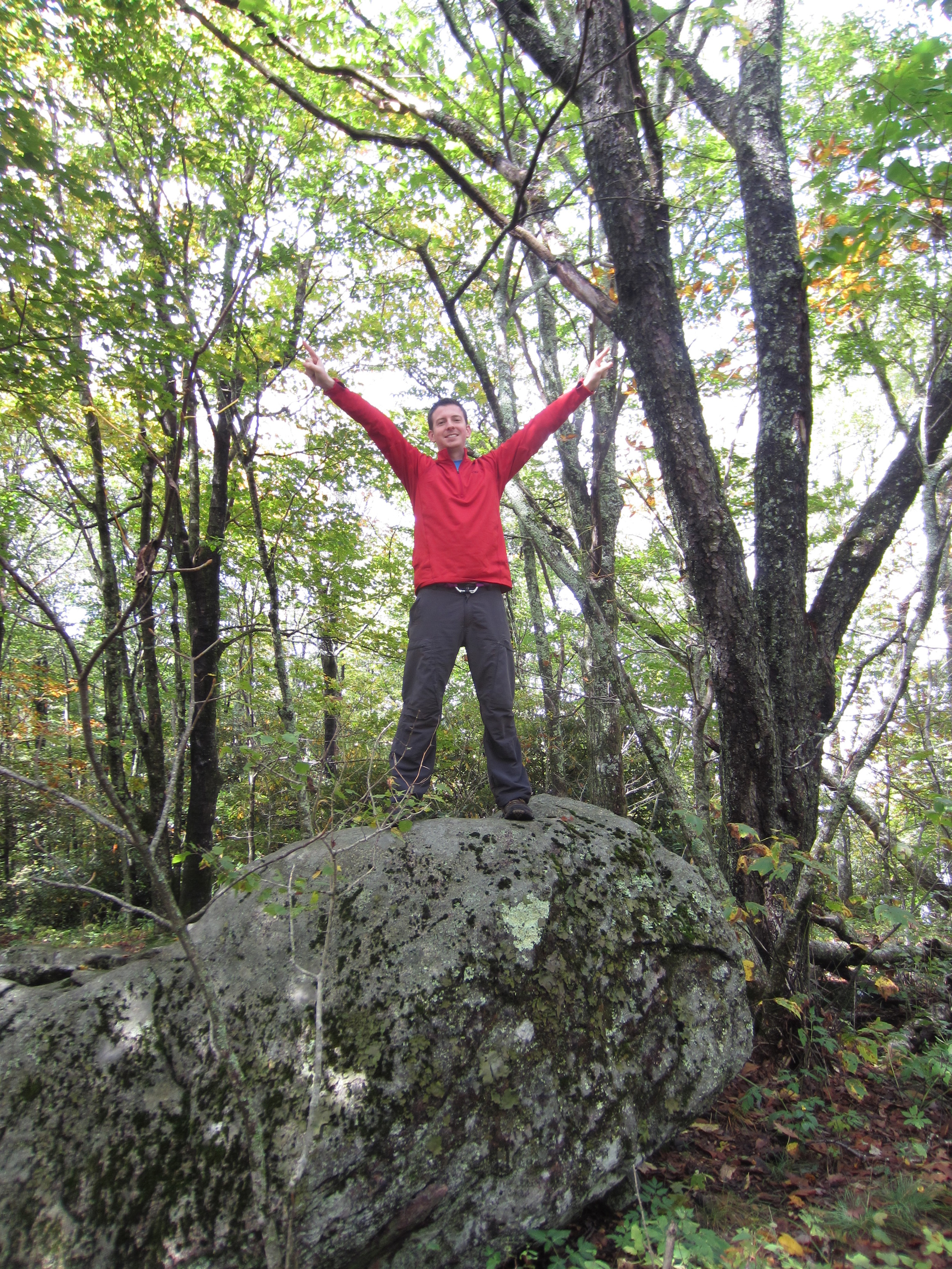
It was pretty much the same from everyone I told about my plans this past Friday, a confused look accompanied by “Why?”. I asked my wife if she wanted to go. “You go have fun... I’ll stay here” was her response. I was planning to head out for a little overnight hike in the woods. Nothing huge, just an eight mile loop in a nearby national forest. That wasn’t the part everyone was getting hung up on, it was the idea I had about camping... in the woods... in winter... when it was just 22 degrees outside. No I'm not homeless.
If you’re an avid backpacker chances are you know where I’m coming from? We have to face the fact that a lot of our friends don’t understand how we can take enjoyment from walking around for days, in the wilderness, with all our necessities on our back and in some cases, without taking a shower. It just doesn’t seem natural or... maybe it’s a little too natural. When Meg and I came back from our Grand Canyon trip last year we got the same reaction over and over again. “You didn’t shower for five days? I don’t understand how you can do that.” Well it’s easy, you just don’t take a shower when you get up in the morning. Instead you walk 10 to 12 miles with your house, bed and kitchen on your back to another secluded location where you camp. Sound fun? Yeah, it does to me too.
We derive excitement and adventure from the places we go, the isolation we find and from the elements. One of the things I enjoy most about a backpacking trip is a little rain or chilly temperatures. It adds to the sense of adventure and survival. When you’re backpacking, isn’t it true that we say hello to most everyone we pass? Why is that? Because they’re one of us... they understand what we’re doing and why we’re out there doing it. And they find it refreshing to stop and talk to someone who shares their same interest.
I hiked my loop and yes, it was cold that night. Would I do it again... absolutely. Will I get lots of confused looks and questions... probably. It’s all just par for the course.
Sport or no sport... a heavy pack and big hills will take it out of you on any backpacking trip.
So we all know there are a lot of weird sports included in the Olympics that never see the light of prime-time television. I mean c’mon, do we really need a sport that involves horses dancing to choreographed music or speed walking... really? A sport is defined, by Sir Webster, as physical activity engaged in for pleasure. That leaves the door wide open for a lot of things we just won’t go into on here.
That definition leads me to this question: Can backpacking or hiking be considered a sport? Is Andrew Skurka our Michael Phelps or Bear Grylls our Tom Brady? Equipment is getting lighter and the price tag heavier and the outdoor market is flooded with brand names. Just as the Nike swoosh means something to a basketball player so does the Patagonia mountain range at sunset to many hikers who sport the latest in down insulation or quick drying pants.
But what about competition? Isn’t sport about competition? I would say that is an element. The thrill of competing against someone else to see who is superior is very much an element of any good sporting match. Whether you’re fighting to the death or fighting the elements competition and the excitement when the adrenaline starts pumping plays a big role.
I know I asked more questions than I answered. I would say yes, backpacking and hiking can be considered sport. You are competing with yourself... challenging yourself and pushing yourself to, in some cases, your limit. We’ll likely never see Bob Costas giving us the highlights on who won the gold for backpacking but that’s okay. It will hopefully continue to be a sport that one competes at on their own stage... a stage deep in the backcountry of some of the wildest places on our planet.
Bundle up and brave the cold for empty trails and excellent vistas!
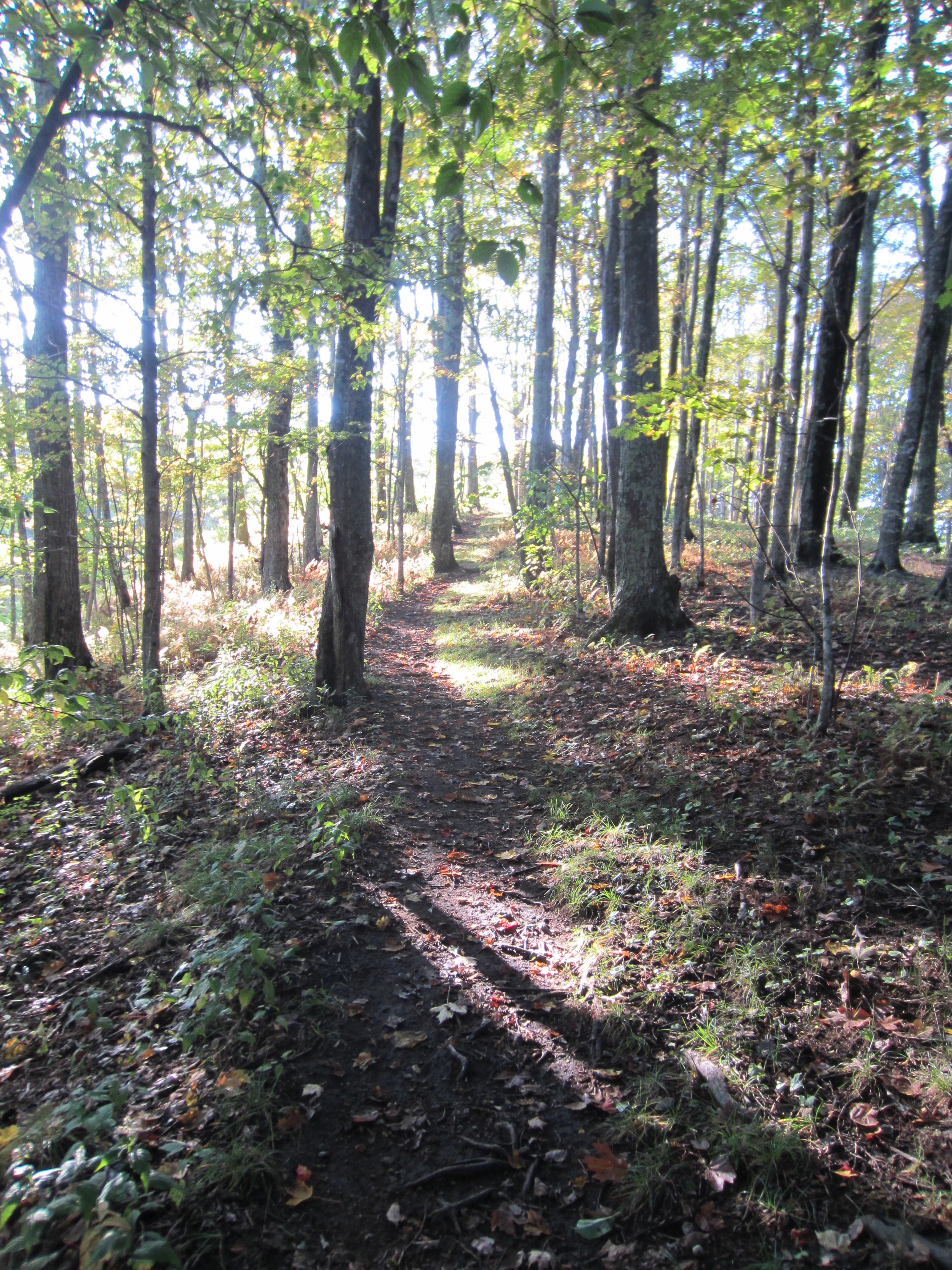
Here we are... it’s cold... it’s dark... it’s January. Most hikers wouldn’t think this is the ideal time to get out and hit the trail. Temperatures are barely reaching into the 30’s during the day here in Kentucky and they dip down into the low 20’s at night. So most sane people run for the warmth of indoors. That’s when you should take to the trail!
Cabin fever has set in and I’m dying to get out and test out the new Christmas gear! So why not go now? What I’ve found from my experience is the best time to get out on the trail is the few weeks before or after the shoulder seasons (late March to early May & late September to early November). Head out a couple weeks before the wild flowers are fully bloomed or maybe before all the leaves have changed and avoid the crowds of day hikers sporting Canon Rebels and stopping at every trail side flower for a shot. Also, head out RIGHT NOW to be completely on your own. Want to hike in some of the most popular spots in the country... Grand Canyon sound nice? Smokey Mountains anyone? Take advantage of ghost town resorts and empty roadside pull offs as no one cares to dare the snow and chill.
I thought about writing some long post about how 2012 was... but really who cares? Instead here are some pictures from some of my trips this past year. I was able to complete my resolution to hike 100 trail miles... in fact I surpassed it, coming in at 110 miles. We took several trips to the Red River Gorge and other climbing spots and completed a couple routes that have beat me down in the past.
Here are pictures from just a few of the trips last year: Land Between the Lakes - Kentucky, Grand Canyon National Park - Arizona, Shawnee National Forest - Illinois.
I'm already in the planning stages for several great trips in 2013. Details coming later on the blog!
Hope everyone has a wonderful new year! Get out in 2013, enjoy life, leave the stress at home and try not to get attacked by a bear.
So I'm sitting at one of those handy charging stations in the Rochester Interntional Airport thinking what better spot to update a travel blog... then while... well traveling. It's been a crazy couple of weeks. I feel like I've spent more nights sleeping in a tent or in a hotel room than I have in my own bed at home. Where is that again?
From rock climbing in the Red to hiking in southern Illinois to attending a conference at the legendary (yes... legendary) Mayo Clinic in Minnesota I return home today with a lot of new knowledge, challenges and goals.
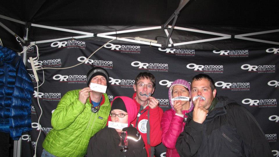
Rocktoberfest - Red River Gorge in Slade, KY
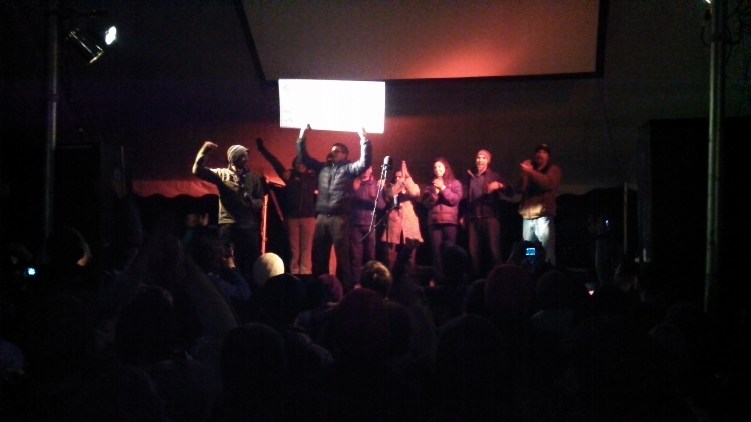
It was my third trip to the Red for this great event and this year's Rocktoberfest was really one that will be hard to top. The Red River Gorge Climber's Coalition celebrated the final mortgage payment on the Pendergrass Murray Recreational Preserve. It was a big deal not only for die hard climbers in our area but for climbing across the country and even across the world. I think such a momumental purchase (it was the largest land purchase by a climbing coalition in U.S. history) will inspire other coalitions and land owners to work together to secure climbing.
I'm proud to support a coalition and an activity that is working hard to help the future of the sport of climbing. It's a sport not just for the adventure junkies or the dirt bags living in their van, it's for the weekend warriors who work 9 to 5 behind a desk or for families with young children looking to show them the beauty of God's creation and the importance of being outdoors and being active. Wow... that was quite a poetic bit... sorry I'll stop that. Moving on...
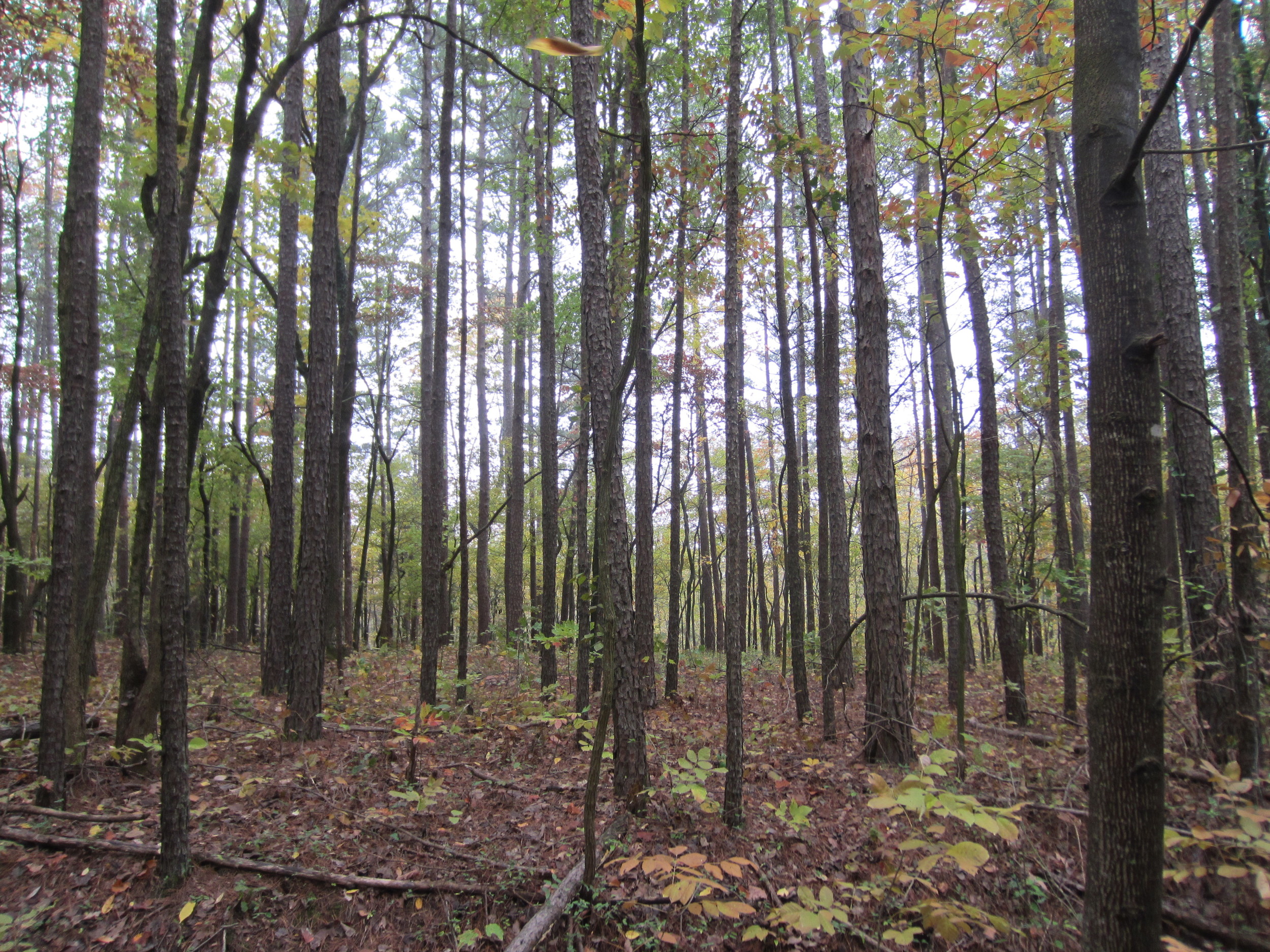
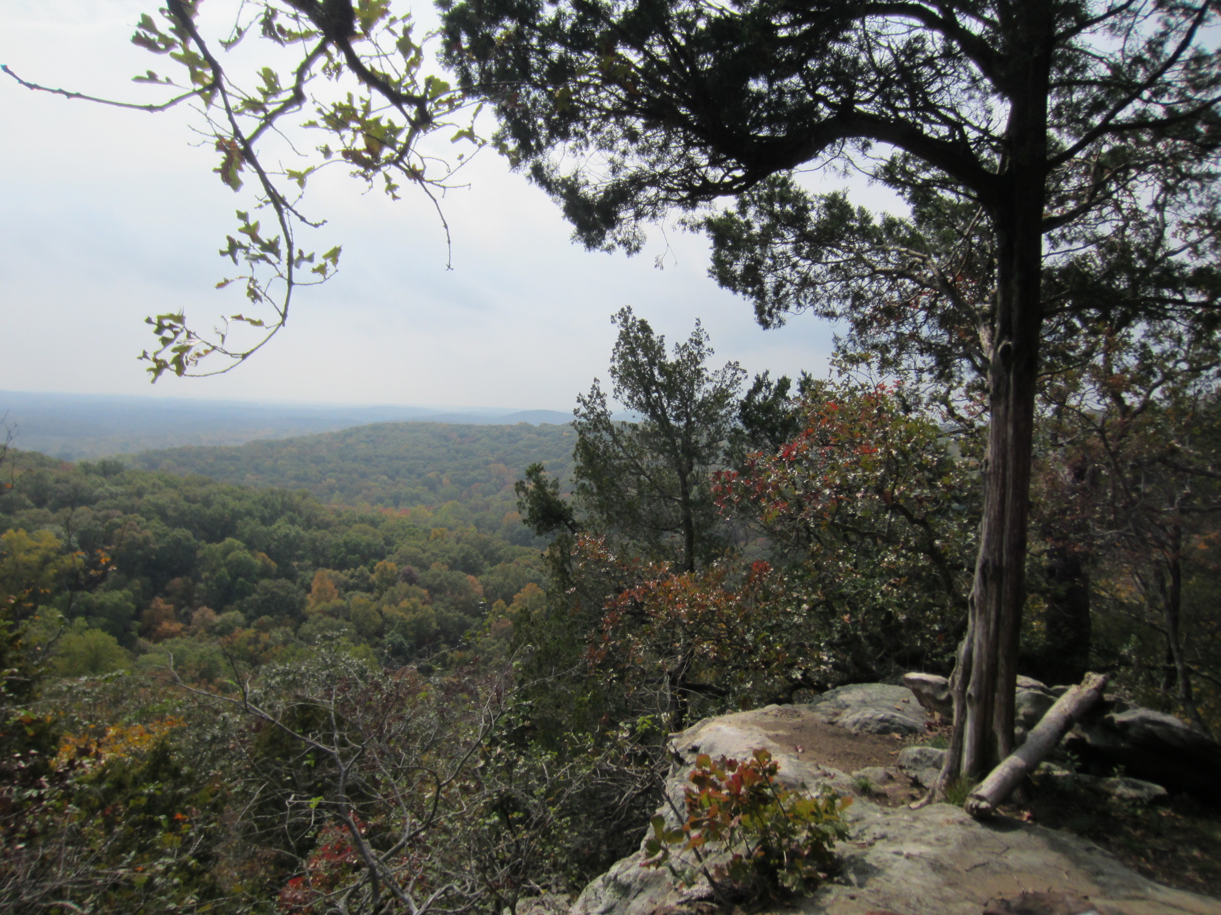
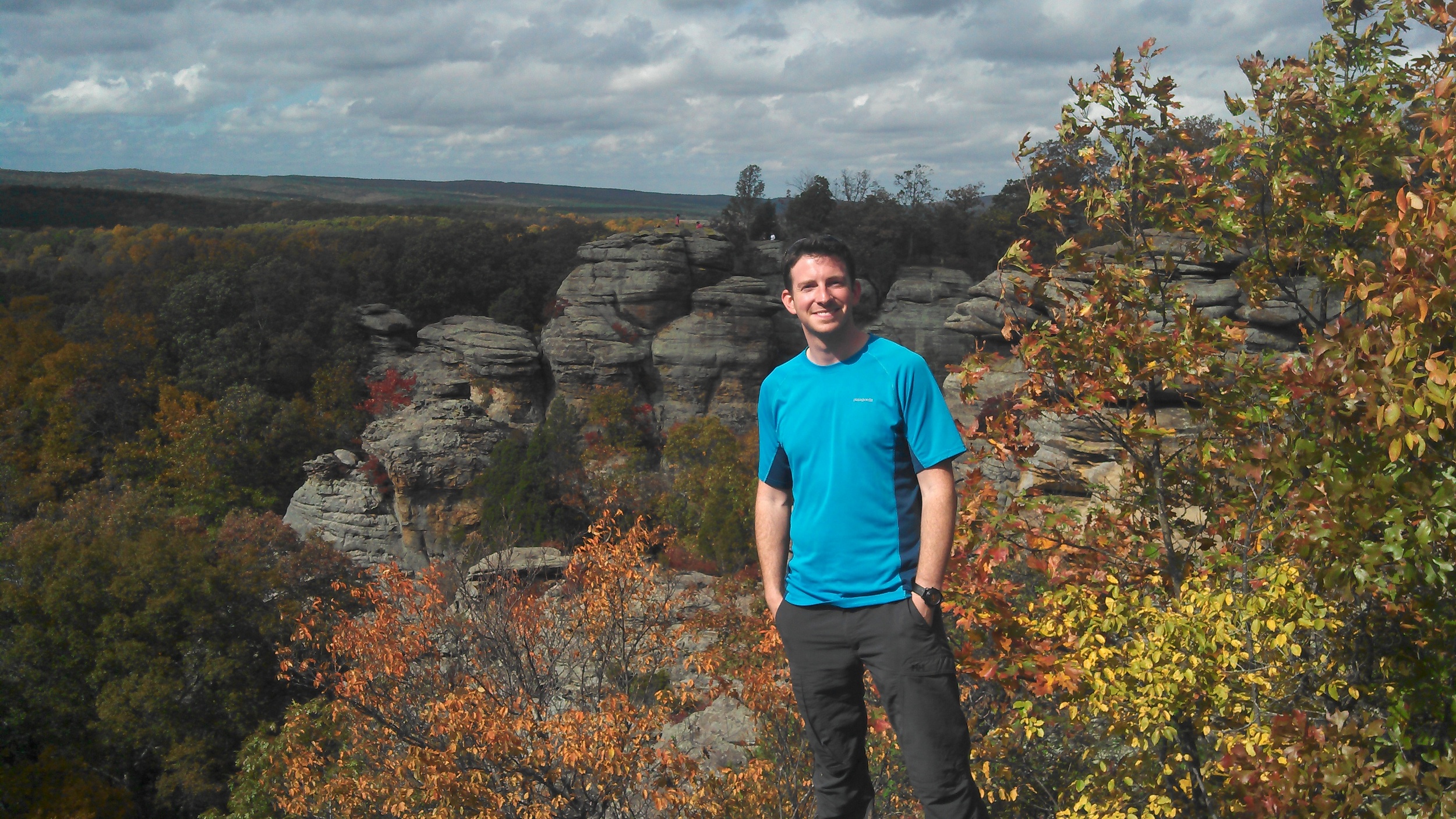
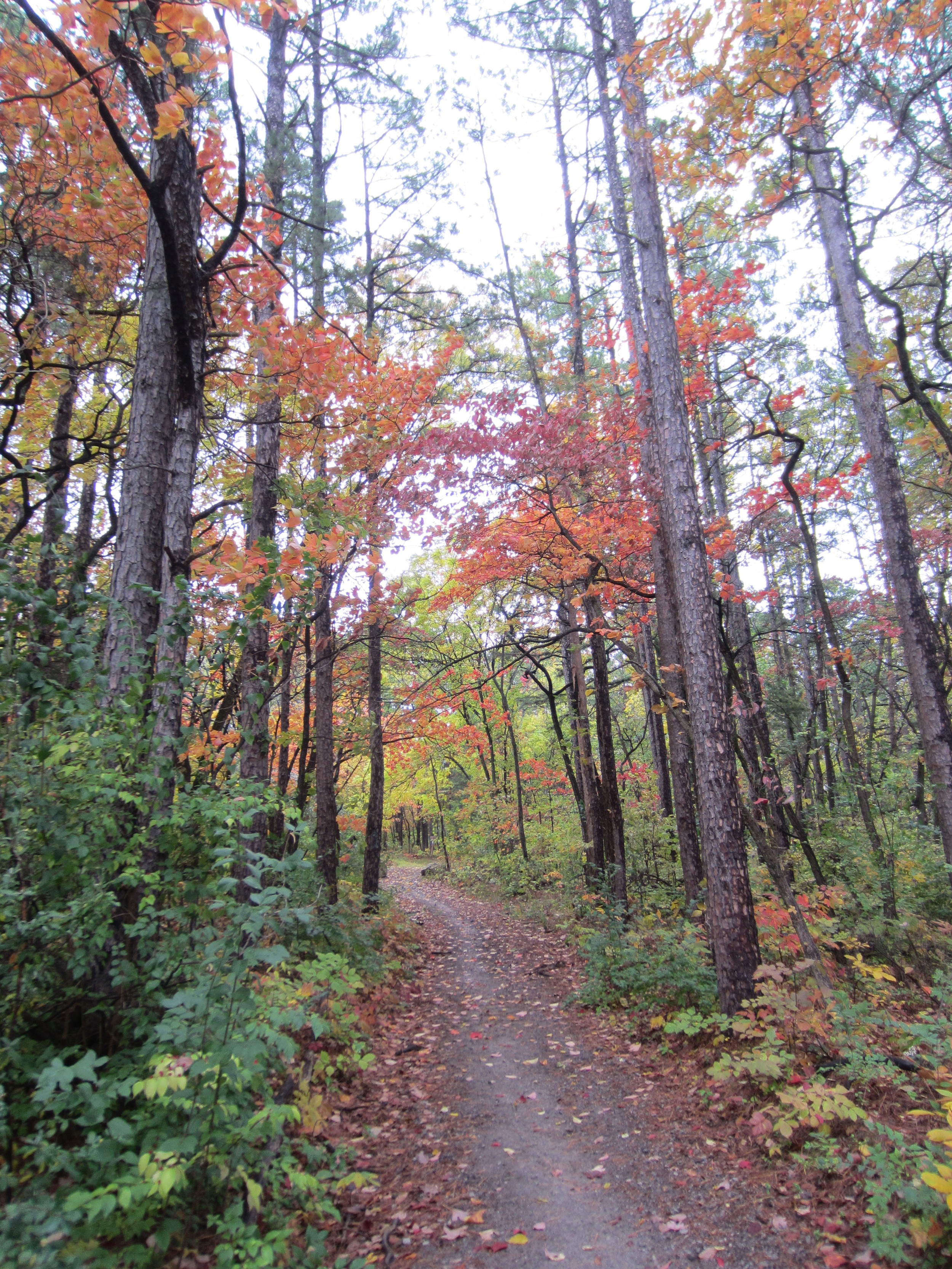
River to River Trail - Shawnee National Forest near Harrisburg, IL
Less than a week after returning from eastern Kentucky I was off in another direction. This time to hike. I've got another Backpacker magazine article in the pipeline and had been wanting to hike part of the R2R Trail for awhile. This is an excellent time of year to go if you're looking to get outside! It was a beautiful hike and the temperatures were ideal for walking 25 miles with a 20 pound pack. I'll give you a little taste of the trek... maybe enough to wet your appetite to read the full trip report when it's in Backpacker sometime next year.
When you think of Illinois chances are featureless cornfields are the first thought that come to mind. Instead southern Illinois holds a well kept secret in the River to River Trail. The path stretches more than 160 miles touching the Ohio River at its eastern end and the mighty Mississippi River at the western confluence.
Hike 18 of the most scenic miles on this hike which takes you through the strangely out of place Garden of the Gods and past steep rocky overlooks which give you Sierra style views in the midwest.
There's a lot of editing that'll go into the finished article but it was truely a neat section of trail with lots of points of interest. I'd never been to Garden of the Gods before but was completely surprised with how cool and out of place it was for this part of the country. The leaves weren't quite at their peak as you can see from some of the pictures but the colors look brilliant after the fresh rain we had one night.
Social Media Conference - Mayo Clinic in Rochester, MN
Totally unrelated to anything outdoors I got the chance to attend a conference taking a closer look at the use of social media in healthcare. I can't say enough about the Mayo Clinic and what they're doing with communcation and specifically with social media. Mayo is sort of like the Mecca for healthcare. They lead the way in innovation. In fact I toured their Center for Innovation which works to discover better ways at improving the healthcare system for patients. The center's mission statement is "Transforming the delivery and experience of health care". It really showed me how thinking outside the box can make a huge impact. I learned a ton from the session and saw some great social media and marketing strategies that worked!
Well that's the last two weeks... and here I sit in the airport waiting for a flight and a cup of coffee from 'Caribou Coffee' when I get to Minneapolis/St. Paul. Owensboro really needs to get one of those...
Recently while climbing in the Red River Gorge in Kentucky Meg and I discovered a nice 50 foot climbing route.... and by discovered I mean in the guide book. The route, named Boilerplate, was tucked away in one of the furthest reaches of the Pendergrass Murray Recreational Preserve.
Now, just to be clear, I don't crush it on 5.11, 12 or 13. I'd like to climb 5.9 without falling... so finding a four-star 5.8 that was described with phrases like 'excellent route for the grade' and 'pull on solid plates' really got me excited for the hike in and the climb! When we arrived the route did look awesome... except I started to second guess myself. The 'steeper run for the chains' looked really steep and the first bolt looked way up there. I was all stoked to climb this highly recommended 5.8 but I didn't want to go all Alex Honnold free solo to the first bolt!
I made it to the chains of Boilerplate... on top rope. Yeah, it pains me to say that... I didn't climb the whole route on lead. I hung all over the crux and mentally fell all over the place. That's one of the things that makes climbing so unique from other sports. While I feel like I failed climbing that day, that might have been someone else's highest moment in the sport. Climbing a stiff 5.8, on top rope, without falling. Is one way bettern than the other? I try and tell myself not to get caught up in the numbers, don't worry about the grades, just enjoy the climbs. Truth be told... I do enjoy climbing but I want to succeed on my terms.
When the astronauts of Apollo 13 (that's right, I'm about to use an Apollo 13 reference in a climbing blog) didn't make it to the moon, but made it back to earth safely the mission was dubbed a 'successful failure'. I feel like Boilerplate was my successful failure. I climbed the route, but I didn't do it the way I wanted to. I think more than that I mentally failed at a climb I am physically capable of doing.
Is pulling on gear or hanging on a draw wrong when climbing a route? I don't see any referee blowing a whistle at the bottom of the line. Does climbing on top rope count as climbing? You made every move...
I say all this to make this statement: Most of us climb because we enjoy it so maybe I should just lighten up. Nope... I'm going to climb Boilerplate and succeed on my terms. Good thing Rocktoberfest is coming soon...
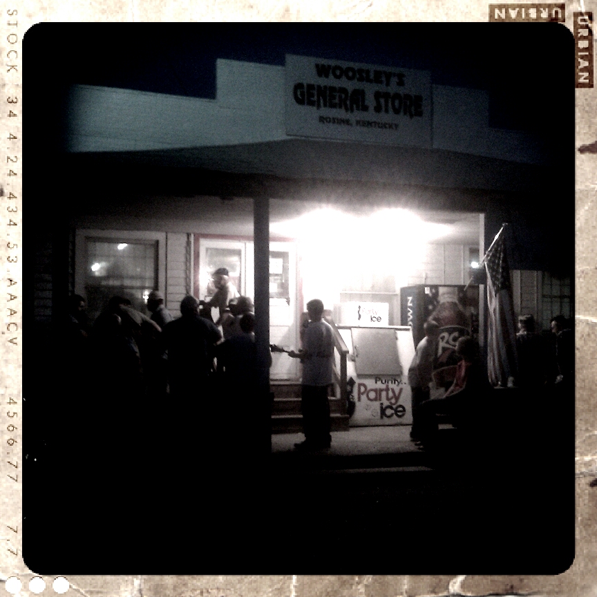
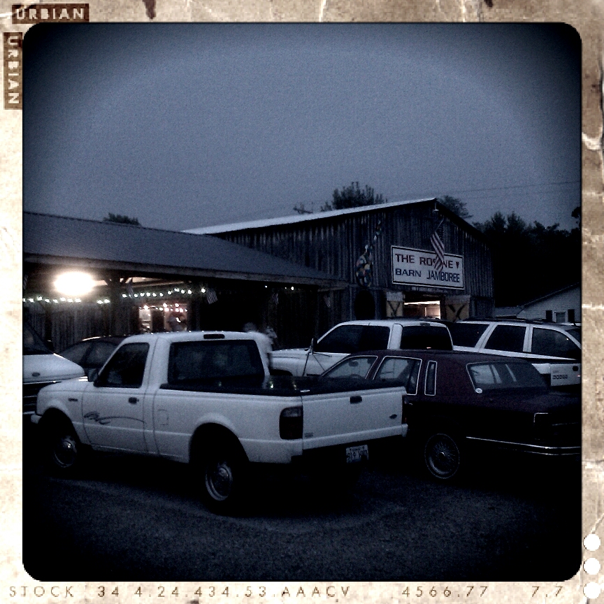
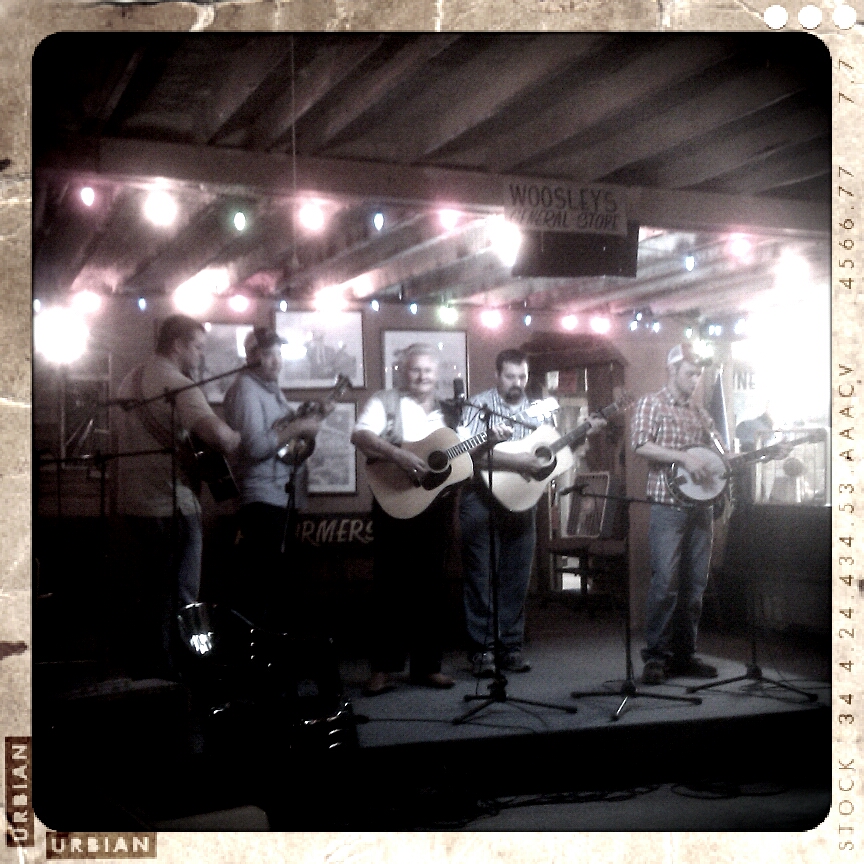
One of the best cultural gems the state of Kentucky has to offer is hands down bluegrass music. If you want true, unadulterated bluegrass, the best place to hear that is Friday nights at "the barn". Meg and I have made the trek down to Rosine several times and have hardly ever left disappointed. Each time we're treated to excellent music from groups who live for Friday night in the barn each week. Some of the groups have been locals... others make a pilgramage to the birthplace of the genre for a shot at playing in the Mecca of the music. It was a rare treat to hear one of Bill Monroe's 'Bluegrass Boys' perform with a young group named the Logan County Ramblers. They lit up the stage with their fast pickin' and great harmony.
If you get a chance to take the trip down the 'Blue Moon' highway I recommend it. If it's a nice evening, roll the windows down on the drive. You'll know when you're getting close to Rosine... just listen for the bluegrass.
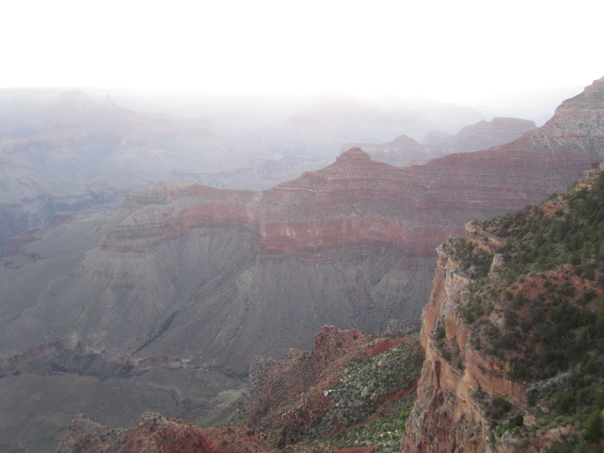
The phrase “pictures don’t do it justice” is cliche’ and overused when describing just how magnificant the Grand Canyon really is. However there’s a reason you hear almost everyone, who has visited the canyon, use that saying to describe just how grand it really is... because it’s true.
John Wesley Powell, who led the first expedition into the Grand Canyon, said it best.
"The wonders of the Grand Canyon cannot be adequately represented in symbols of speech, nor by speech itself. The resources of the graphic art are taxed beyond their powers in attempting to portray its features. Language and illustrations combined must fail."
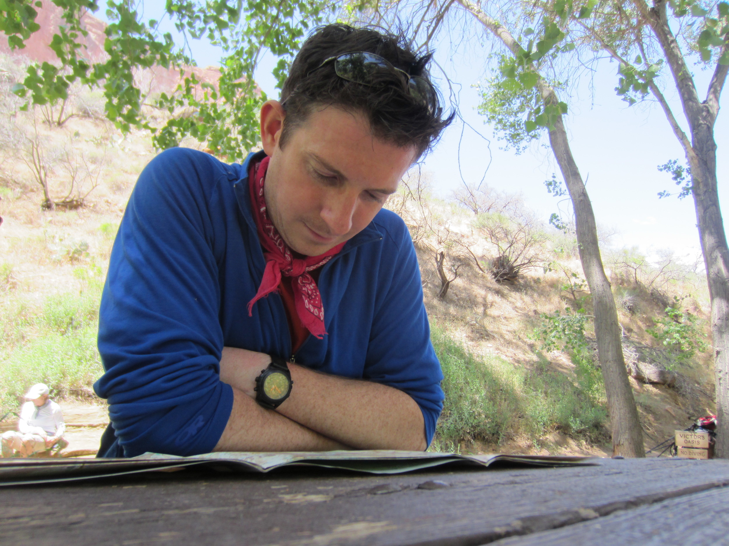
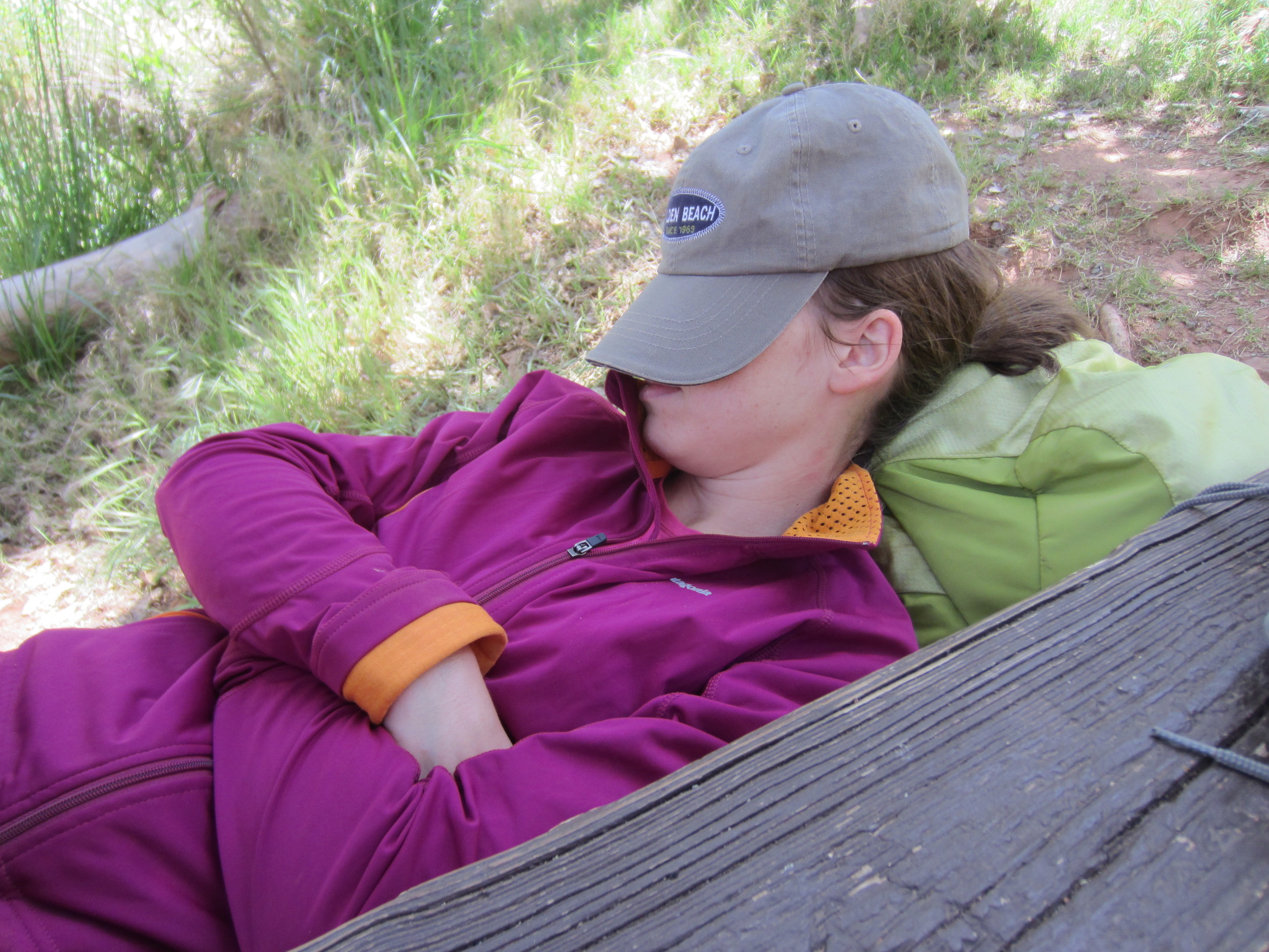
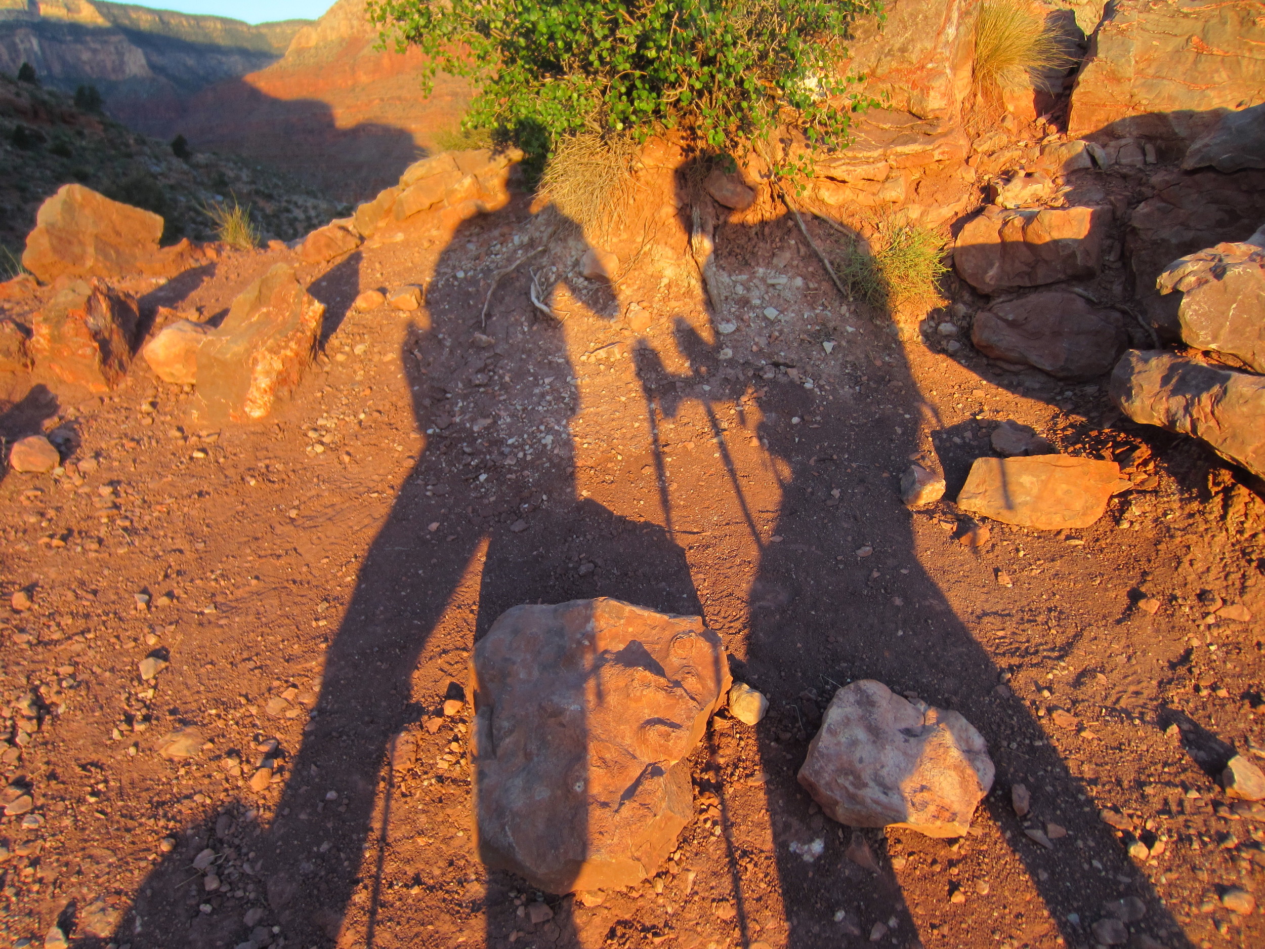
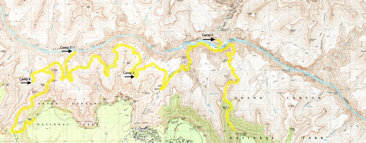
I could throw the thesaurus at you and use every adjective available to describe our hike through the desert landscape of the Grand Canyon but I won’t. Instead I’ll share my daily log from our backpacking trip which covered 43 miles over five days and span from some of the highest points on the south rim to the Colorado River at the bottom.
Sunday 5.6.2012
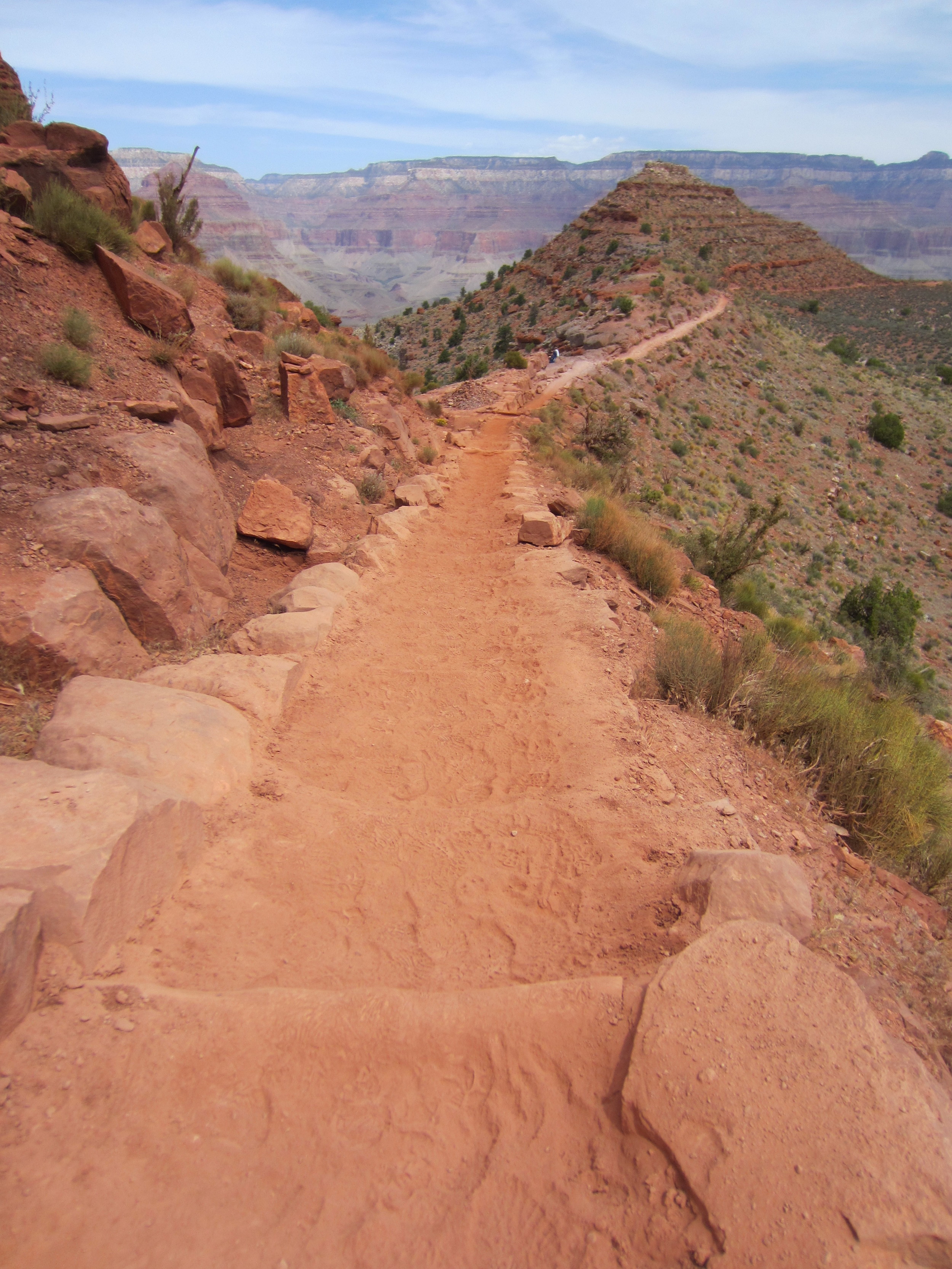
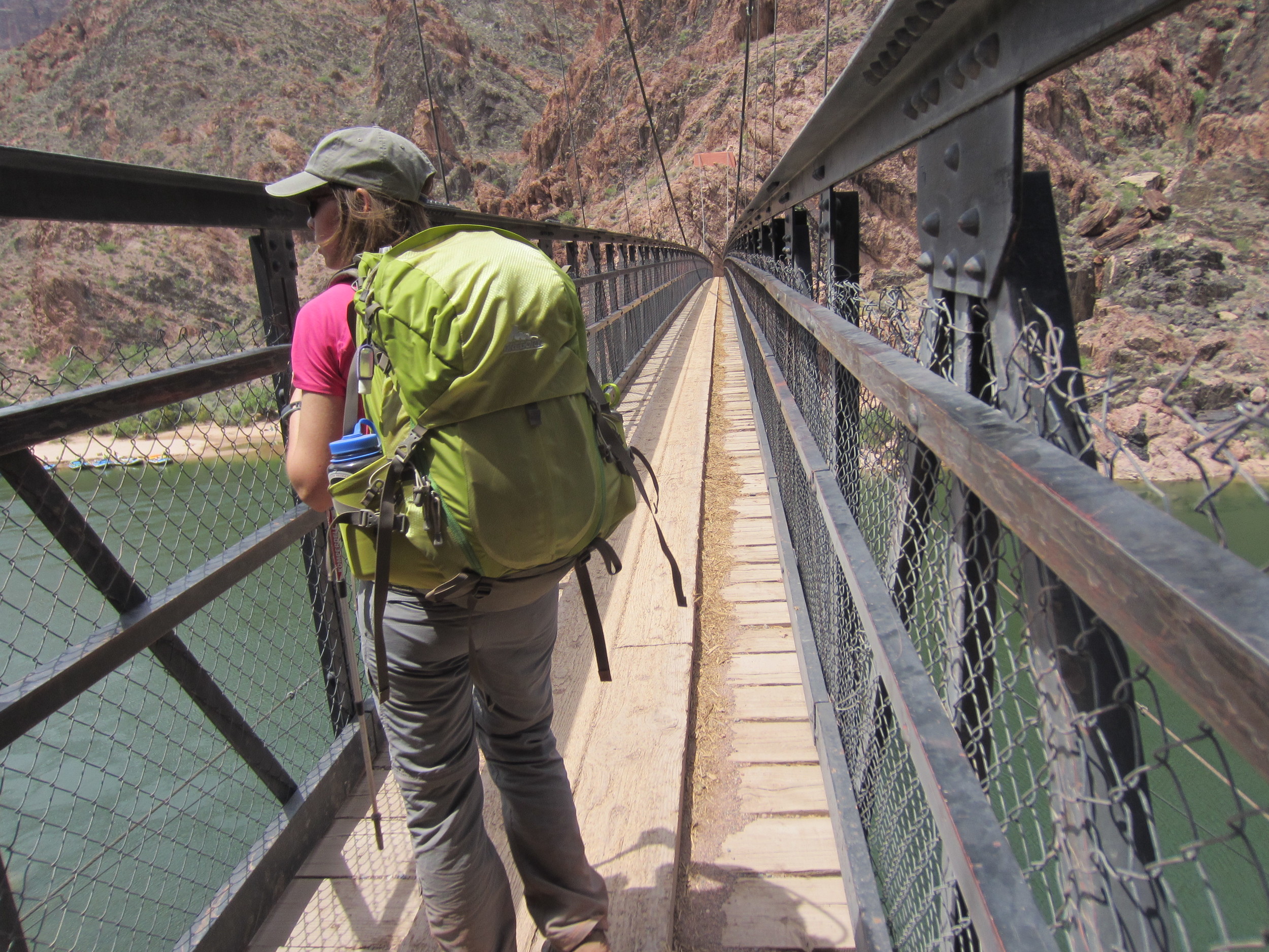
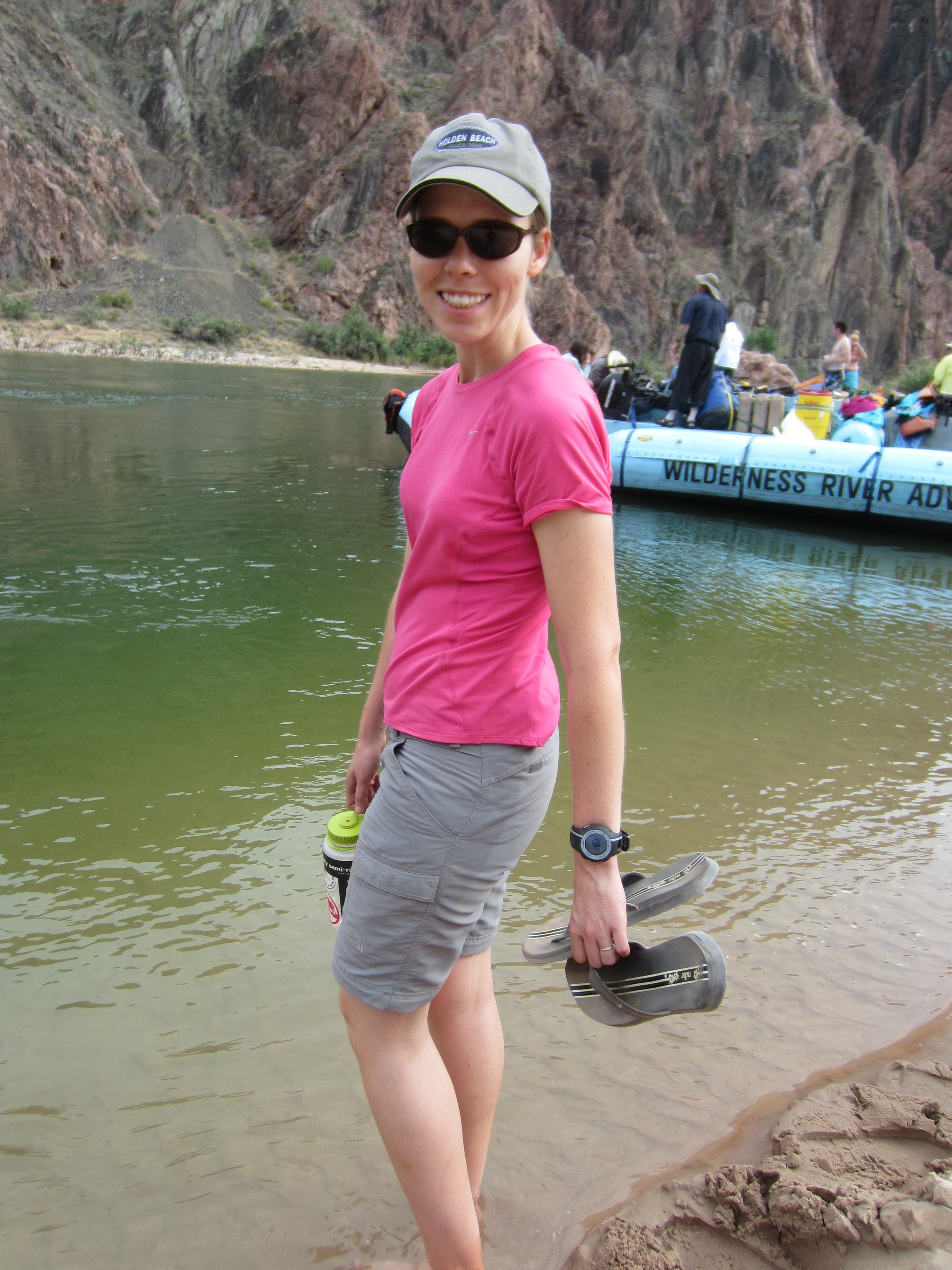
Hiked down the South Kaibab trail to Bright Angel Camp Ground. We left the south rim at about 8:30a and arrived at B.A. around 1:30p. It’s truly an amazing hike. Around every twist and turn on the trail were either a 360 degree panoramic view of distant buttes or an overlook that dropped thousands of feet. So far it has been a nice, relaxing hike. Stopped in the Phantom Ranch canteen and mailed some postcards and relaxed around camp. Tomorrow we head to Horn Creek.
Monday 5.7.2012
Started the day with oatmeal and coffee. Food always taste better in the backcountry (until you’ve eaten it for five days and then you’re ready for a meal that wasn’t cooked over a camping stove.) Sipping the morning joe while watching the sun hit the canyon rim 4,000 feet above.
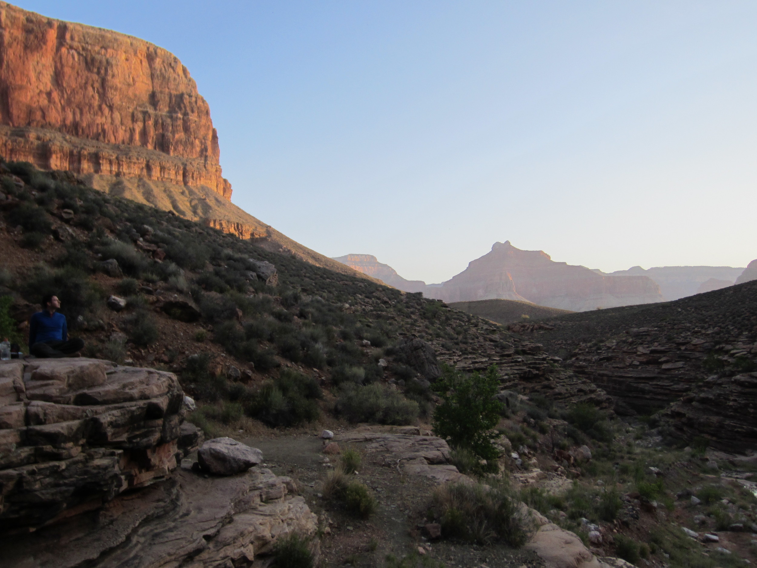
Had a strenuous climb up the Bright Angel trail this morning to Indian Garden camp ground, five miles and approximately 1,000 to 1,500 feet of elevation gain. We’ve been relaxing at I.G. in the heat of the day. It has been a nice break! Temperatures are in the upper 70’s and low 80’s but in the hot, desert sun it shoots up into the high 90’s or right around 100 degrees. I feel like I’ve been cheating so far on this hike. We’ve had water sources and pit toilets at every stop. I think things are going to get a little more wild once we hit the Tonto Trail.
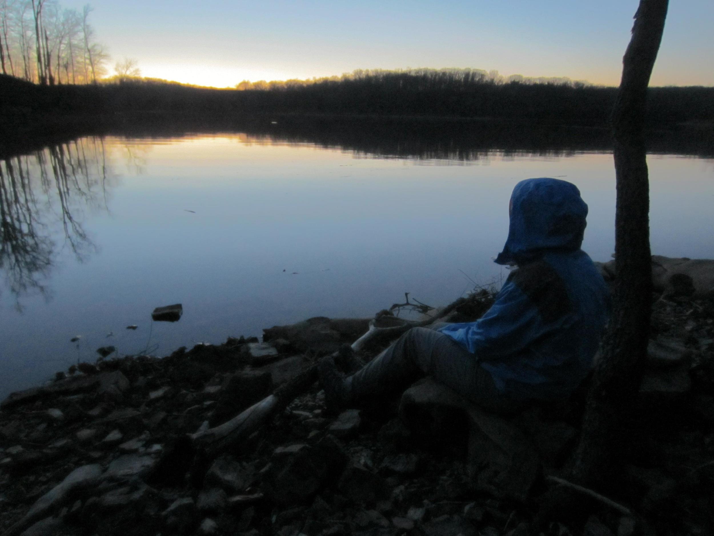
The Tonto is a lot more wild and exposed then I had anticipated. As soon as you leave the comforts of the corridor trails you immediately realize how isolated you are in the backcountry of the canyon. It’s very strange to go from full campsites and facilities to pitching our tent in what seems the furthest reaches of the canyon. It is so eerily quiet out here without the sounds of other campers. We arrived at Horn Creek about 5:15p cooked and ate dinner. I’ve picked out my spot for coffee and breakfast while watching the sunrise in the morning. Part of me is excited about the isolation while another part hopes I know what I’m doing!
Tuesday 5.8.2012
I think we both were a lot more comfortable with the Tonto today. Ticked off 10 miles and now we’ve set up camp on a beach overlooking the Colorado at Granite Rapids. The last mile and a half were pretty thrilling. We followed a slot canyon down, walking in Monument Creek and sliding down waterfalls. Now we’ve got the whole beach to ourselves. Second night not having to share a campsite with anyone. I thought that was unheard of in the Grand Canyon.
Wednesday 5.9.2012
Our routine continued of hiking in the morning and arriving at camp in time to retreat into the shade away from the hot Arizona sun. We sat under the tent rainfly which we fastened to a tree and snacked on peanut butter and honey sandwiches and trail mix. The Tonto is hot and provides no protection from the elements except at the occasional small oasis near the creeks flowing down the canyon into the valley. A Tonto trail mile feel a lot longer than other trails. Never have I felt so exposed and isolated while hiking as on this trail. Our last stop before heading out of the canyon is at the Hermit Creek campsite. The camp sits above a creek with a waterfall flowing into a small pool. We sat in the pool during the afternoon and rested up for our final push up and out of the Grand Canyon.
Thursday 5.10.2012
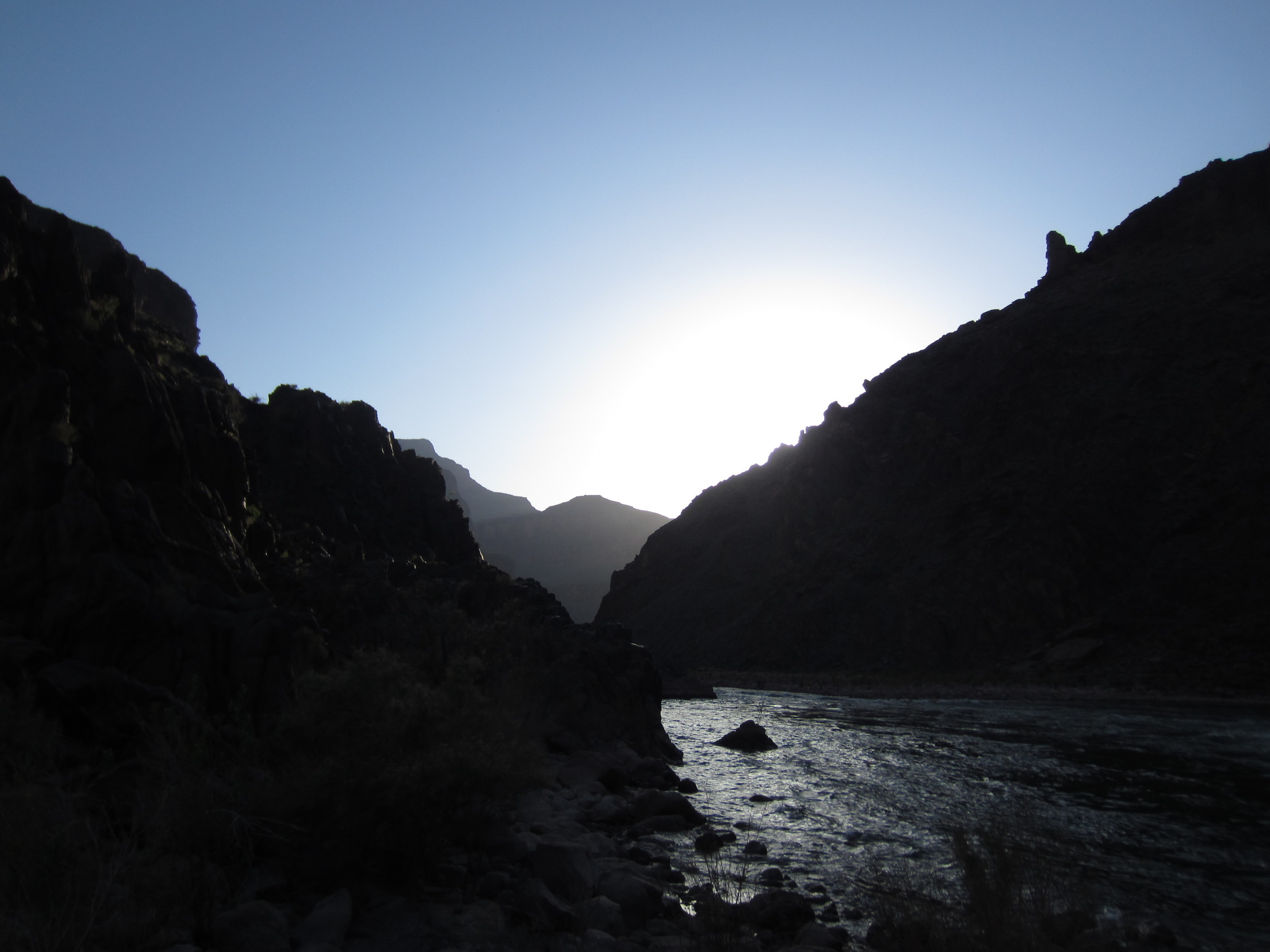
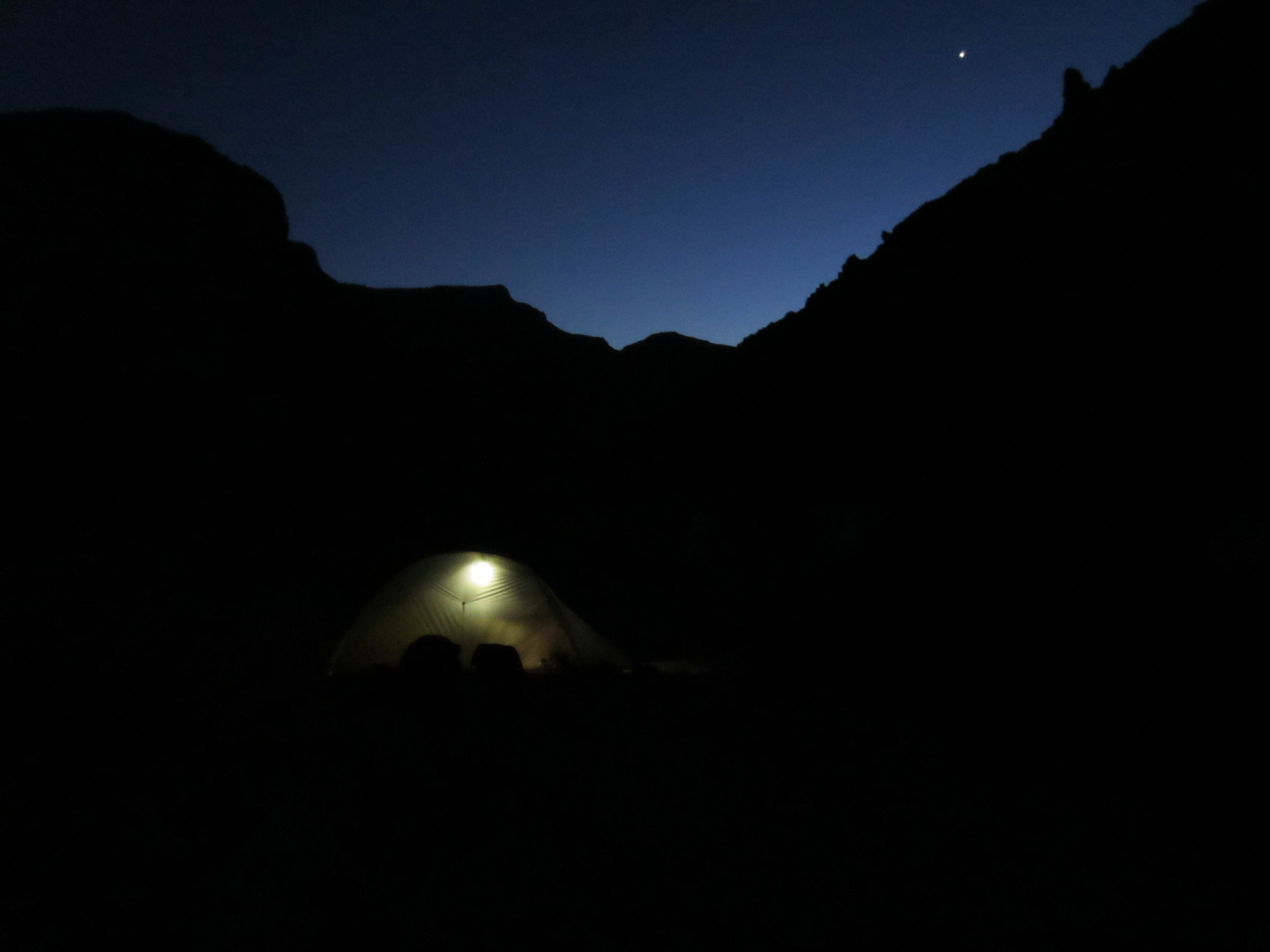
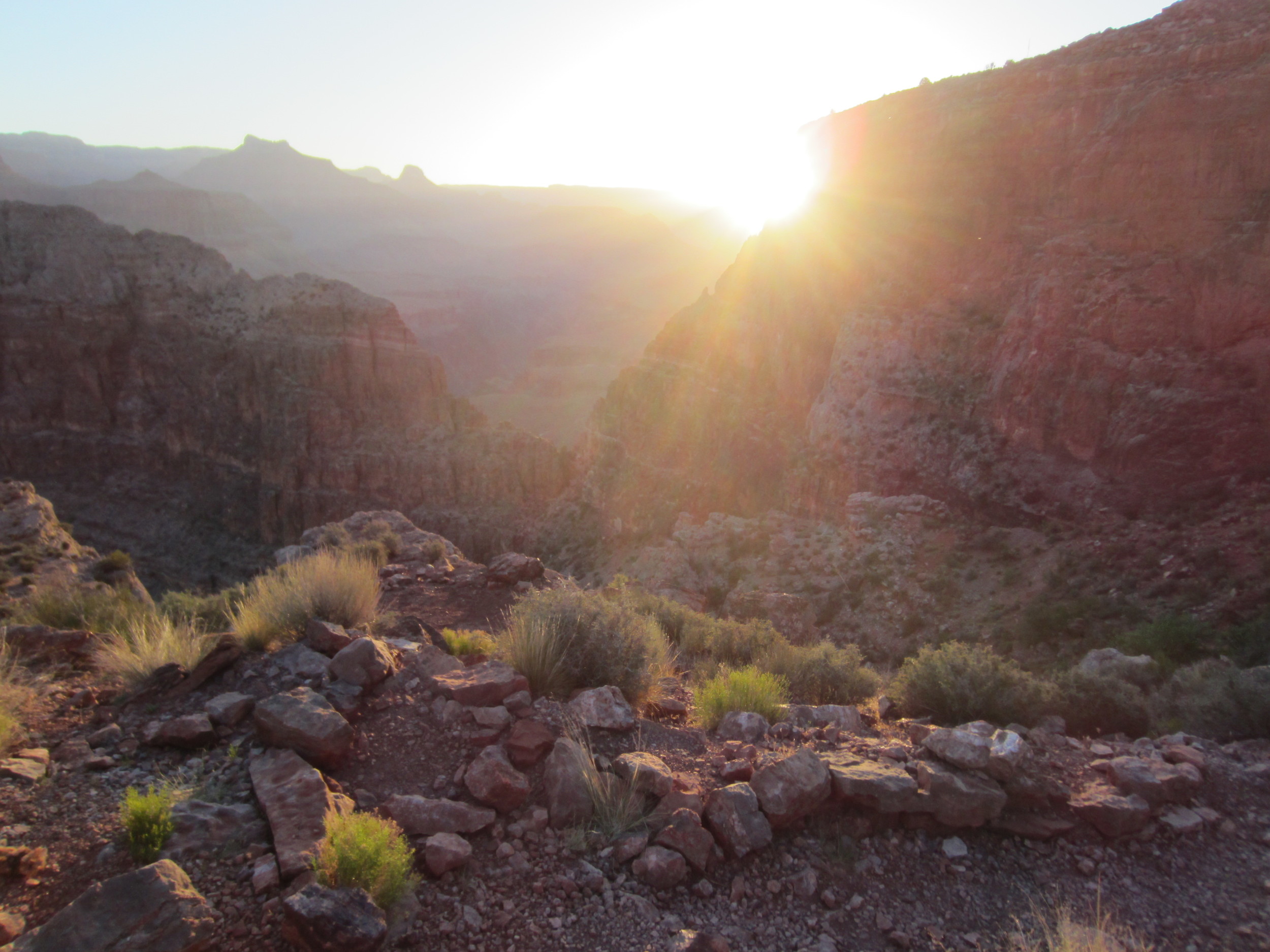
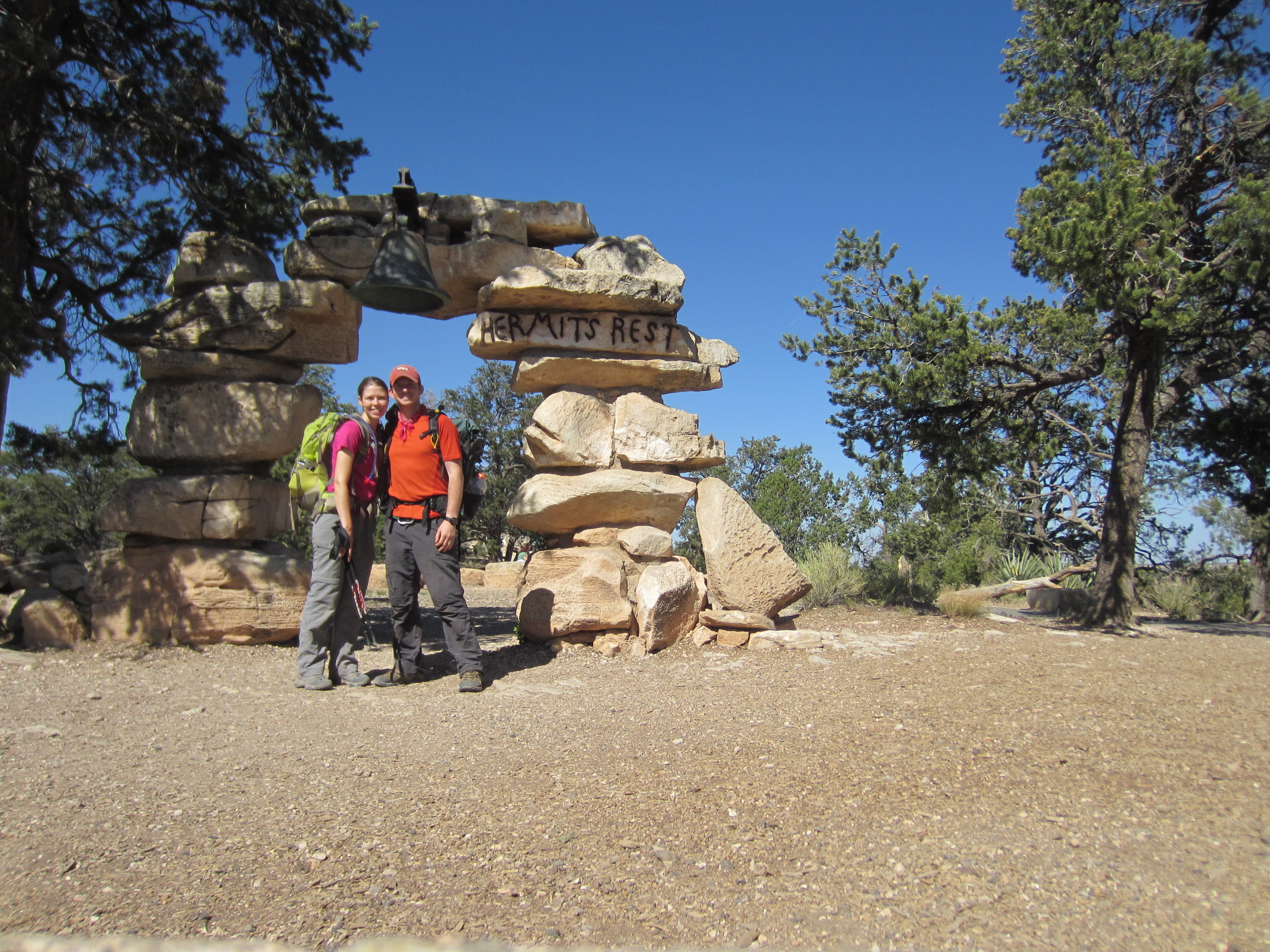
We awoke at 3:30a to a bright, nearly full moon peaking out from behind one of the canyon buttes. The stars were bright and vivid and I watched as a satellite moved across the early morning sky. We boiled water for coffee and oatmeal with the light of our headlamps and packed up camp in silence as nearby hikers continued to sleep. We were on the trail by 4:30a... focused and ready for what we knew would be a challenging hike ahead. After about a mile we came to the intersection with the Hermit Trail and started the ascent. As dawn came we were able to hike without our headlamps and by sunrise we had reached the Cathedral Stairs, a steep, loose section of switchbacks, the first real challenge of the hike. Much of the trail was rocky and narrow which lived up to it’s reputation since it’s unmaintained by the National Park Service. Several section were nothing more than giant boulders, the result of rock slides, we had to scramble over. Even though the trail was rough, it was awesome to see the canyon from up high once again, the first time in nearly five days. We reached the Santa Maria Spring about 8:00a and stopped for a few minutes to enjoy the shelter and rocking chair. The last 2.2 miles of trail was the most difficult by far. Few switchbacks and lots of elevation gain meant we climbed long, sustained sections straight up the side of the canyon. As we got closer to the top we could see sunlight and were certain the end was around every corner, only to be greeted with another switchback. At about 9:15a we made it to the top.
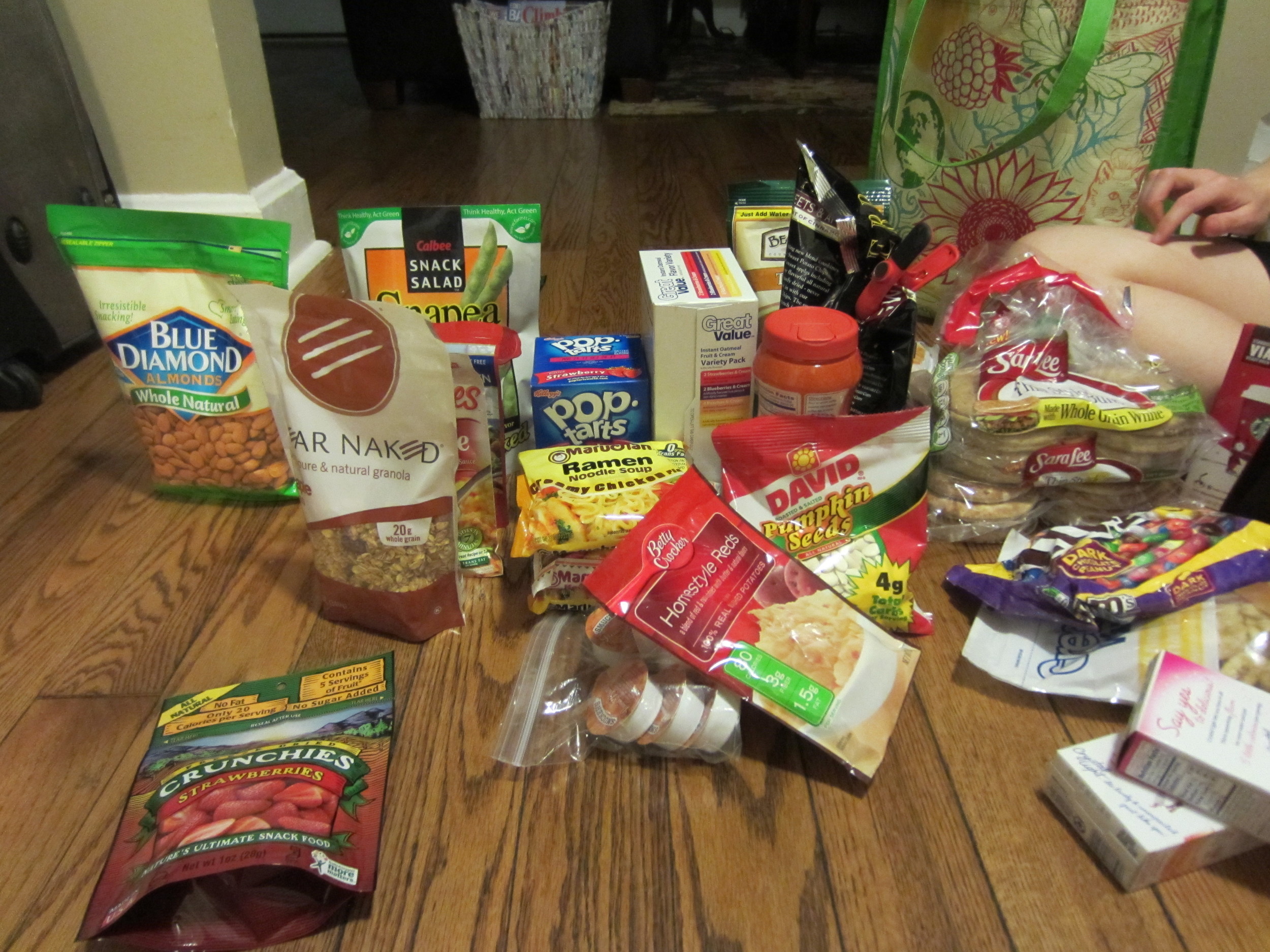
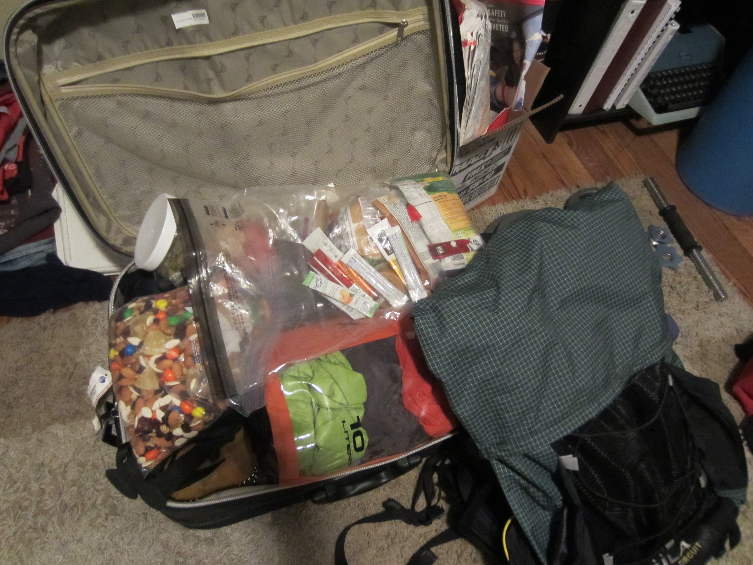
It's been a long road of preparation that started in December of last year when Meg and I decided we were going to backpack in the Grand Canyon. Permits were submitted January 1 and we waited until almost the end of January before our confirmation arrived. That's when the real preparation began and it ended May 4 when I zipped up my suitcase. Inside, four months of planning; all the food, equipment and supplies needed to camp for five days in the canyon.
Temperatures are looking good for May in the desert of northern Arizona. On the south rim highs will be in the mid 60's with overnight lows in the low 30's. At the bottom, highs will climb to the mid to high 80's with lows around 60 degrees.
I'll try and keep everybody updated but naturally there will come a time when cell phones no longer have a signal... and for that I am thankful! It's always nice to switch of the phone and put it away for a few days and not worry about email, facebook or twitter.
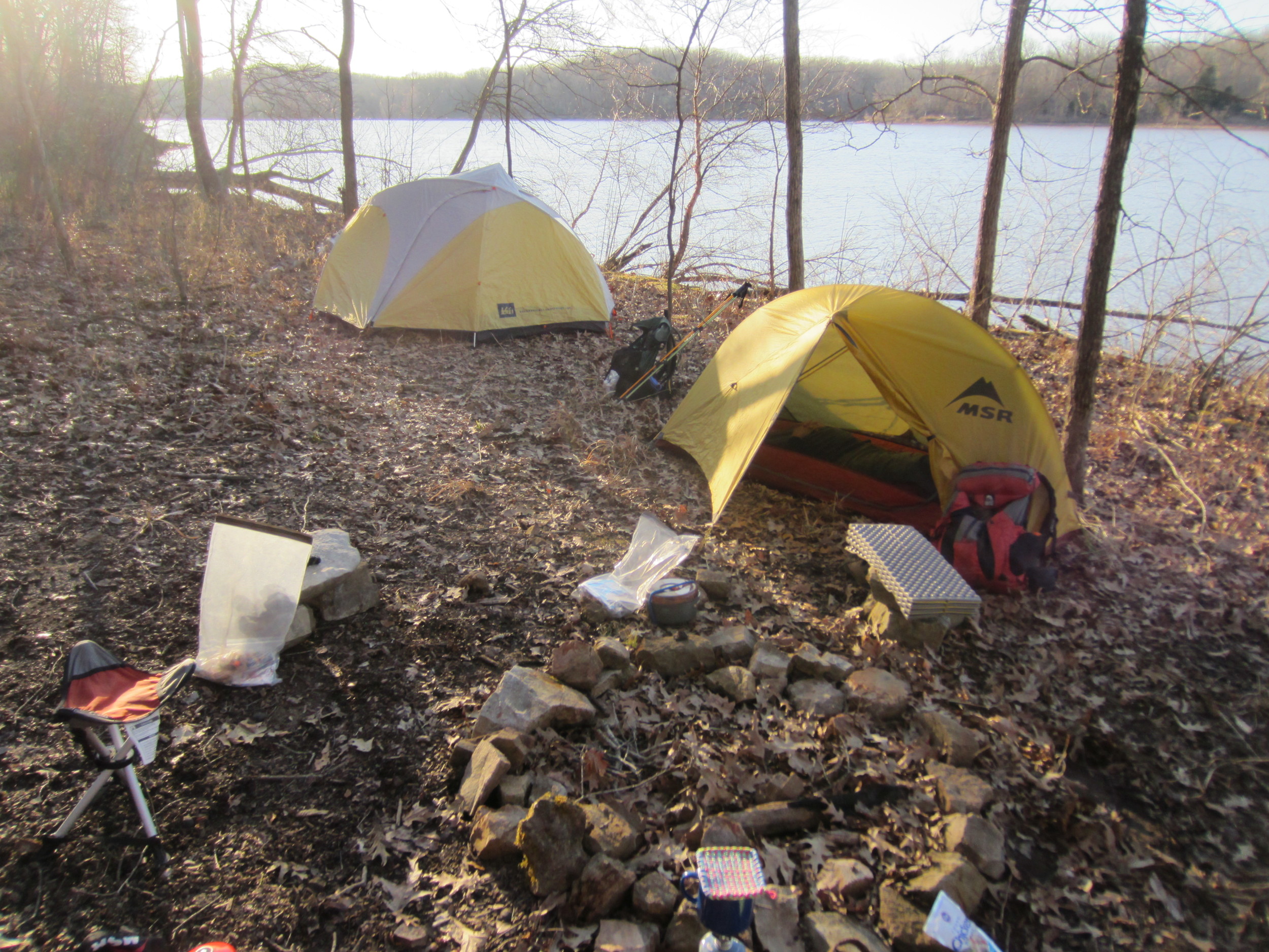
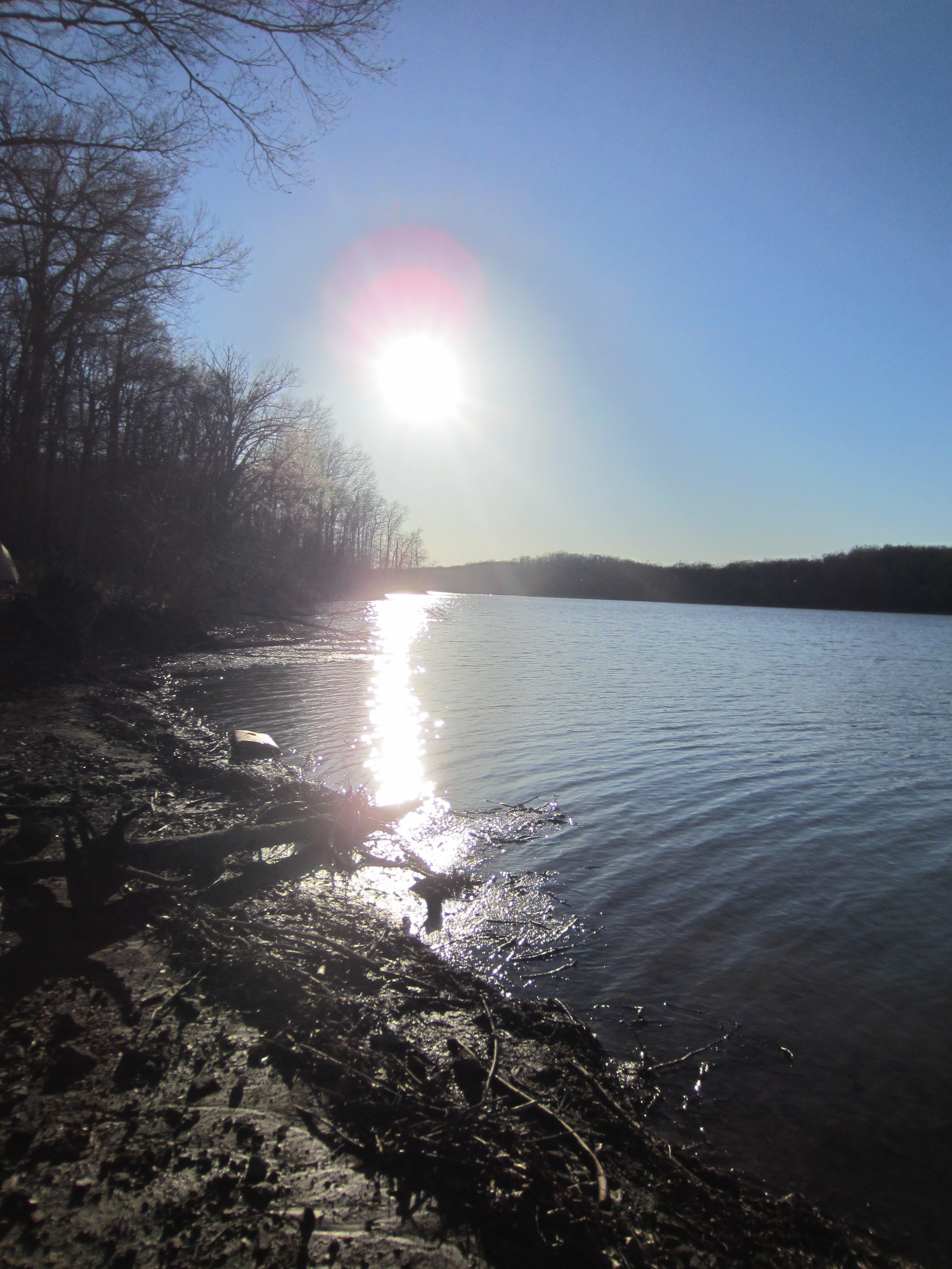
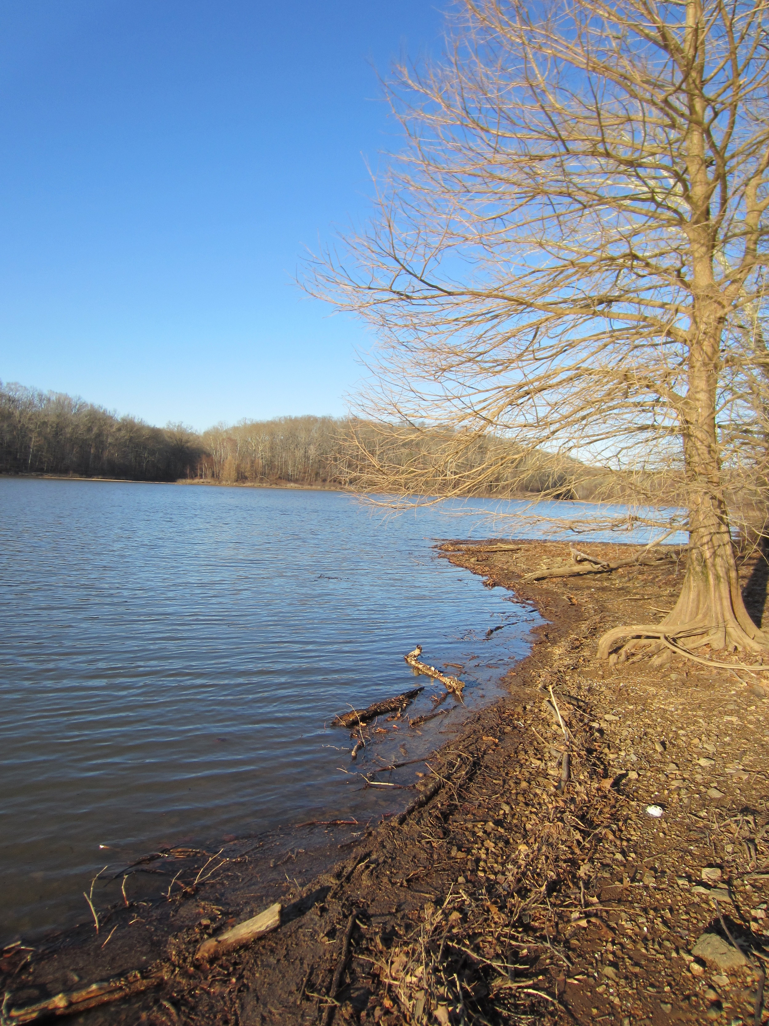
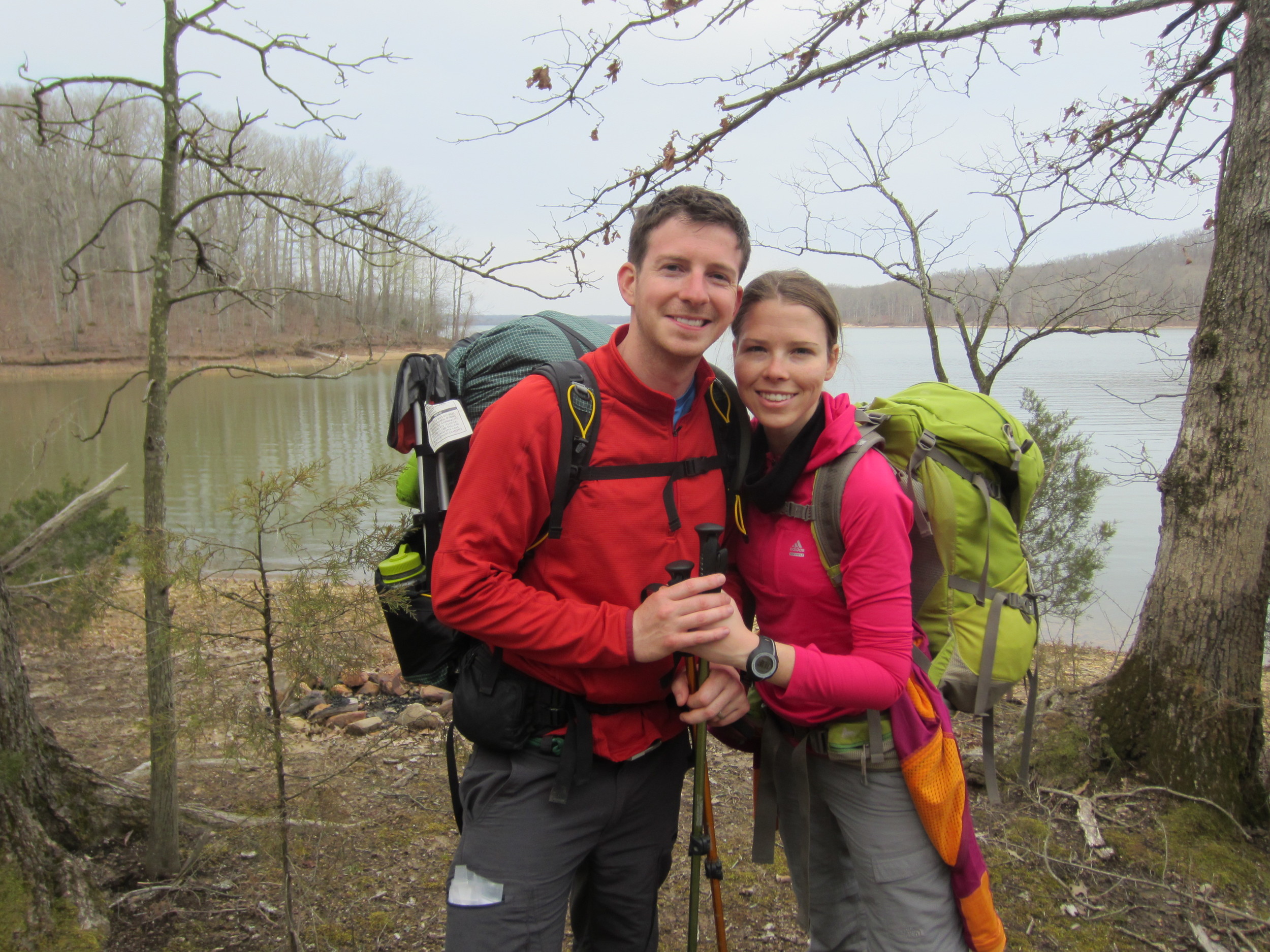
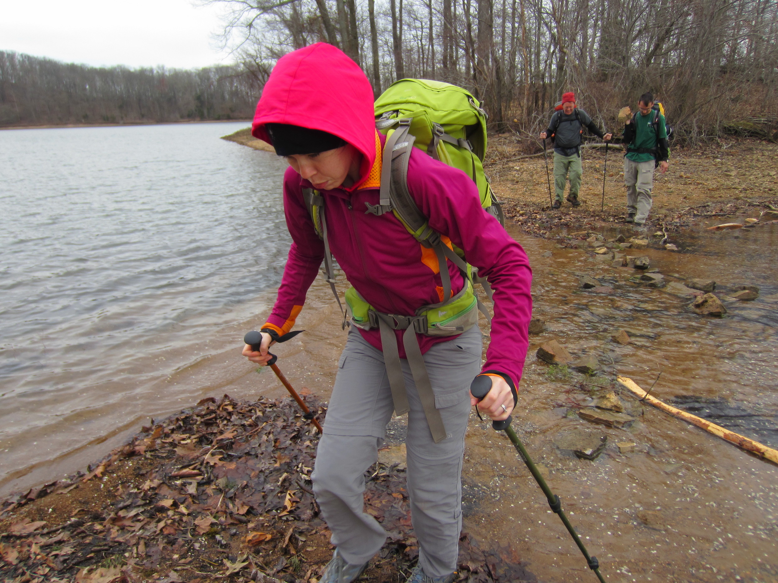
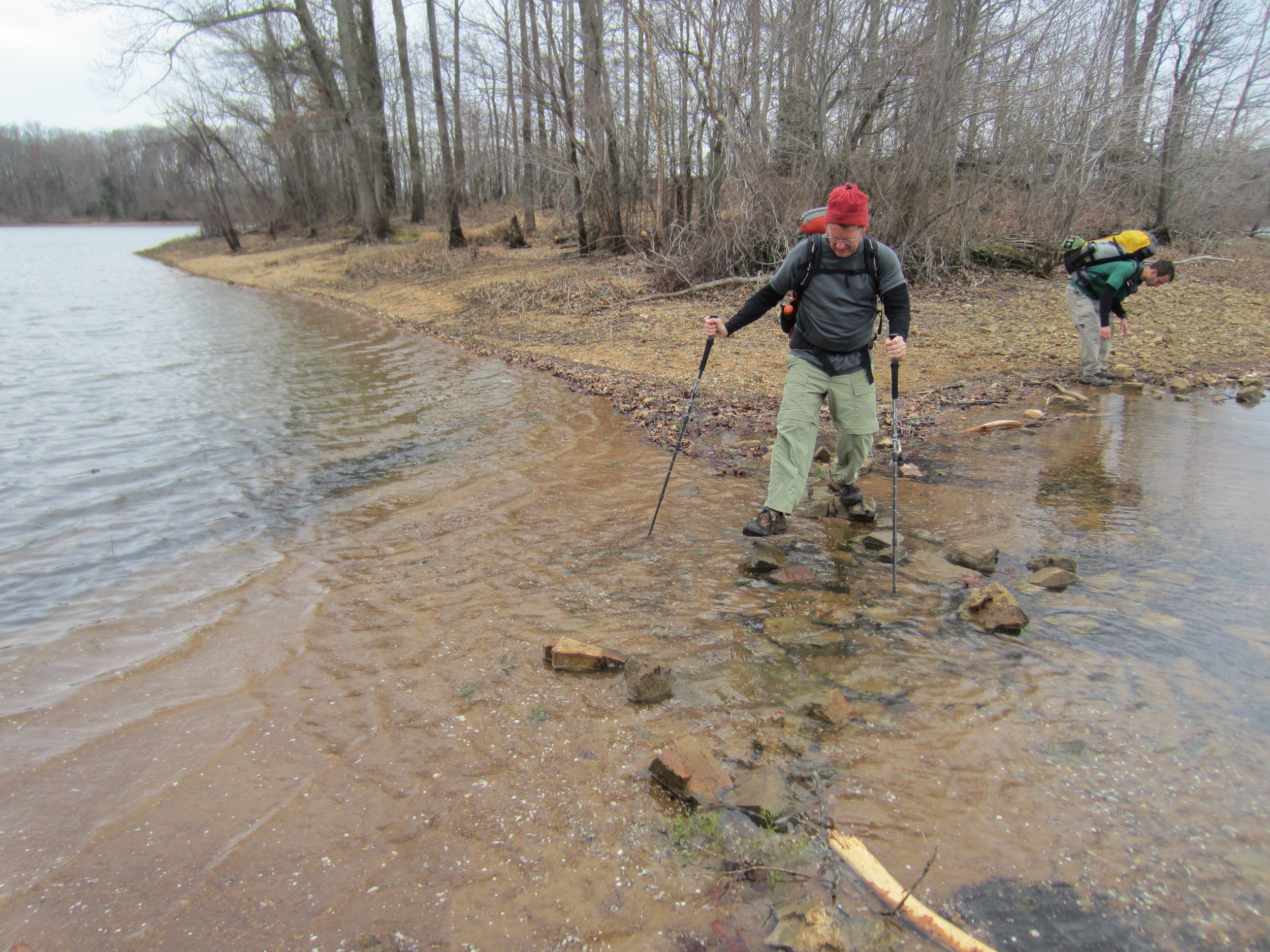
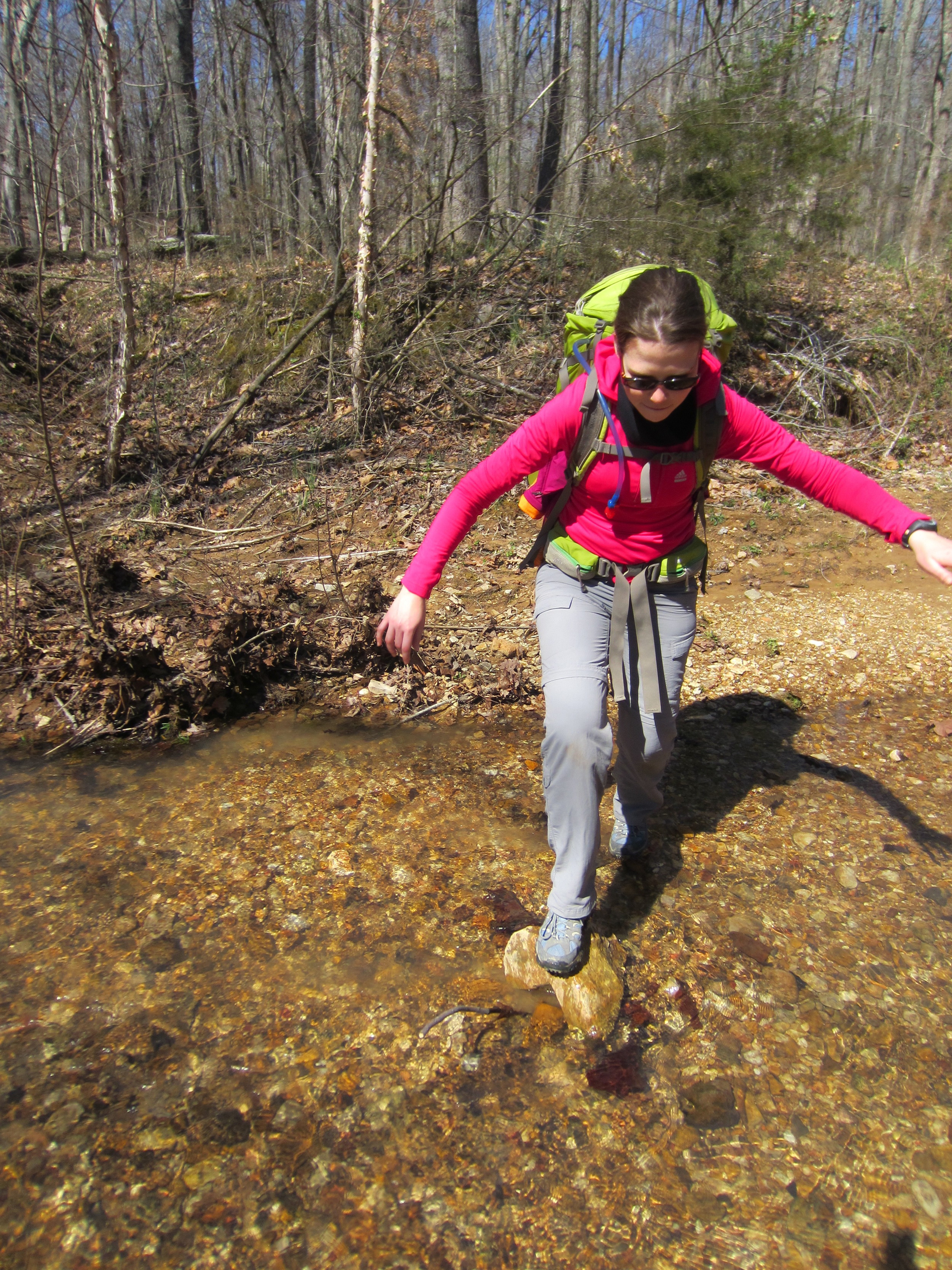
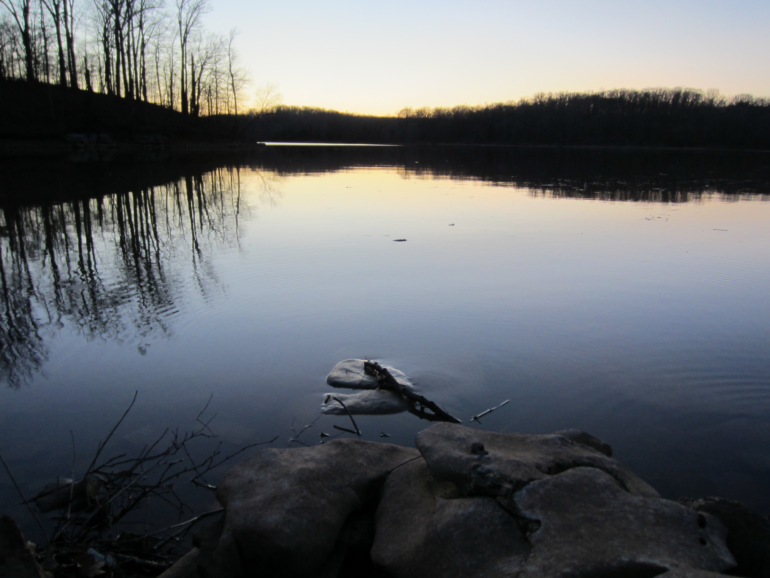
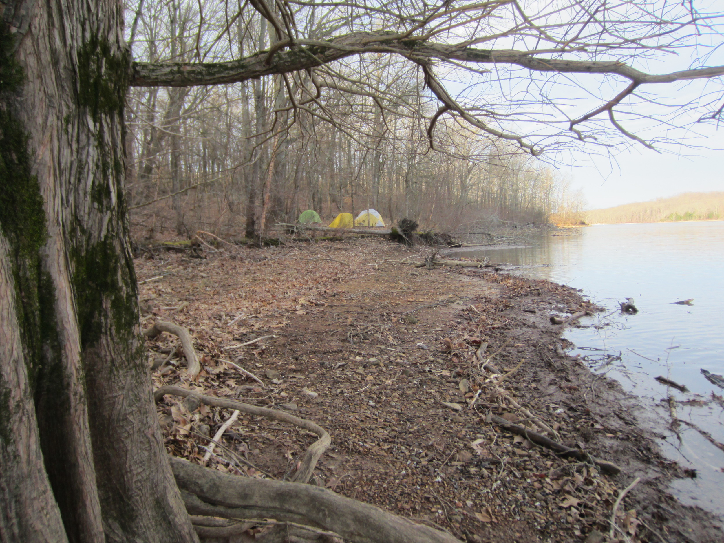
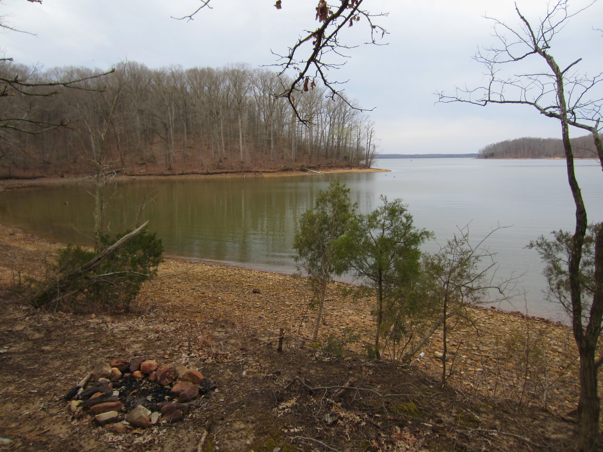
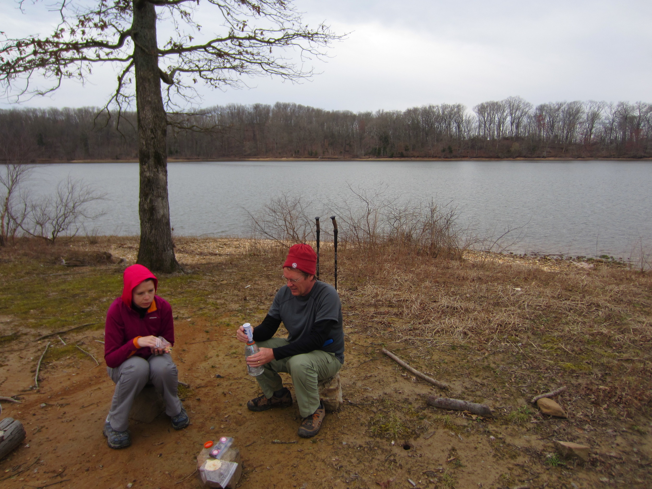
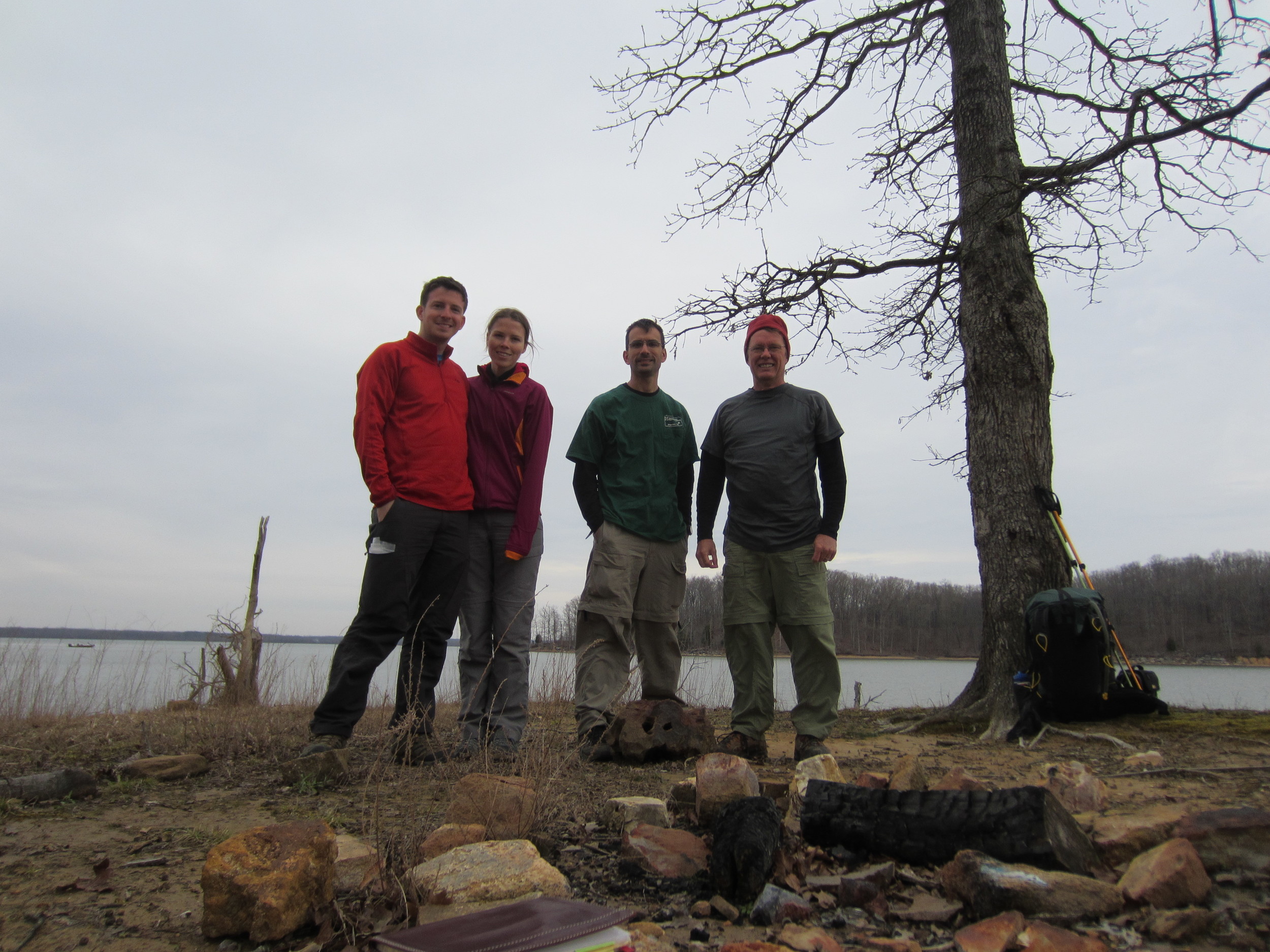
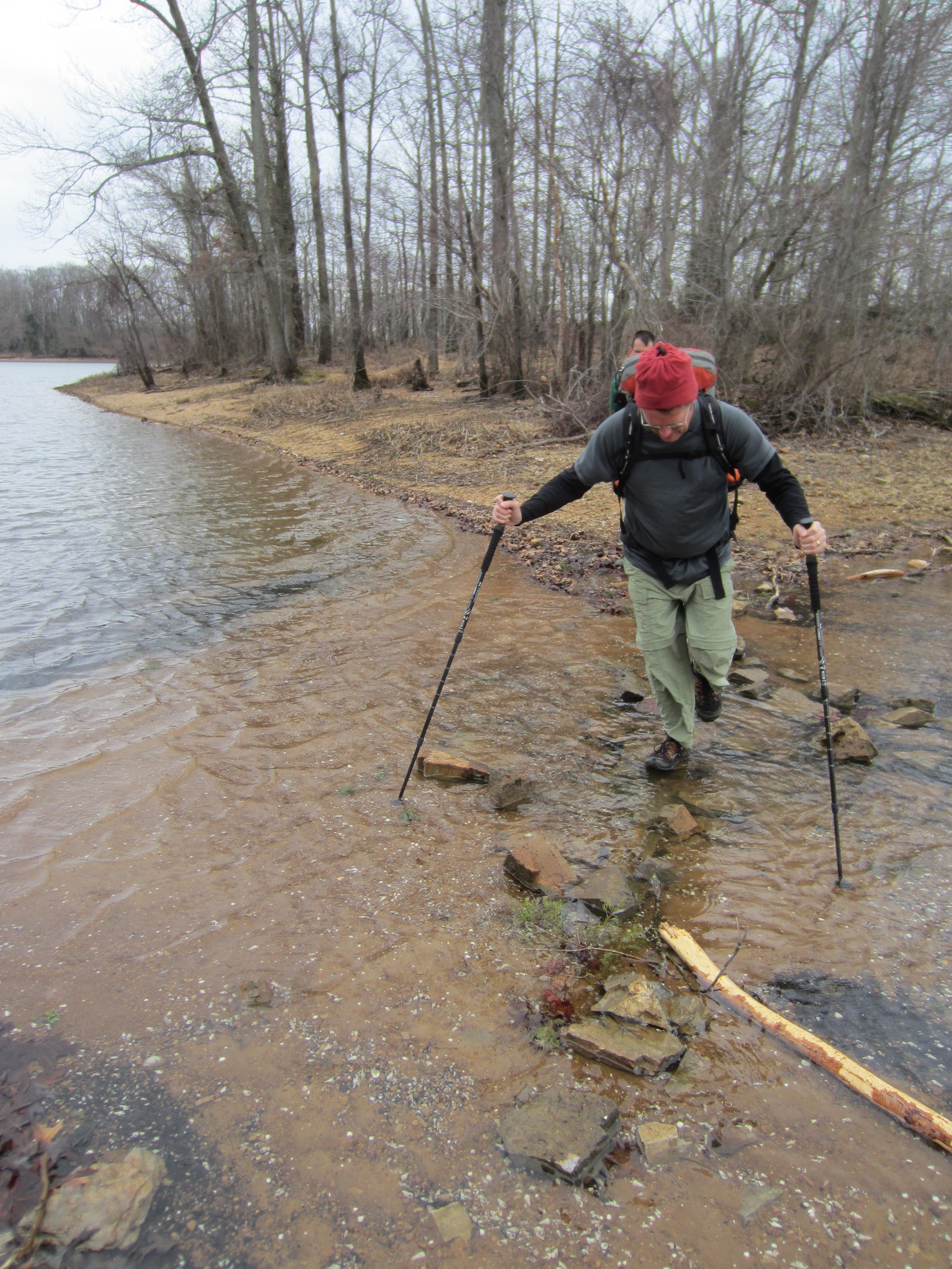
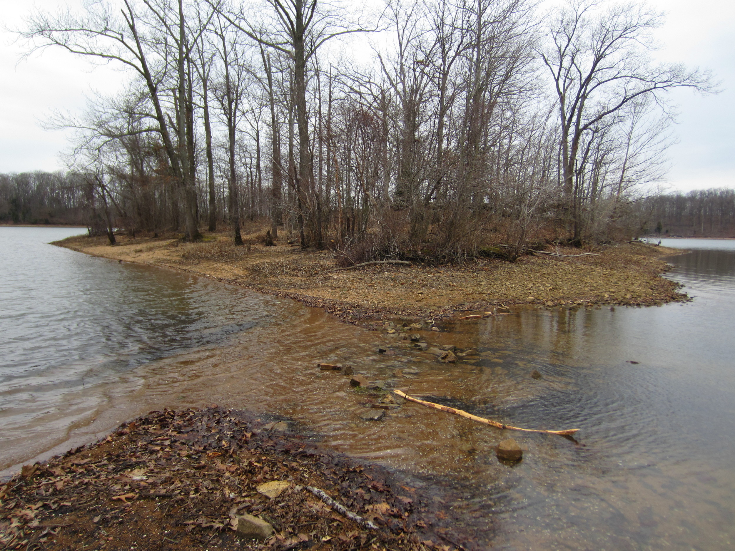
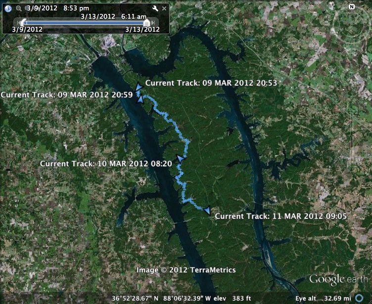
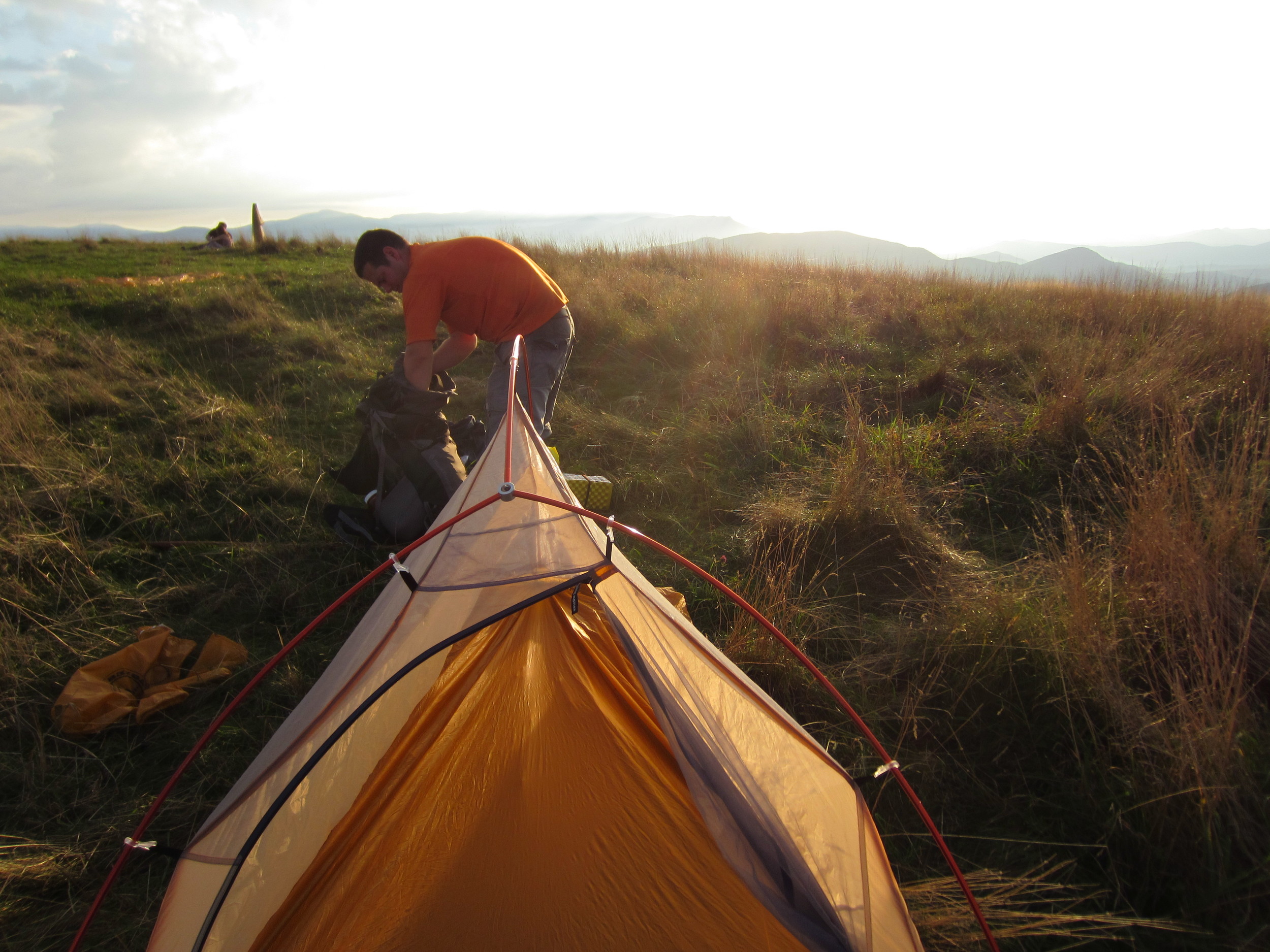
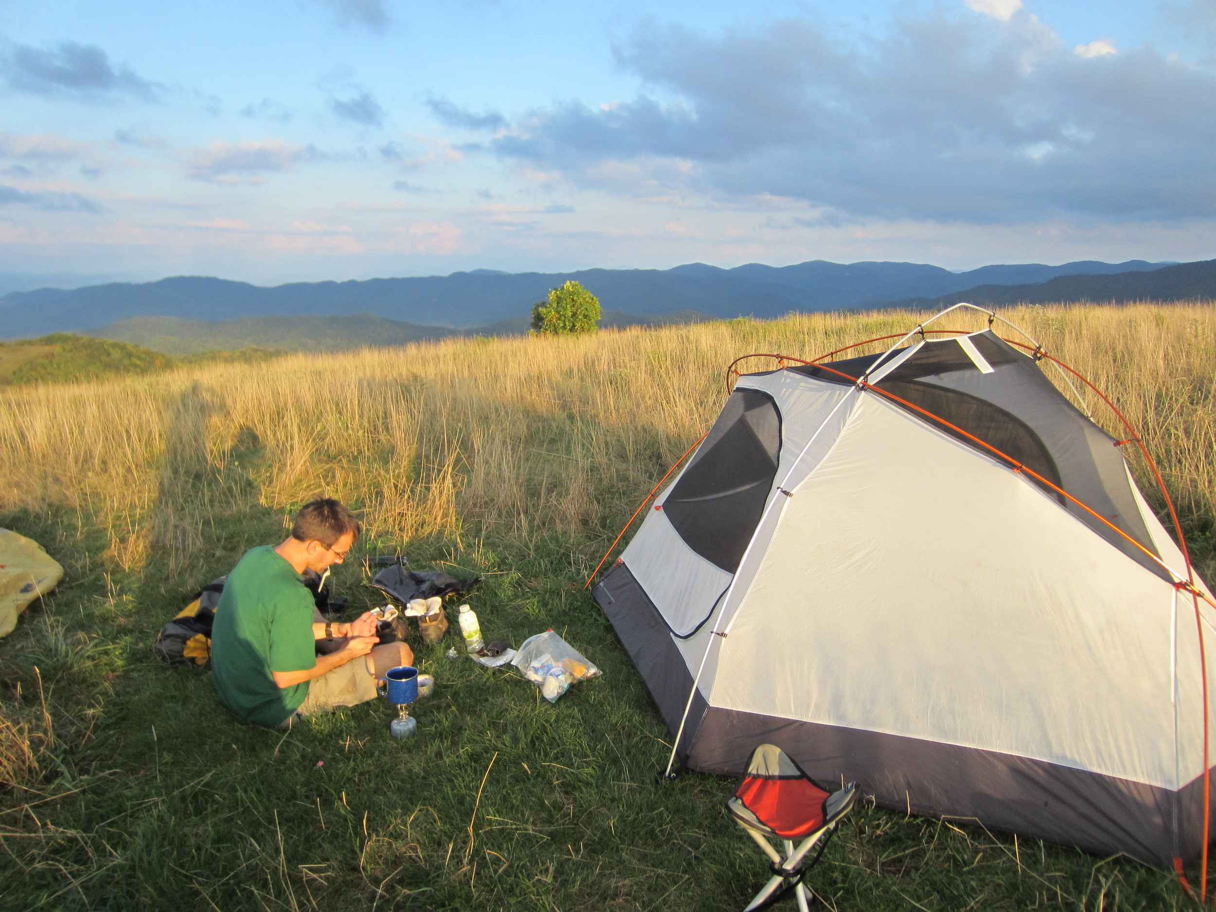
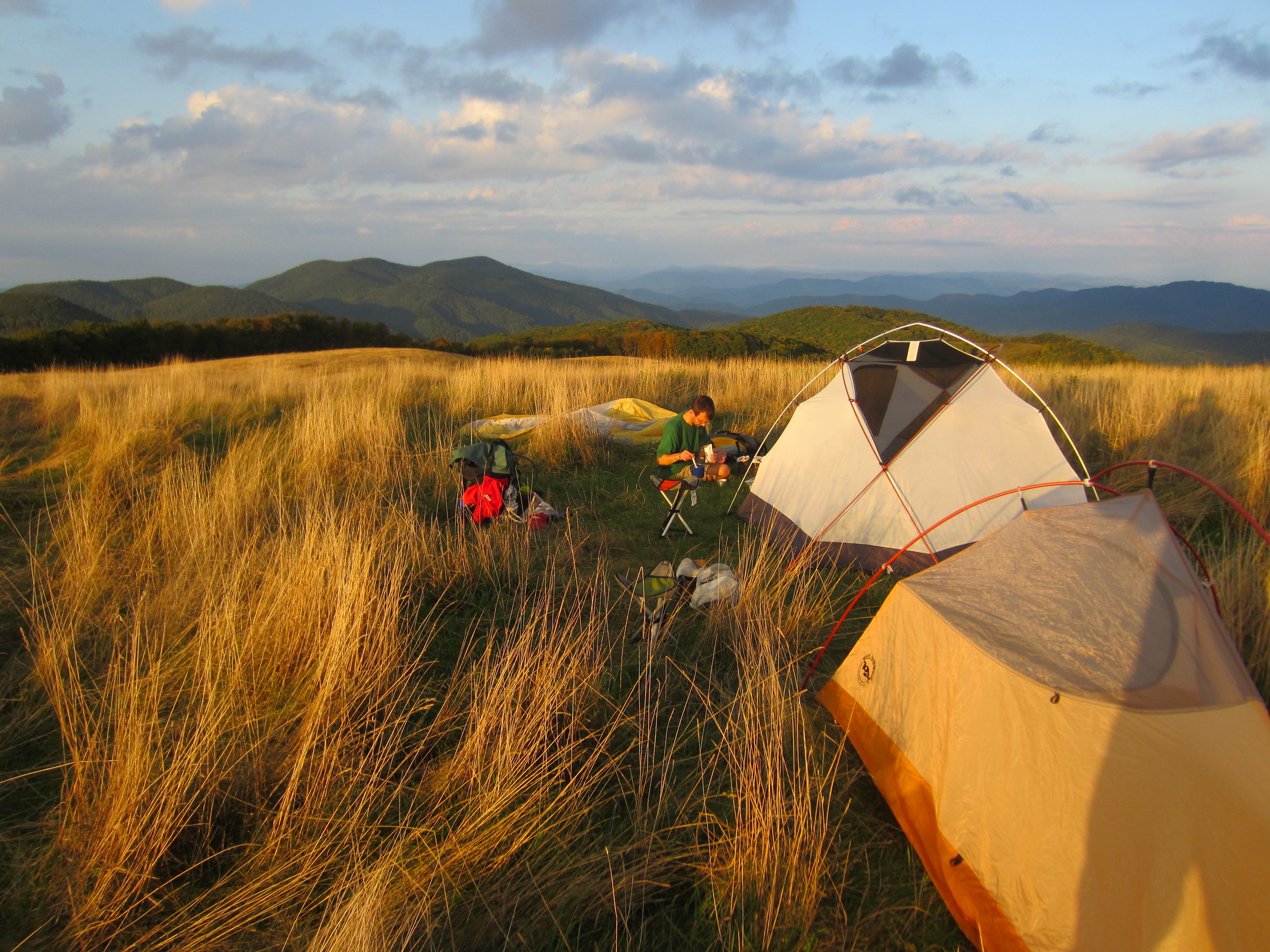
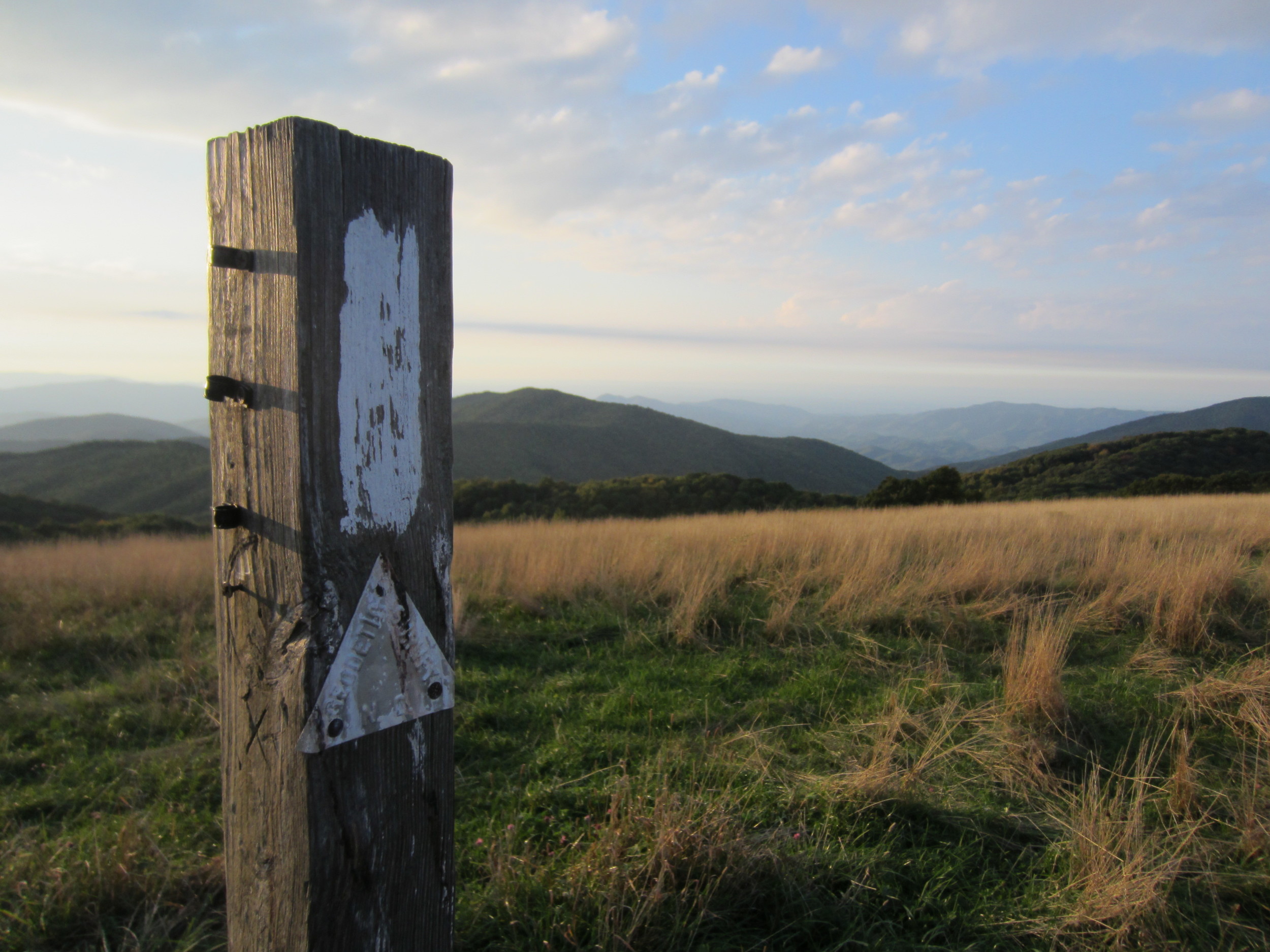
The North/South Trail at Land Between the Lakes in western Kentucky is a good week long challenge for any backpacker. Meg and I used the 31 mile northern section of the trail to help prepare us for our trip in May to the Grand Canyon. We did the hike over a weekend with a couple other avid hikers, Larry and Curt. The trail winds around hidden bays and inlets, which jut off Kentucky Lake, and goes back and forth between views of the water and the woods as you pass from one bay to the next. Along sections of the hike bright green and yellow Easter Lillies marked the spots where homes once stood and in some locations along the trail the foundation could still be seen through the undergrowth.
We started at the North Welcome Station and hiked south crossing a half dozen bays and rounding hills and dipping down into hollows and drainage systems for the lake. Our campsites were pristine and the second night we even pitched our tent on the edge of Sugar Bay which is about half way between the North Welcome Station and Golden Pond Visitors Center. The best section of trail was a few miles along the south side of Higgins Bay where the trail follows the shoreline and comes to an island before turning inland, toward the south. The island is connected by a sandbar and the water was not very deep and can be crossed on stepping stones. In fact, during summer and fall, when it is dryer, the island is probably connected to the mainland. We had worship services, on Sunday, at the tip of the island and explored a small cemetary where the newest resident died in 1922.
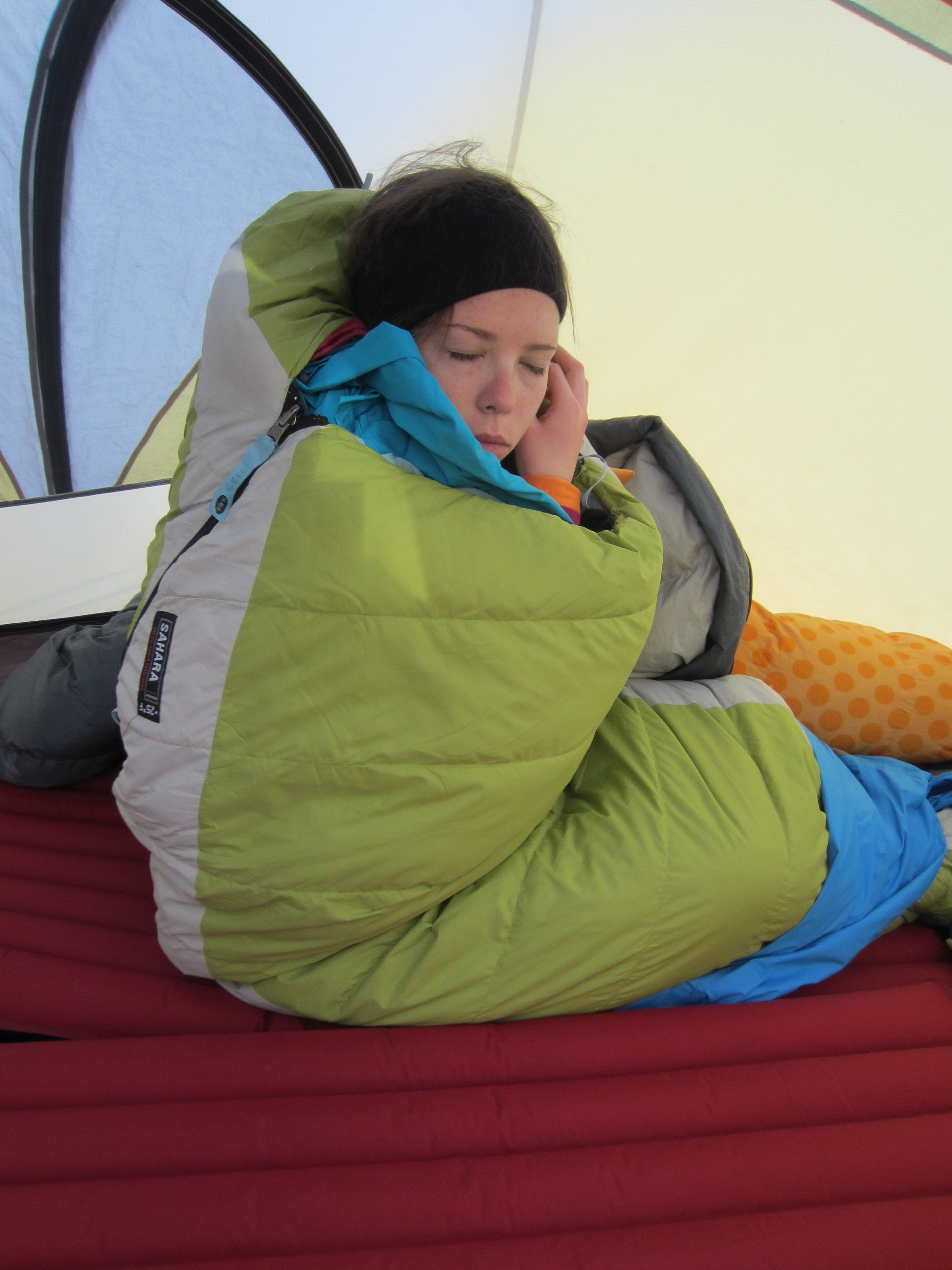
It's one of the few backpacking trips I've been on where the weather forecast actually improved as we got closer to the trip. In early March it can be hit or miss with good weather but the unseasonably warm winter continued to hold out for us. The temperatures were perfect for backpacking. After a crisp, chilly Saturday morning, the sun came out and brought the high to right around 60 degrees making it just warm enough you could hike with just a base layer but still cool enough that you weren't sweating a whole lot. Sunday was even warmer, with highs pushing close to 70 but overcast. I actually got a little burned on our trip.
It was a great trip and a real calf and thigh burner... excellent preparation for the steep descents and ascents of the Grand Canyon. One important point to note: The Forest Service trail maps provided on the LBL website are approximately four miles off with their mileage. Originally the hike was only supposed to be a 26.8 mile trek... but ended at mile 31 according to the GPS. Even the signs along the trail didn't add up with the map or the GPS.
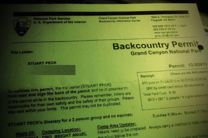
It's no secret that one of the biggest holes in the ground is one of the most popular spots to backpack in the world. That became all the more apparent to Meg and I as we submitted an application for a chance to spend a few nights below the rim of the Grand Canyon later this year. Like clock work, from the recommendation of the GCNP website as well as several experieced hikers on Backpacker's message boards, we faxed in our application on January 1, 2012 for a trip in May. After our submission we waited... and waited... and waited - Meg patiently, myself not so much. I never thought it'd be so difficult to get permission to hike and camp. Most of the time you don't have to ask anyone's permission to walk in the middle of no where and then, when you get tired, pitch a tent and go to sleep. If permission is required, the conversation usually goes something like this:
Hiker: "Hello, I'd like to hike this route and stay here, here and over here."
Park Service employee: "That's a tough section of trail, are you sure you're up to hike that?"
Hiker: "Yes sir/mam, I've done several hikes, similar to this one, before."
Park Service employee: "Ok, have a good time and be safe."
Hiker: "Thank you, I will."
In GCNP you not only have to ask permission, but you might (and during peak seasons probably will) get denied the right to spend the night below the, tourist covered, rim.
Alas the very last day of January the news arrived and the official planning began. We're doing a five day, four night hike below the rim from the South Kaibab Trail Head to the Hermit Trail Head via the Tonto Trail with stops at the Bright Angel Campground, Horn Creek, Granite Rapids and Hermit Creek. In all about 26 spectacular miles of backpacking.
I'll keep everyone posted on the trip and if you have any advice or recommendations please share!
Here we are... December 31, 2011. Here it is... the cliche' end of the year blog post. I won't bore you with a recap of every adventure I've had in 2011. It has been a fun year... there have been great hikes, great climbs, all with some pretty cool people to boot.
I've learned a lot this year about what's important in life and what... well... isn't as important. Looking back on the year of our Lord, two thousand eleven, my eyes were opened to the value of spending time with the ones I love and making new, amazing memories all the time. Often times I find myself day-dreaming about epic trips to wild destinations and many times they stay just that... dreams. Meanwhile I get up, go to work, go home, go to bed, get up, go to work, go home... while all that is important and necessary, in 2012 I challenge you to take a different perspective.
Live for spontaneity, adventure and soak up and take in every amazing moment you can. It doesn't have to be an epic trip to be an adventure. Do something different, out of the ordinary... something you can look back on and say "Remember when we did that? Wasn't that so awesome?" Just the other day a coworker of mine said "I'm going to be more intense... like a gazelle." Ok... while that's an odd comparison the idea of being intense and doing exciting things is a great idea!
I encourage CHALLENGE you to try something new; even if it's that weird, new flavor of frozen yogurt. Be awesome this year and do awesome things!
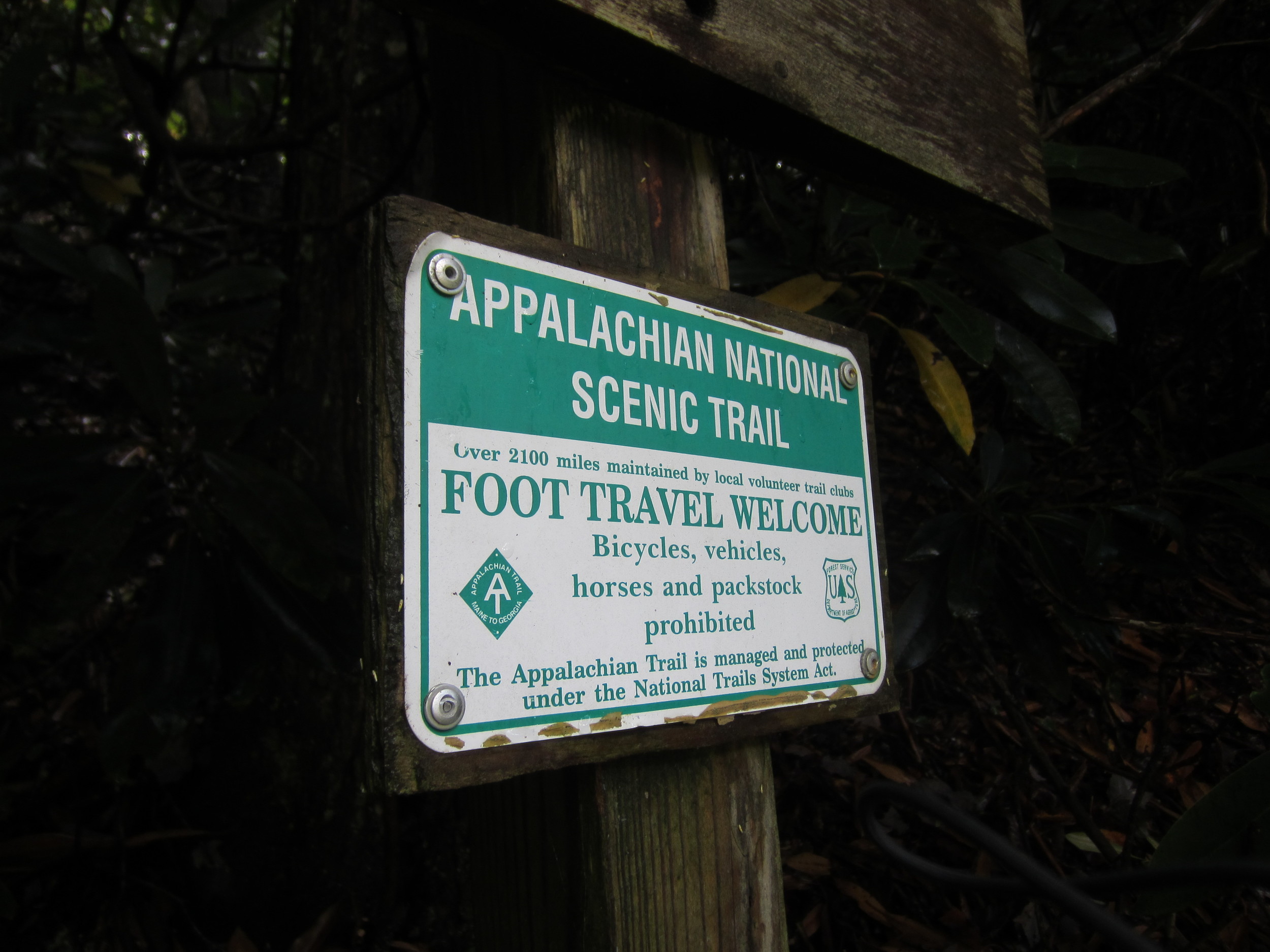
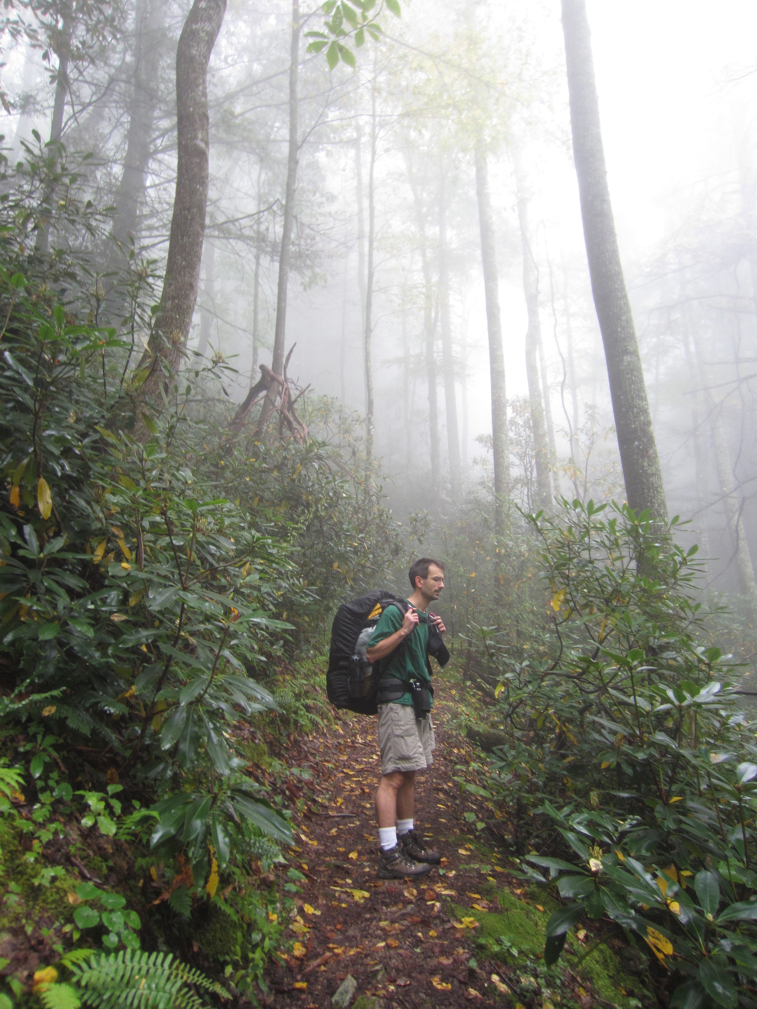
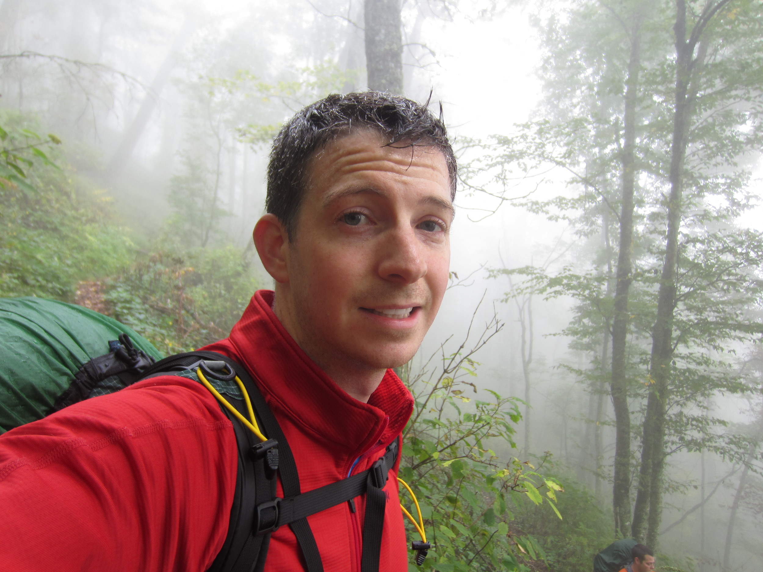
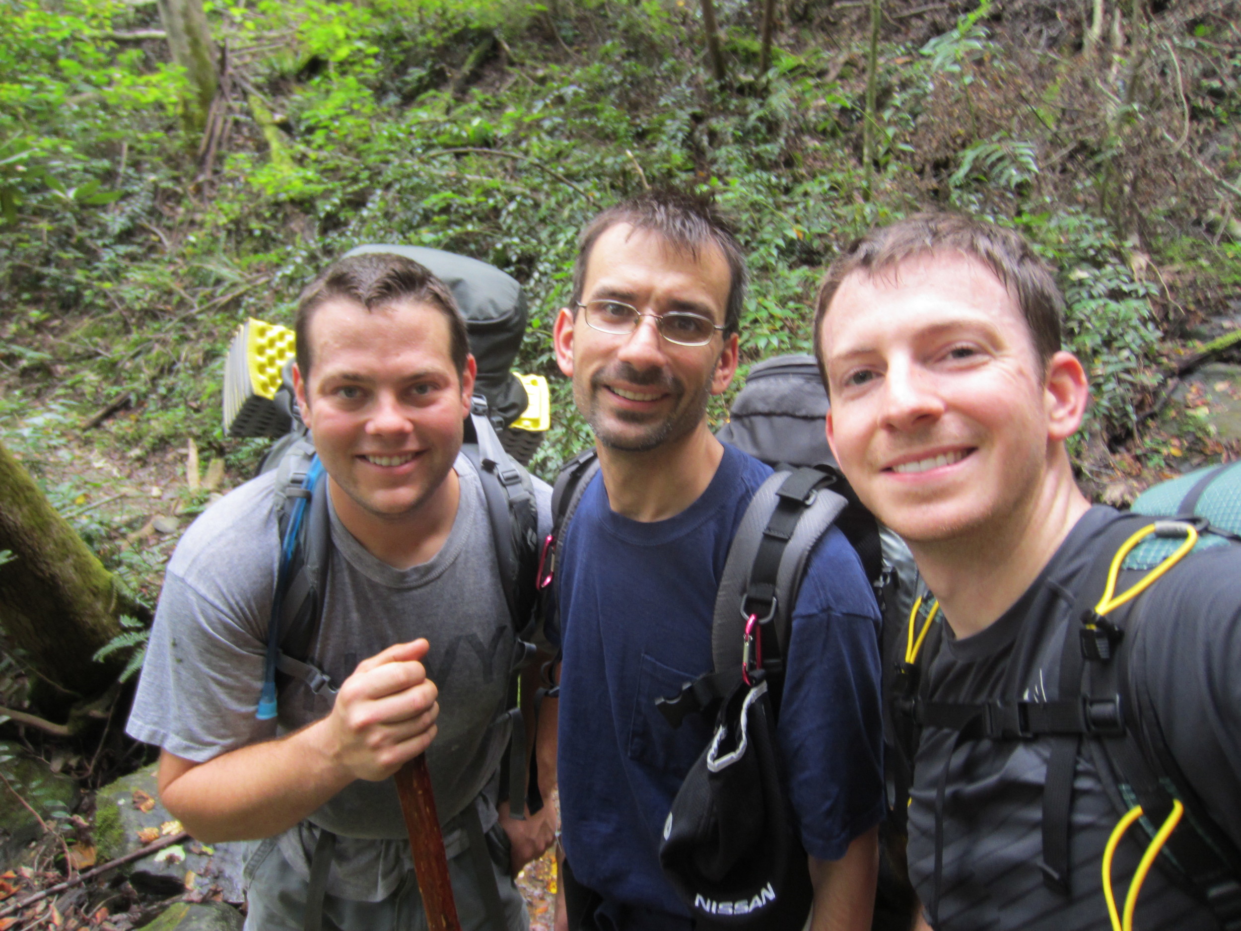
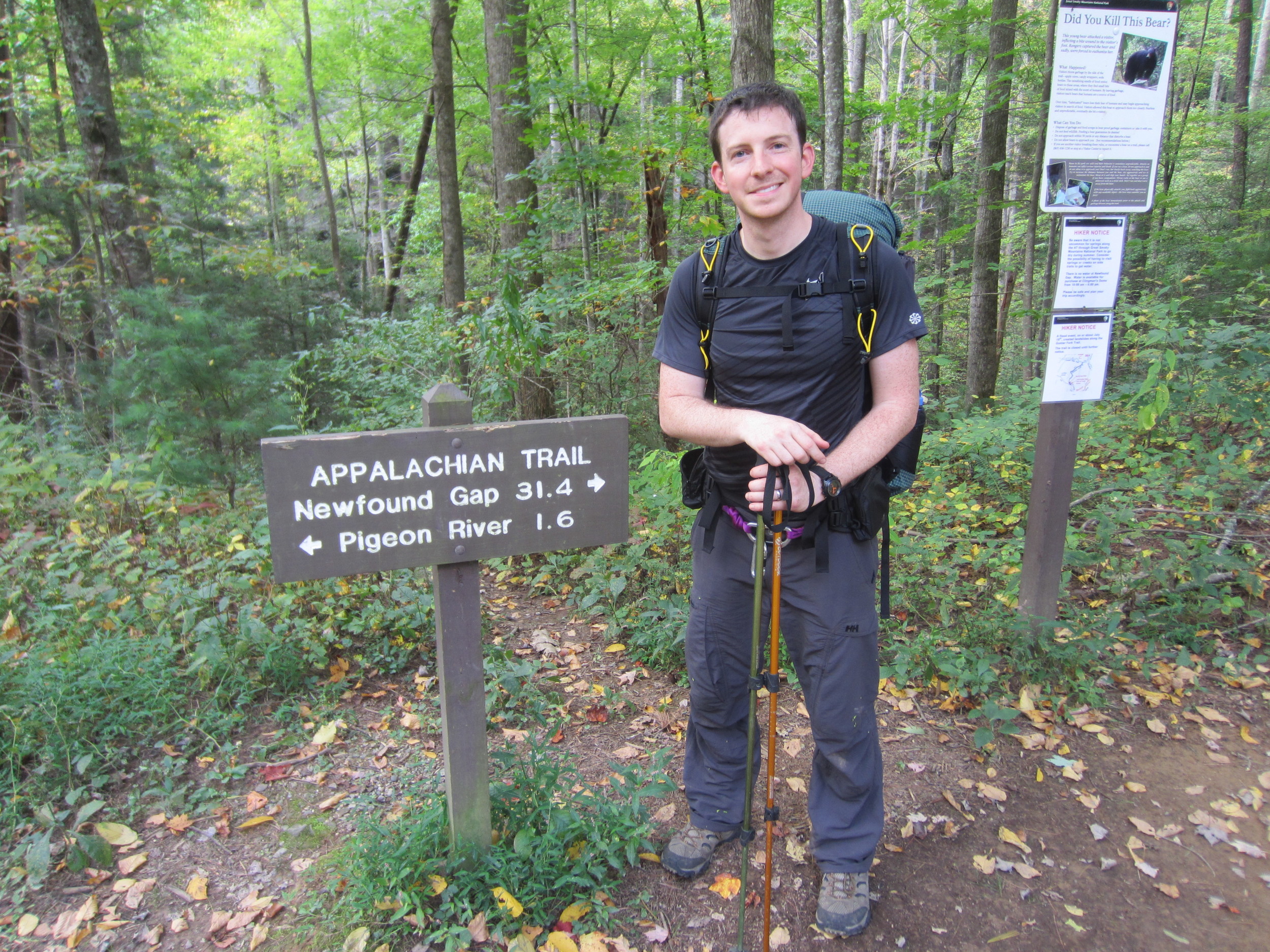
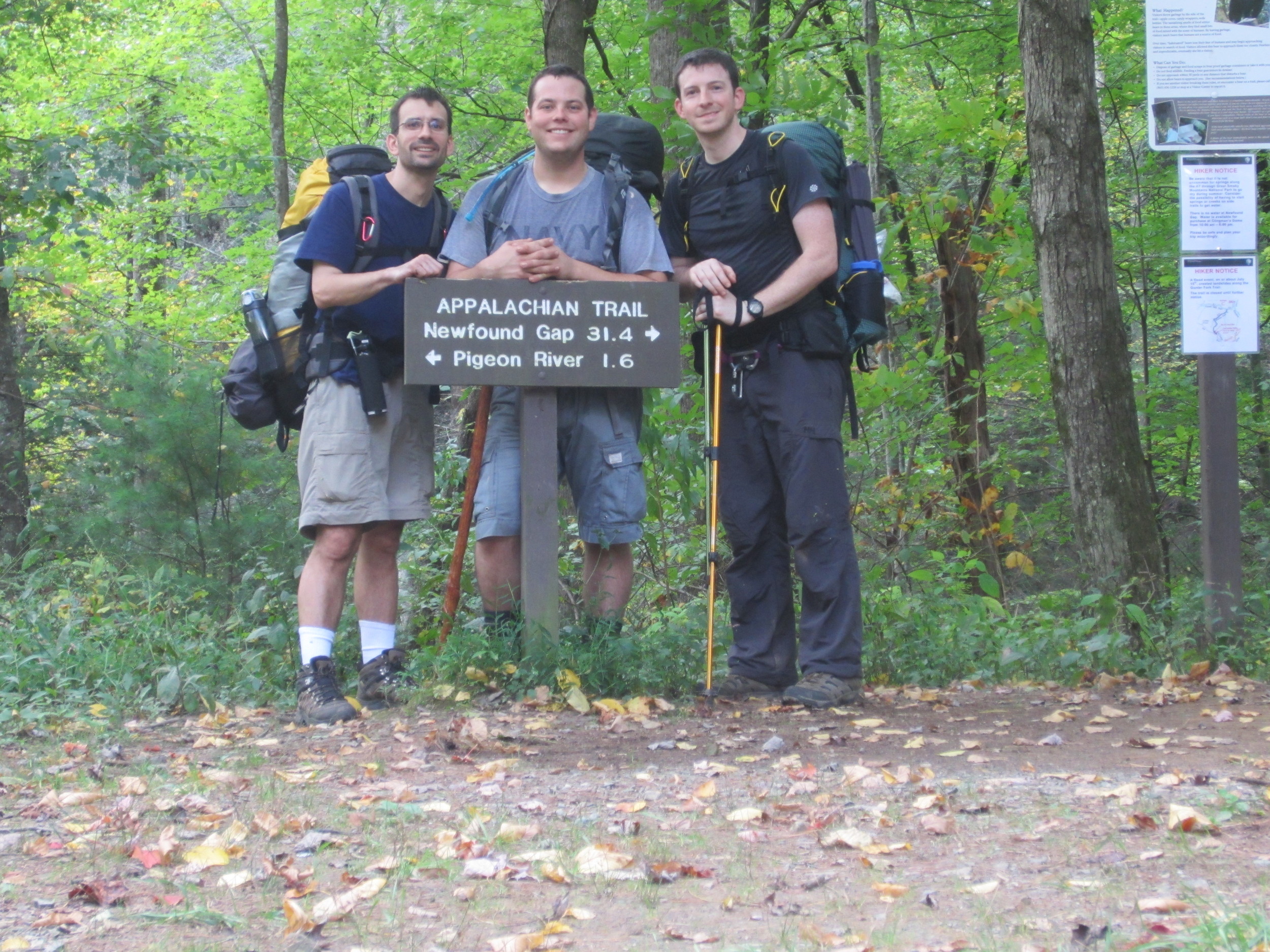
I've been bitten by the AT bug... after just four days on the trail I'm ready for more grueling climbs rewarded with out-of-this-world views. I finished a 43(ish) mile section of the trail from just north of Hot Springs, North Carolina to Davenport Gap on the door step of the Great Smoky Mountain National Park.
The weather played nice and we had several miles of trail that transported us from thick, dark forest to beautiful mountain top vistas with views for which I'm at a loss for words to describe. Myself, Curt and John listened to stories from several hikers who had been on the trail much longer than we had. The three of us shared many thoughts throughout the trip, some deep... others not quite. To say hiking a trail like this can be a spiritual experience is absolutely justifyable. Having worship services high up on a mountain top as the sun rose is an experience I'll be hard pressed to ever forget and will remain one of the most fond memories of my life.
If you haven't stepped foot on the AT, do it! Hike it! However start off small... it's a long trail.
As I've done in the past, the week of a hike means it's time to check the weather... constantly. It's an obsessive compulsive characteristic that I can't seem to shake, nor do I really care to. John, Curt and myself leave for North Carolina Thursday night and the hike is shaping up to be a great one. All the plans have been made and the littlest details sorted out.
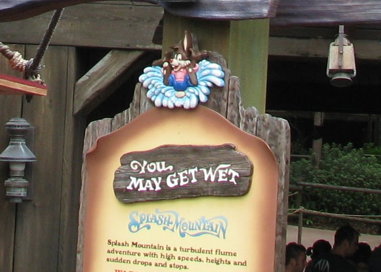
However God makes his own plans and as much as we can control how prepared we are for this hike, we have no control over the weather conditions. That's alright though, we'll be prepared for that as well. Most of us have seen the infamous signs at the beginning of water rides: "You may get wet". That's about how I feel when monitoring the weather for this hike. The latest models show the rain chances to be be in the range of 40% to 70% for Hot Springs, North Carolina and some reports I've seen say the area could get 1 to 3 inches of rain by Sunday. Excellent! I'll believe it when the rain is falling on us on the trail. Until that time the weather forecasts are just that, forecasts.
At least we won'thave to deal with this beast: Track Tropical Storm Ophelia. Although in a way... I think it'd be neat to have that story to tell. "Remember the time we were hiking in a tropical storm?" I'm a bit strange that way...
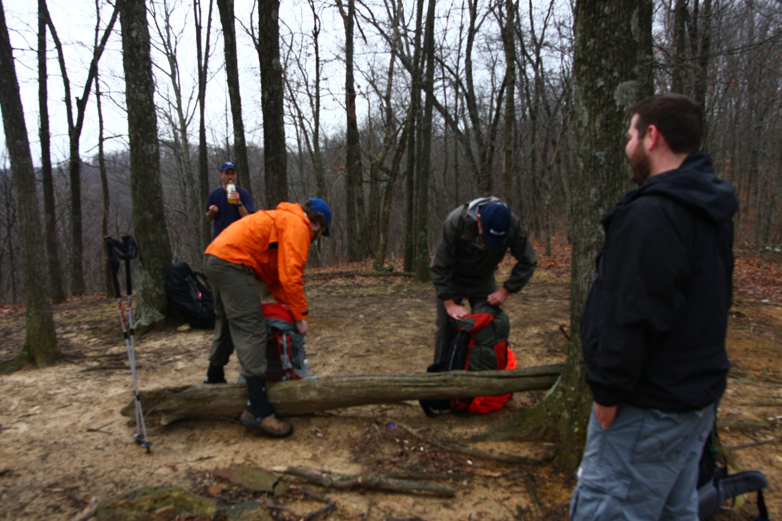
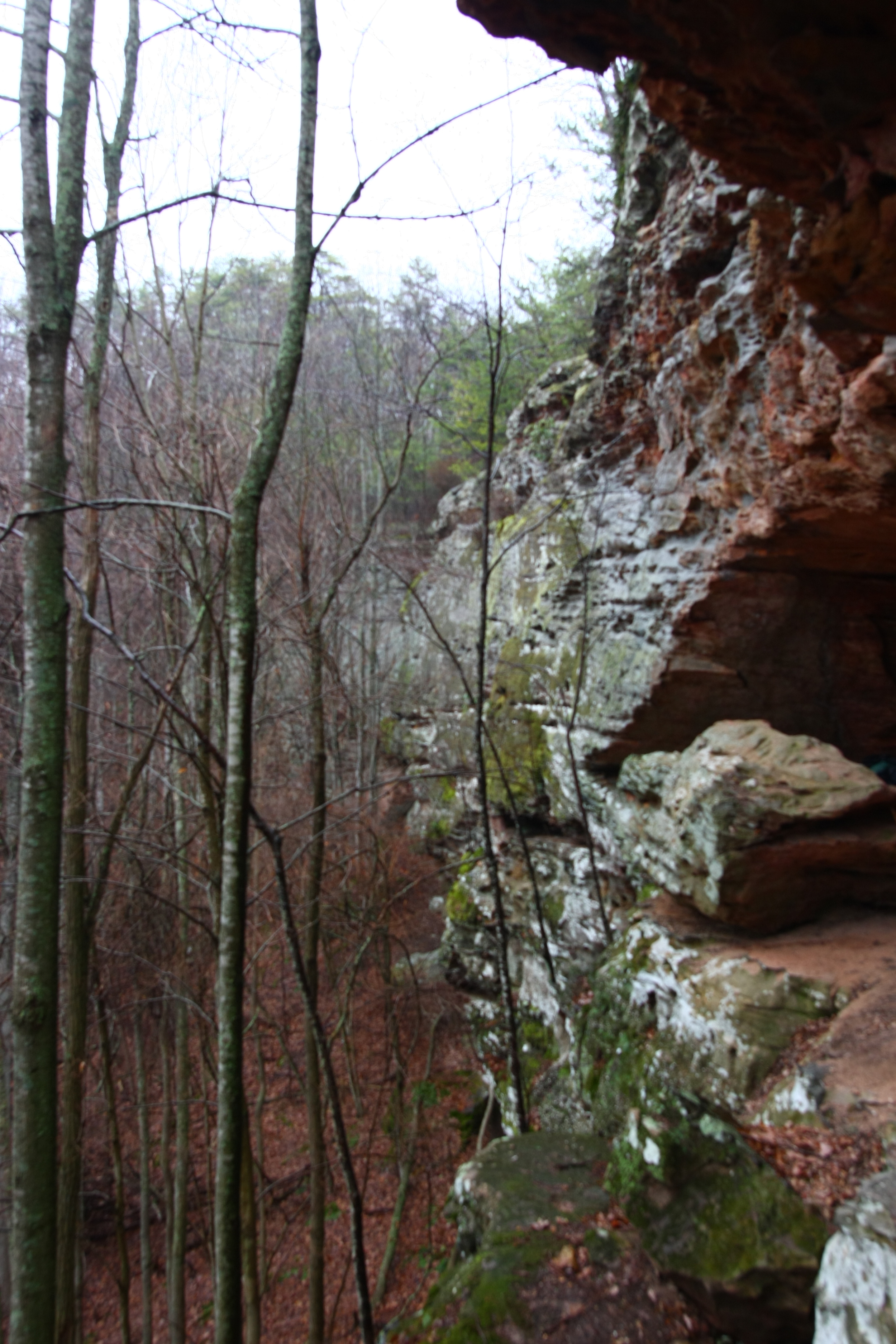
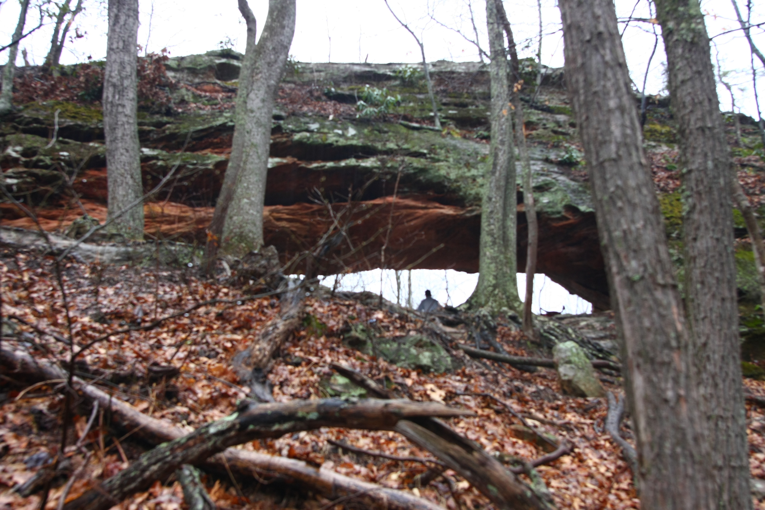
I think it goes without saying but I am awful with keeping up with a blog, I'll just go ahead and throw that out there. It has been about a month since we got off the trail from our 33... er 40 mile hike on the Sheltowee Trace through the Daniel Boone National Forest and the Red River Gorge region. It was really a great trip and the trail was well maintained and well marked most of the way. I definitely recommend the hike and there are portions I want to go back and explore more, especially in the RRG area.
I'll keep this post short and let the pictures tell most of the story since I've got massive amounts of wedding related stuff to take care. Right now I'm in the writing and editing process for the Backpacker magazine article. If all goes as planned it is scheduled to be published in the August edition of the magazine. Also, working on a some exciting plans for a website with Clinton Lewis, a photographer, outdoor stud and fellow climber/backpacker from Bowling Green. The planning is still in the beginning stages and when we start to nail down details I'll share them. Enjoy the pictures!
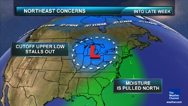
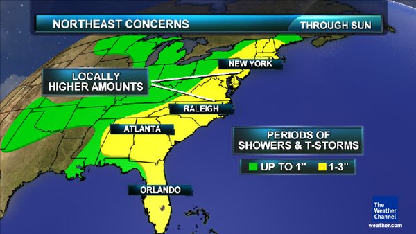
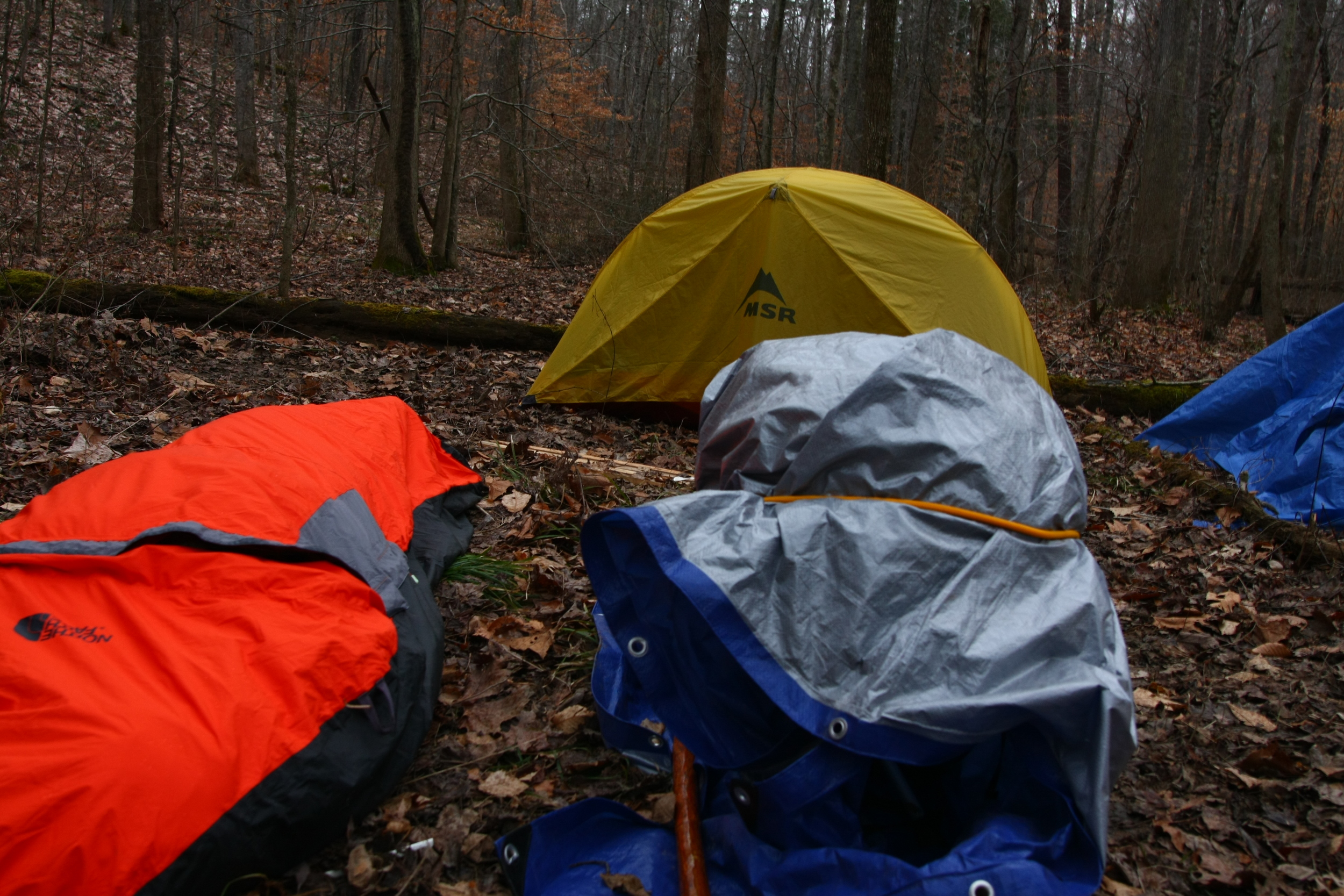
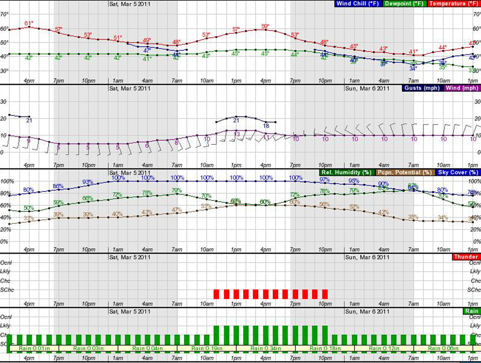
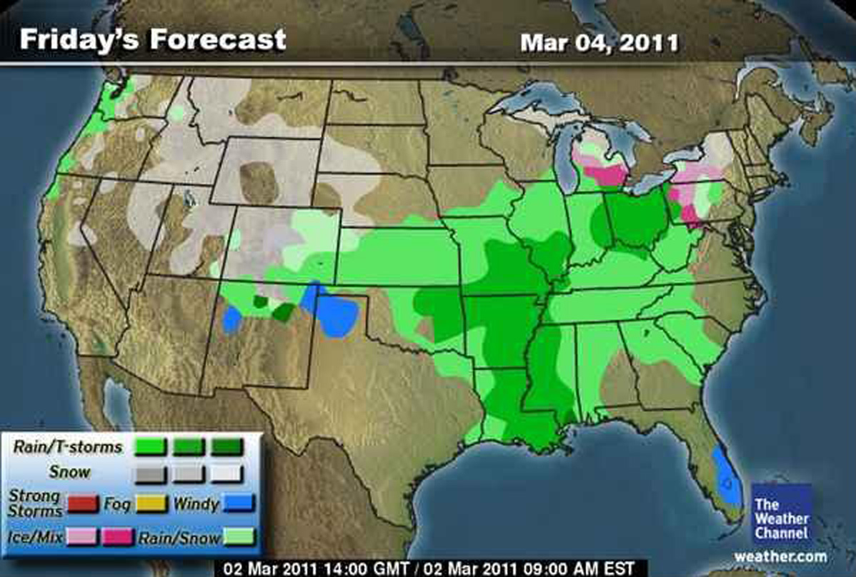
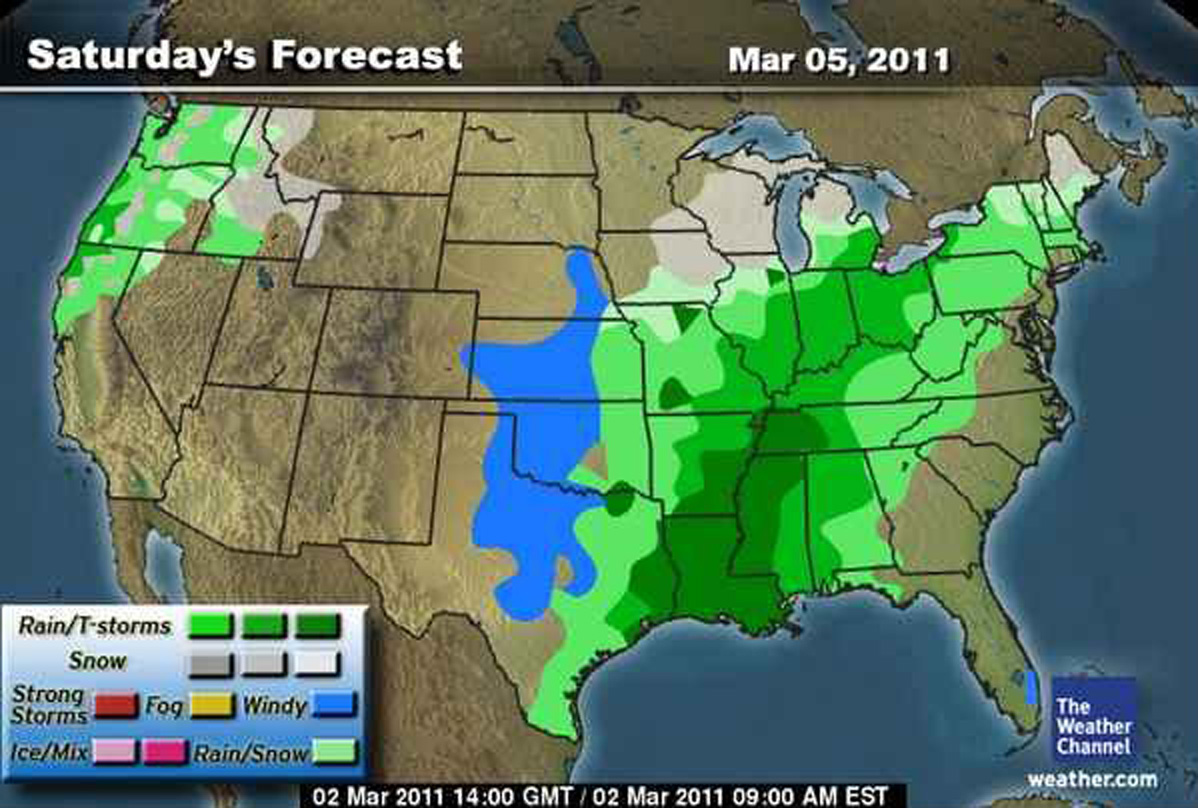
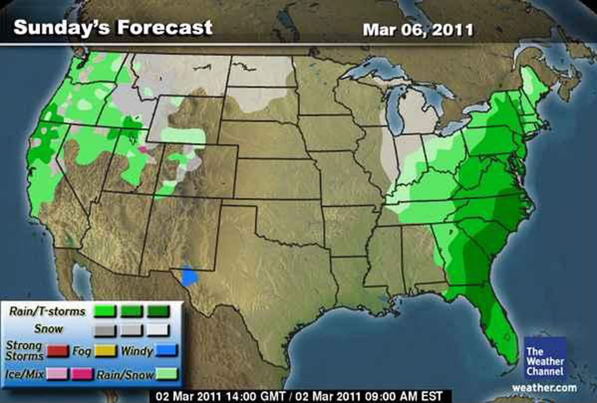
After months of planning the backpacking trip is upon us! In addition to backpacking and climbing... I have an unusually large interest in the weather. Around the time of a big trip like this I tend to watch the forecast like a hawk, checking it practically every couple of hours to see the latest developments. For some folks this first graph I've posted will probably not look like anything even remotely weather related, however it tells me a great deal about the potential outlook for our trip. I've posted a few maps as well.
Occasionally when you go to Disney World or another theme park you see the signs at the beginning of the water rides that state "Caution: You may get wet!". That probably sums up at least part of our trip this weekend. Pack the rain jacket because it looks like we will indeed get wet. We may even hear some rumbles of thunder while we're on the trail. I'm personally very excited about this (insert 'you're crazy' comments below)! I think some inclement weather adds an element of adventure to the hike! At this point it doesn't look like the entire trip is a wash out. I'm really crossing my fingers Friday is dry when we climb in Muir Valley. It also looks like Monday has the potential to be a clear yet chilly day. That suits me just fine since Monday proves to be the most spectacular day, on the trail, as we make our way through the Red River Gorge and Natural Bridge State Park area. Honestly God is in control and as one of my fellow hikers said to me last night on the phone - the weather could be completely different then what the forecast is showing.
Alright, that's all for right now - more to come soon!
Friday: A 30 percent chance of showers, mainly after noon. Mostly cloudy, with a high near 62. South wind between 6 and 10 mph, with gusts as high as 22 mph.
Friday Night: A 40 percent chance of showers. Cloudy, with a low around 47. Saturday: A chance of showers, then showers likely and possibly a thunderstorm after 11am. Cloudy, with a high near 60. Chance of precipitation is 60%.Saturday Night: Showers likely and possibly a thunderstorm. Cloudy, with a low around 40. Chance of precipitation is 60%.Sunday: A 40 percent chance of showers. Mostly cloudy, with a high near 49. Sunday Night: A 20 percent chance of showers. Mostly cloudy, with a low around 30. Monday: Partly sunny, with a high near 50.